Tropical Invest 91P south of American Samoa
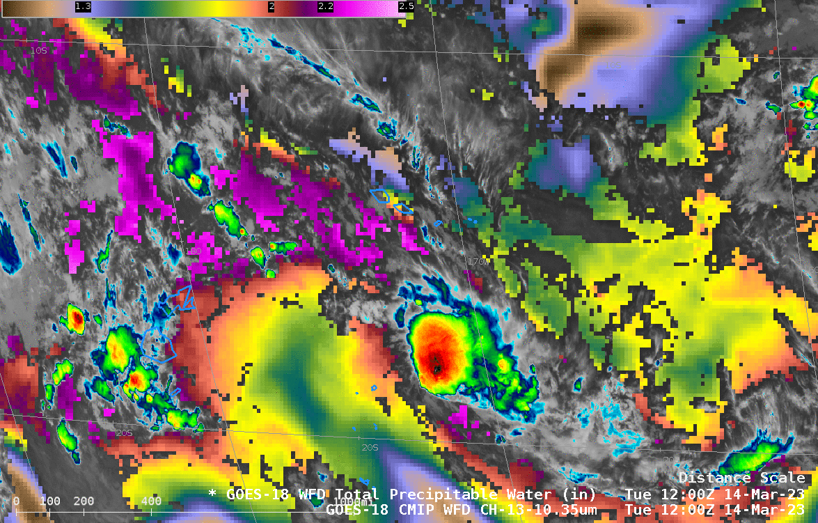
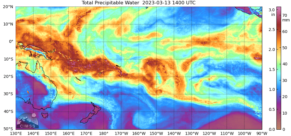
GOES-18 infrared imagery (Band 13, 10.3 µm) and derived Total Precipitable Water, above, shows tropical Invest 91P several hundred miles south of American Samoa within a corridor of moisture associated with the South Pacific Convergence Zone (SPCZ). (Note that the default color scale for Total Precipitable Water (TPW) has been rescaled so the “dryest” value is 1.0 inches). The Samoan islands are just at the northern edge of the deepest moisture — observed TPW at the Pago Pago sounding has decreased from 55 mm at 1200 UTC on 12 March to 44 mm at 1200 UTC on 14 March, the start of the animation above. MIMIC Total Precipitable water for the 24 hours ending 1300 UTC on 14 March, below, (source) shows dryer air very slowly moving over the Samoan islands from the north and northeast. (SAR and Scatterometry surface winds are all northerly around Samoa, as shown in this blog post).
A Suomi-NPP VIIRS Day/Night Band (0.7 µm) image valid at 1252 UTC is shown below — ample illumination from the Moon (in the Waning Gibbous phase, at 56% of Full) provided a useful “visible image at night”. No bright lightning streaks were seen within the convective cluster associated with Invest 91P.
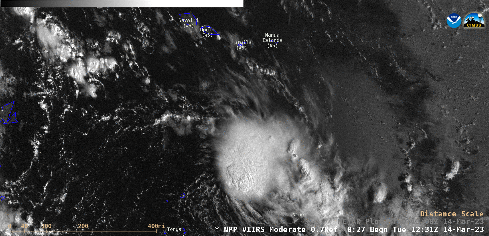
Suomi-NPP VIIRS Day/Night Band (0.7 µm) image valid at 1252 UTC, with and without plots of surface observations (credit: Scott Bachmeier, CIMSS) [click to enlarge]
_________
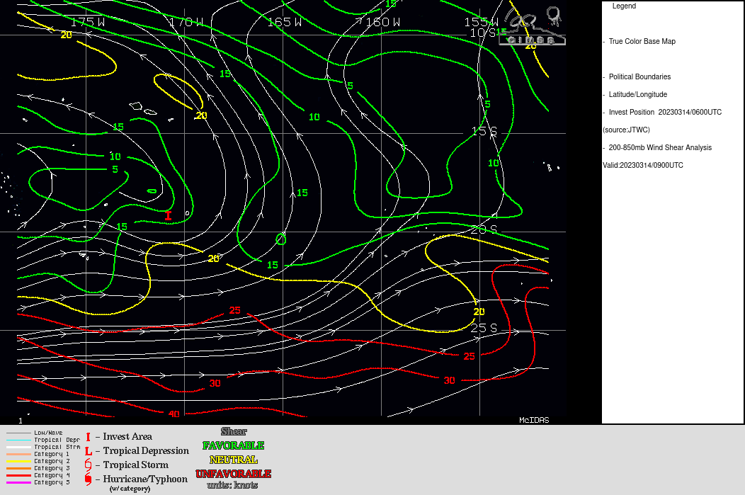
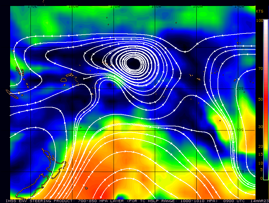
What does the future hold for Invest 91P? The toggle below shows imagery from the SSEC/CIMSS tropical weather site (link). Shear values are low and Sea Surface Temperatures are warm. However, winds in the atmosphere (shown below, from here) are moving the invest area to the south, towards a less favorable environment.
For more information on Invest 91P (or 90P to its west!), refer to the SSEC/CIMSS Tropical Weather website (link) or the webpages of the Joint Typhoon Warning Center (link).