SAR wind observations near Samoa on 13 March
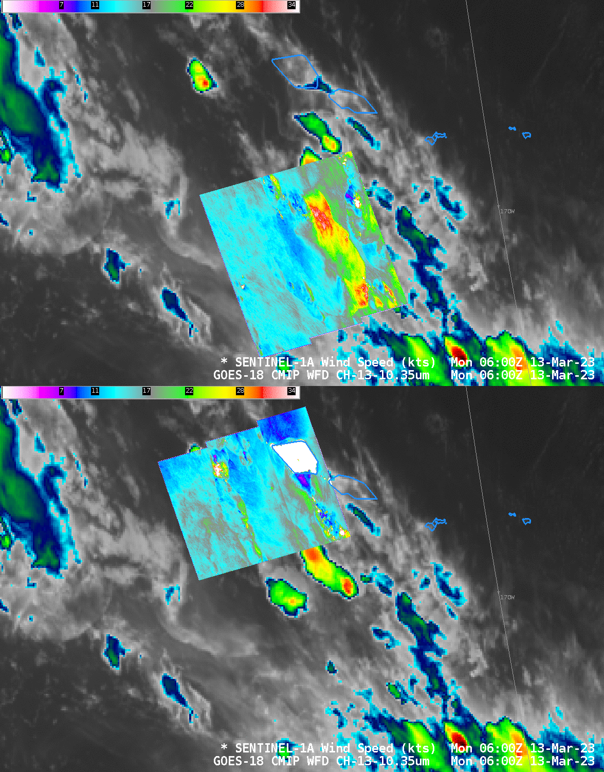
The special SAR observation period over American Samoa, allowing extra observations from RADARSAT and RCM satellites (see CIMSS Blog posts here, here, here, here, here, here, here and here!) has ended, but Sentinel-1A will still routinely send back SAR observations over the Samoan Island chain. The pass above show GOES-18 Clean window imagery (10.3 µm) with SAR winds overlain.
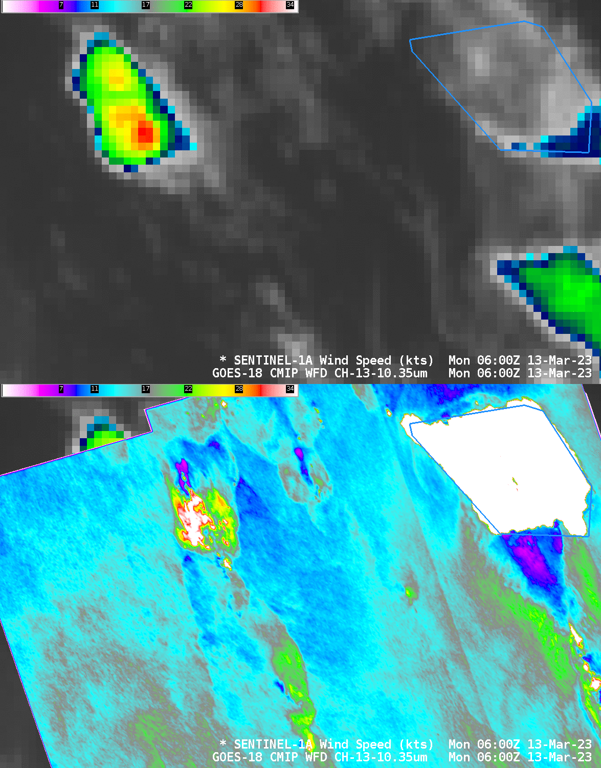
A zoomed-in view of the SAR winds to the west of Samoa shows how parallax must be considered. GOES-18 navigation assumes clear skies, and if a tall (GOES-18 cloud-top heights — not shown — diagnose heights exceeding 44000 feet) cumulonimbus cloud is present, it will be navigated such that it is displayed farther from the sub-satellite point (0oN, 137.2oW) than its true position. Ice within that cumulonimbus cloud is likely altering the SAR return so that stronger winds are diagnosed. As noted in previous SAR blog posts, the presence of ice can be inferred by feathery features within the Normalized Radar Cross Section (NRCS).
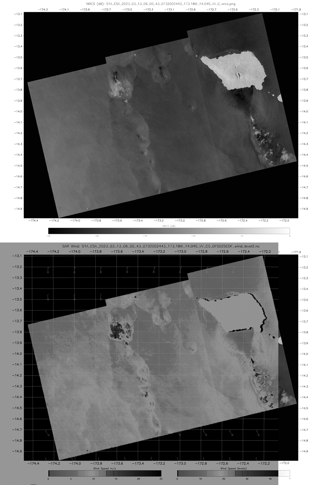
The image below toggles between the NRCS and Wind Speed (from this page) and highlights the feathery structures (suggestive of thick ice within the cumulonimbus cloud) in the regions of strongest diagnosed winds. Note that the wind direction is northerly, and a wind shadow is obvious to the south of Savai’i (Salafai).
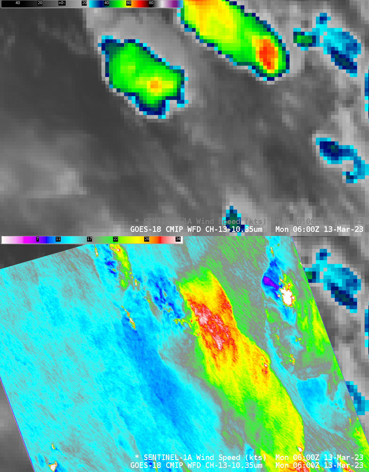
Part of the earlier of the SAR observations on this ascending Sentinel-1A pass is shown below. The coldest cloud top, in the northeastern part of the domain (orange/red enhancement) also shows a parallax shift away from the GOES-18 sub-satellite point (at about 137.2oW) such that the cold cloud top is shifted west of the strong SAR winds (40-50 knots in the white enhancement) that are likely an artifact of the ice within that cloud. The large area of strong winds (20-25 knots, yellow/green in the color enhancement) over the center of the domain do not arise from cloud ice.
A toggle between NRCS and wind speed at 06:00:18 is shown below.
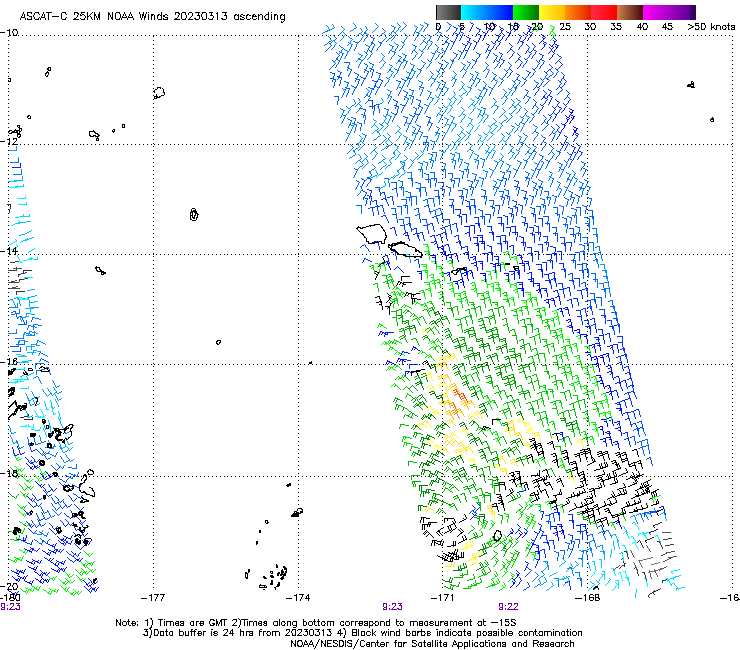
MetopC ascended over the Samoan islands after 0900 UTC on 13 March 2023, and Advanced Scatterometer (ASCAT) winds from that pass are shown below. ASCAT also diagnoses relatively weak winds just south of Western Samoa, 20-25 knot winds south of the lighter winds.
Dora Meredith from the NWS Forecast Office in Pago Pago asked the excellent question: Would the Parallax shift be different from Himawari-9? GOES-18 is over the equator at 137oW, about 35o east of the Samoan Islands, and Himawari-9 is over the equator at 140.7oE, about 45o west of the Samoan Islands. The toggles below shows two examples of SAR winds south of Samoa in three panels; the right panel also showing GOES-18 Band 13 infrared imagery — and a parallax shift in the imagery to the west, away from GOES-18’s sub-satellite point is apparent; the left panel shows Himawari-9 Band 13 infrared imagery — and a parallax shift in the imagery to the east, away from Himawari-9’s sub-satellite point is likewise apparent.


