Category 5 Super Typhoon Ragasa moves WNW across the Philippine Sea and into the Luzon Strait

2.5-minute Himawari-9 Infrared images, from 0002-2042 UTC on 21 September [click to play animated GIF | MP4]
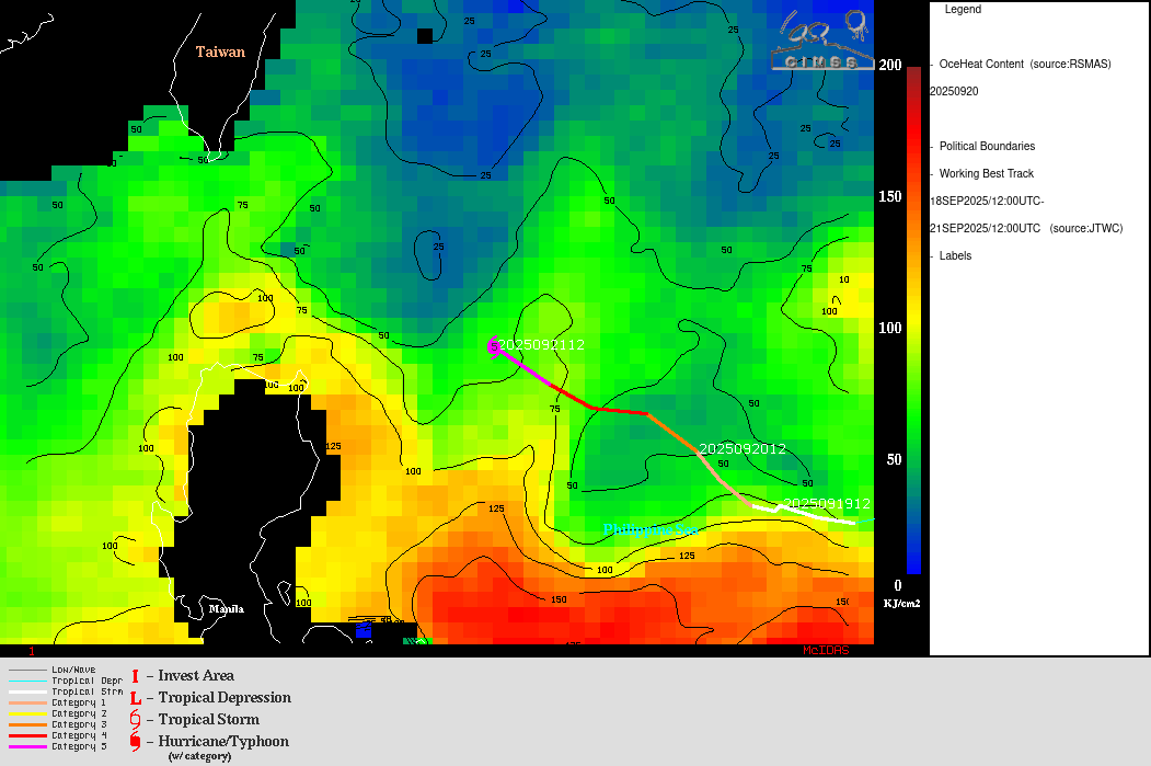
The primary environmental factor that favored this intensification was low values of deep-layer wind shear (below) — in addition, Ragasa traversed a lobe of slightly warmer waters (Sea Surface Temperature | Ocean Heat Content) as it reached Category 5 intensity.

Himawari-9 Infrared images, with contours and streamlines of deep-layer wind shear at 1800 UTC on 21 September
Ragasa was undergoing an eyewall replacement cycle (ERC) on 21 September, which was evident in the MIMIC-TC product (below) — the smaller-diameter inner eyewall was eventually replaced by a larger-diameter outer eyewall. However, the ERC did not adversely affect the intensity of the Super Typhoon during the course of the day.

MIMIC-TC product on 21 September
3 snapshots of microwave imagery during the day (from DMSP/SSMIS and NOAA-21/ATMS) are shown below.

DMSP-16 SSMIS image at 1003 UTC on 21 September
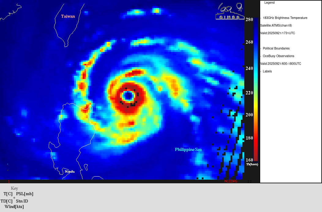
NOAA-21 ATMS image at 1731 UTC on 21 September
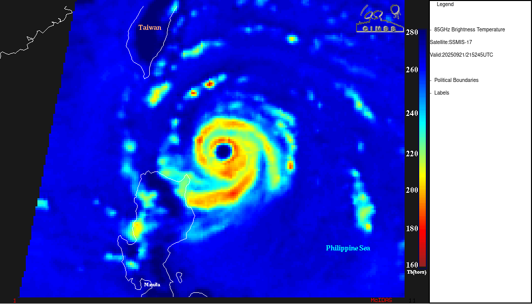
DMSP-17 SSMIS image at 2152 UTC on 21 September
[the wind shear, sea surface temperature, ocean heat content and microwave products shown above were sourced from the CIMSS Tropical Cyclones site]
An RCM-3 Synthetic Aperture Radar (SAR) Wind Speed image (below) also highlighted a narrow “moat” of lower wind speed that was surrounding the inner eyewall at 2131 UTC (a “brightness temperature moat” feature was also seen in the 2152 UTC DMSP-17 SSMIS microwave image).
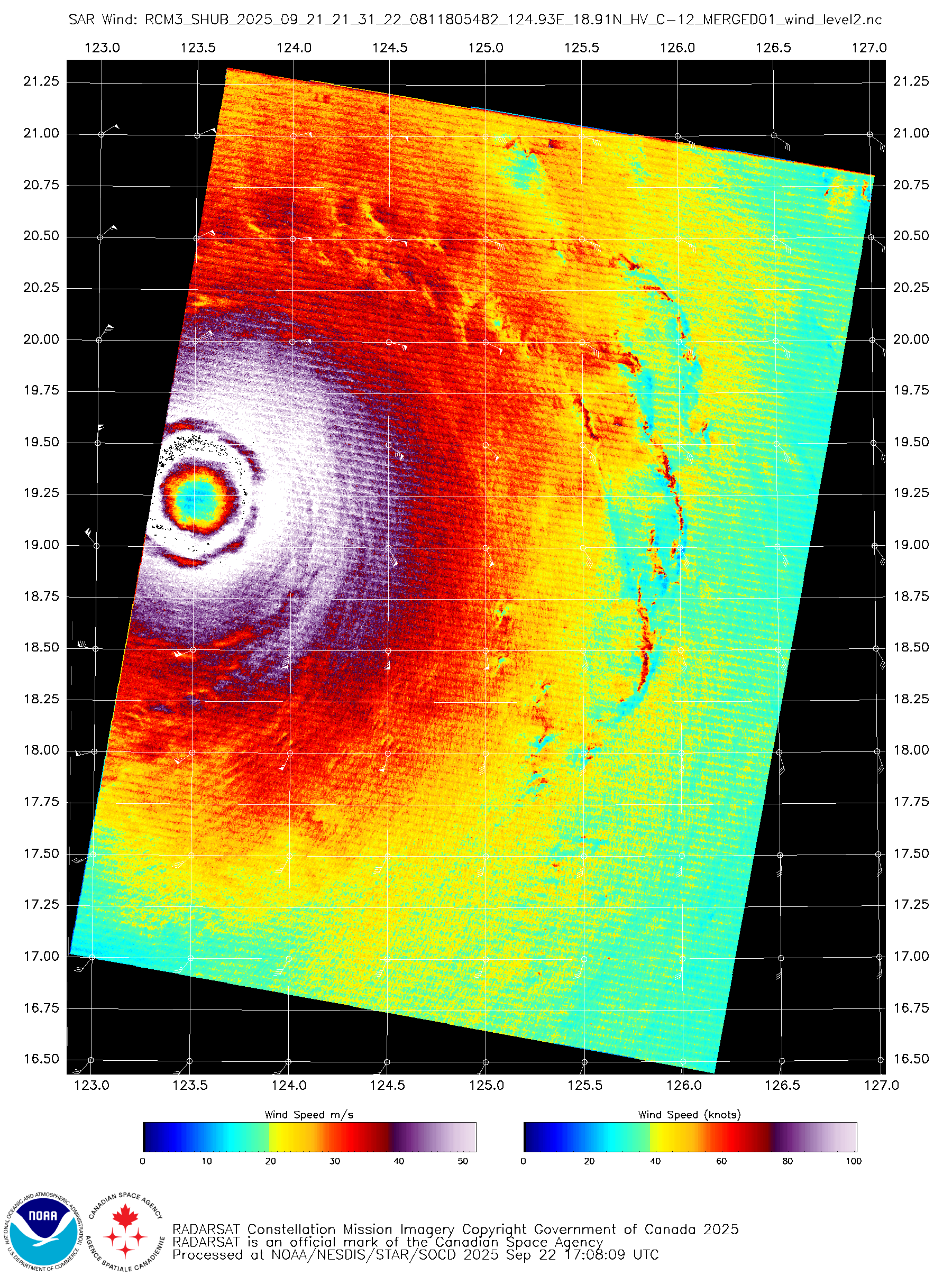
RCM-3 Synthetic Aperture Radar image at 2131 UTC on 21 September [click to enlarge]

2.5-minute Himawari-9 Visible images, from 2152 UTC on 21 September to 0832 UTC on 22 September [click to play animated GIF | MP4]
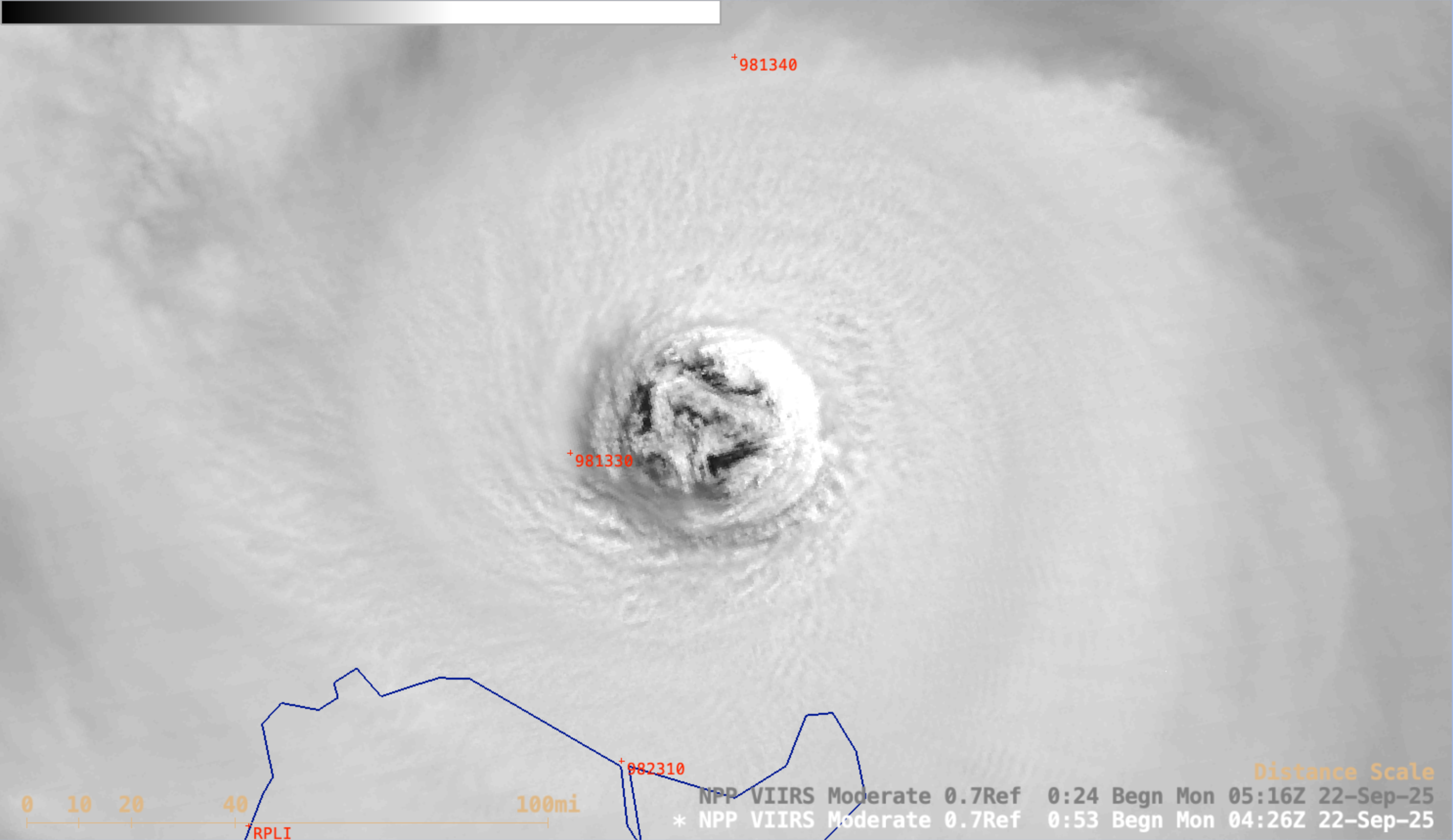
Suomi-NPP VIIRS Day/Night Band image valid at 0511 UTC on 22 September [click to enlarge]

Sentinel-3B Altimetry data, showing a Significant Wave Height value of 27.75 ft east of Luzon at 0129 UTC on 21 September
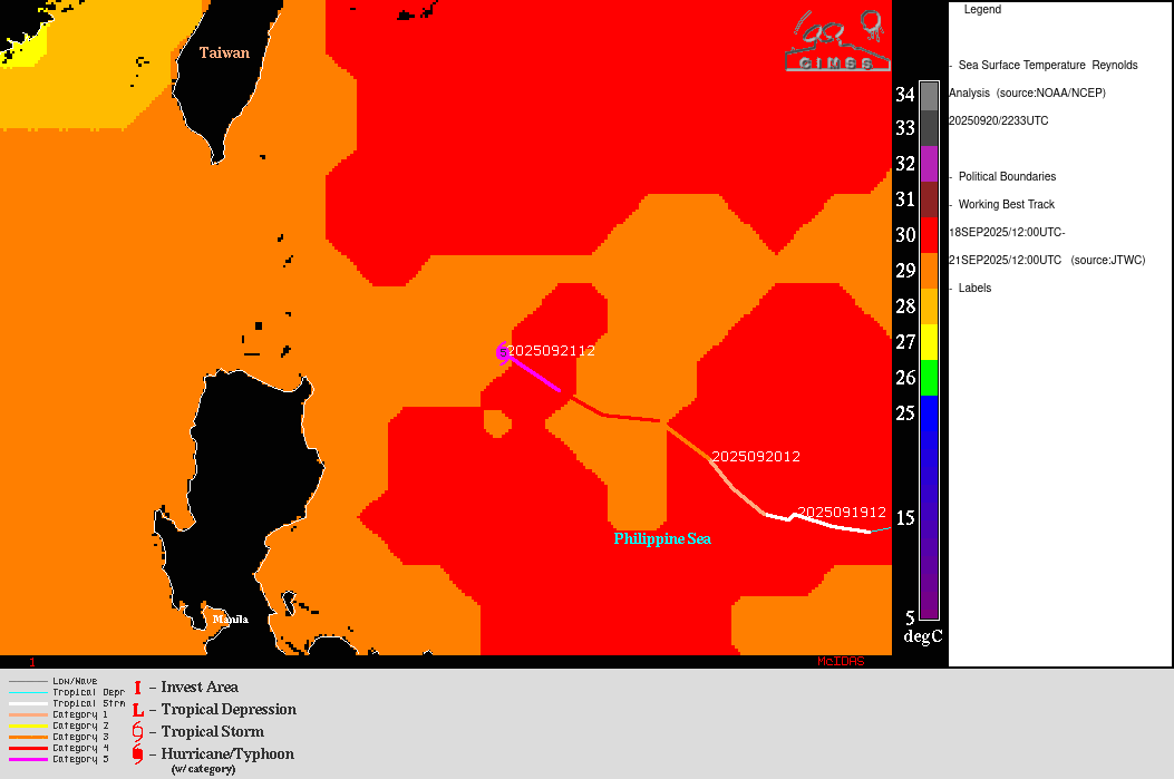
The strong winds associated with Super Typhoon Ragasa caused high waves (above), which resulted in an upwelling of cooler sub-surface water in the northwest Philippine Sea — late in the day on 22 September (when Ragasa was located far to west, in the South China Sea), note the pocket of 27-28ºC Sea Surface Temperatures (yellow to light orange) along and north of the track of Ragasa at the point where it first reached Category 5 intensity from 0600-1200 UTC on 21 September (below). Sea Surface Temperatures over that area of upwelling were around 30ºC just prior to the passage of Ragasa.
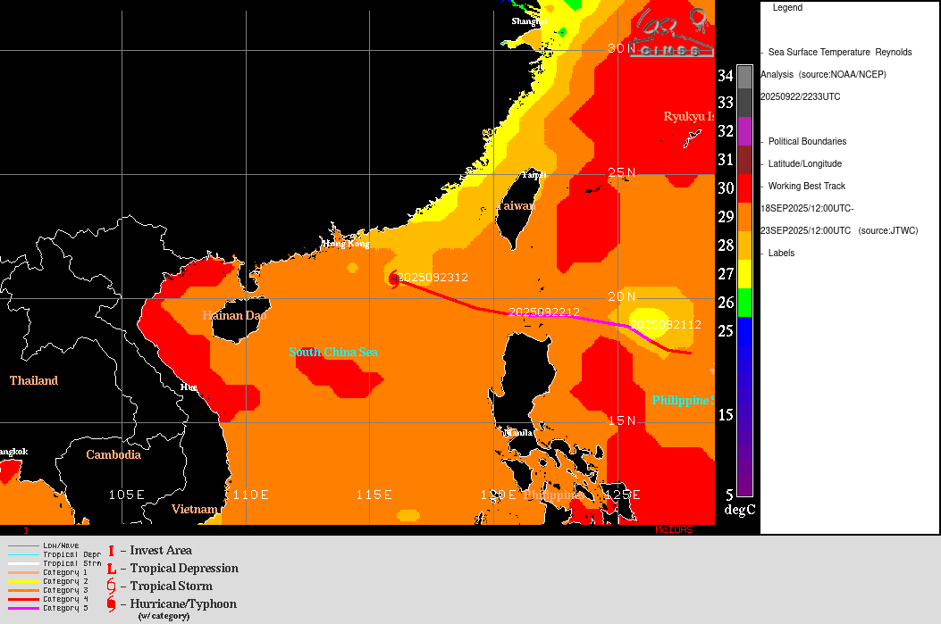
Sea Surface Temperature analysis at 2233 UTC on 22 September, with a plot of Ragasa’s track from 18-23 September
As Ragasa was beginning to move west-northwestward away from northern Luzon on 22 September, a Significant Wave Height of 58.26 ft was sensed at 1352 UTC (below).

Sentinel-3B Altimetry data, showing a Significant Wave Height of 58.26 ft north of Luzon at 1352 UTC on 22 September
Additional information pertaining to Ragasa is available in this blog post.