Hurricane Florence continues to approach the southeastern US
GOES-16 “Red” Visible (0.64 µm) images [click to play MP4 animation]
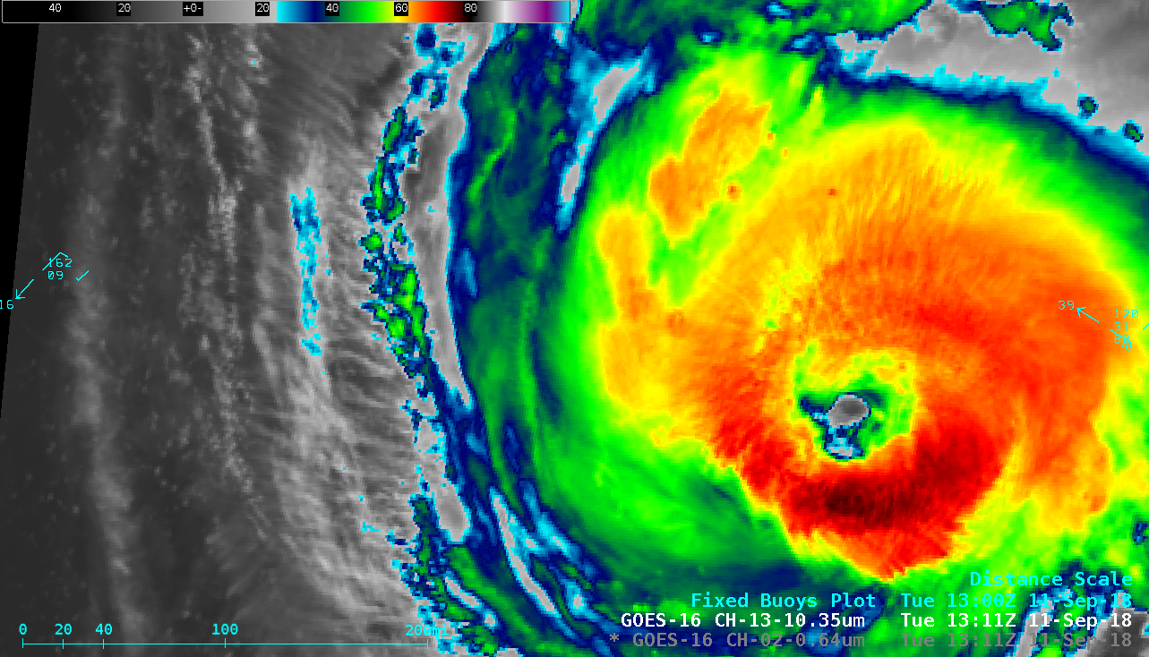
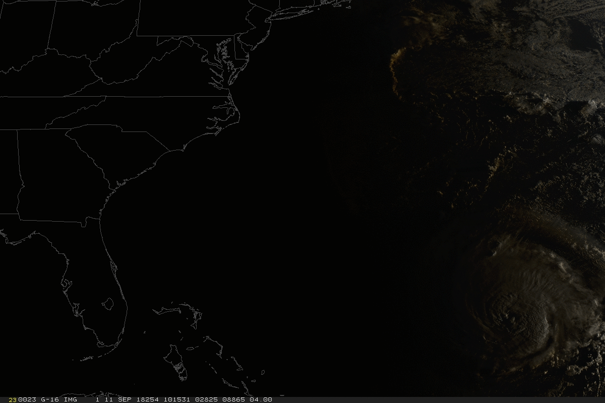
GOES-16 “Clean” Infrared Window (10.3 µm) images [click to play MP4 animation]
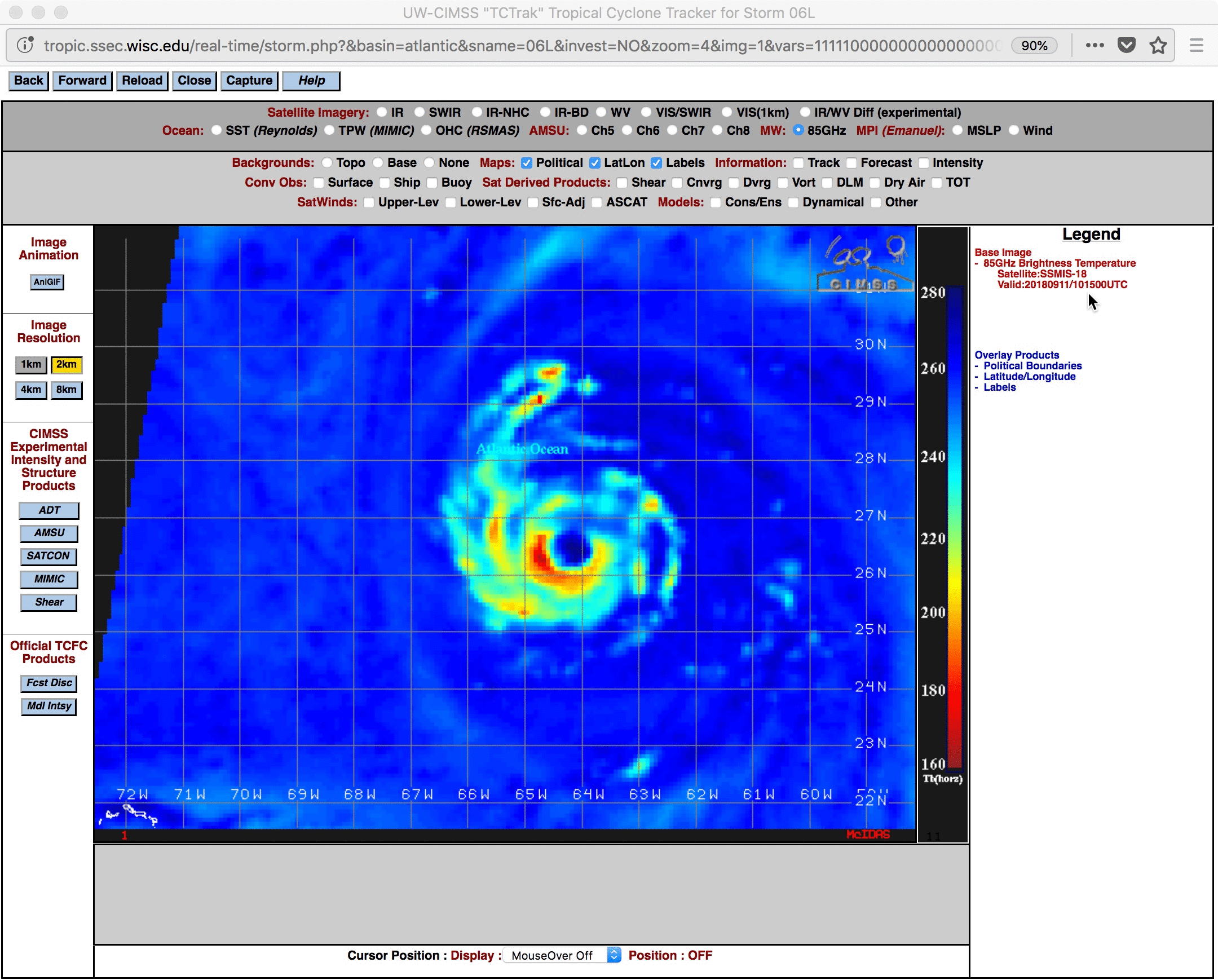
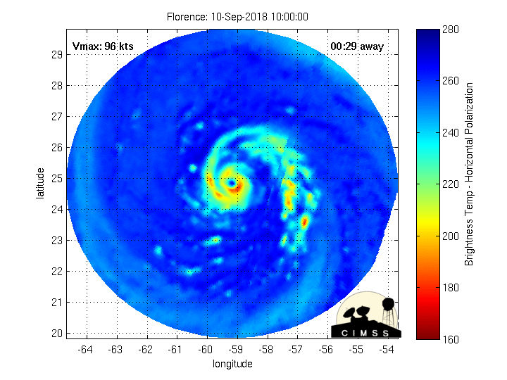
DMSP-18 SSMIS Microwave (85 GHz) and GOES-16 “Clean” Infrared Window (10.3 µm) images at 1015 UTC [click to enlarge]
![GOES-16 Upper-level Water Vapor (6.2 µm) images, with Derived Motion Winds [click to play MP4 animation]](https://cimss.ssec.wisc.edu/satellite-blog/wp-content/uploads/sites/5/2018/09/florence_wv_winds-20180911_115713.png)
GOES-16 Upper-level Water Vapor (6.2 µm) images, with Derived Motion Winds [click to play MP4 animation]
![GOES-16 natural color RGB images [click to play MP4 animation]](https://cimss.ssec.wisc.edu/satellite-blog/wp-content/uploads/sites/5/2018/09/180911_1300utc_goes16_truecolor_Florence.jpeg)
1-minute GOES-16 True Color RGB images, 1330-1440 UTC [click to play MP4 animation]
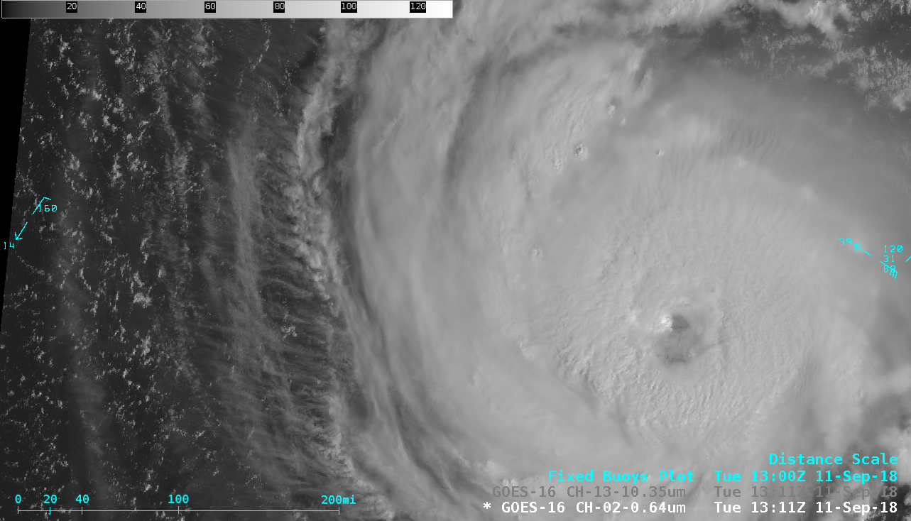
GOES-16 “Red” Viisible (0.64 µm) images [click to play MP4 animation]
GOES-16 “Clean” Infrared Window (10.3 µm) images [click to play MP4 animation]
===== 12 September Update =====
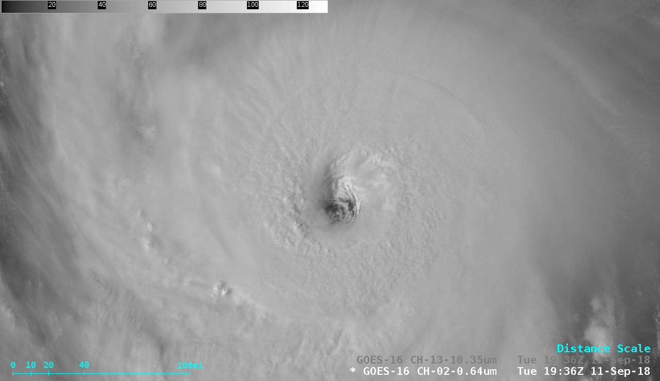
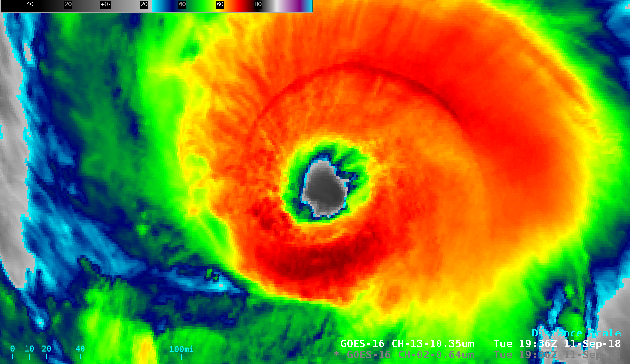
Florence remained at Category 4 intensity early in the day as it continued its northwestward motion toward the southeast coast of the US on 12 September. A 20-hour period of 1-minute GOES-16 Infrared images (from 0000-2015 UTC) is shown below.
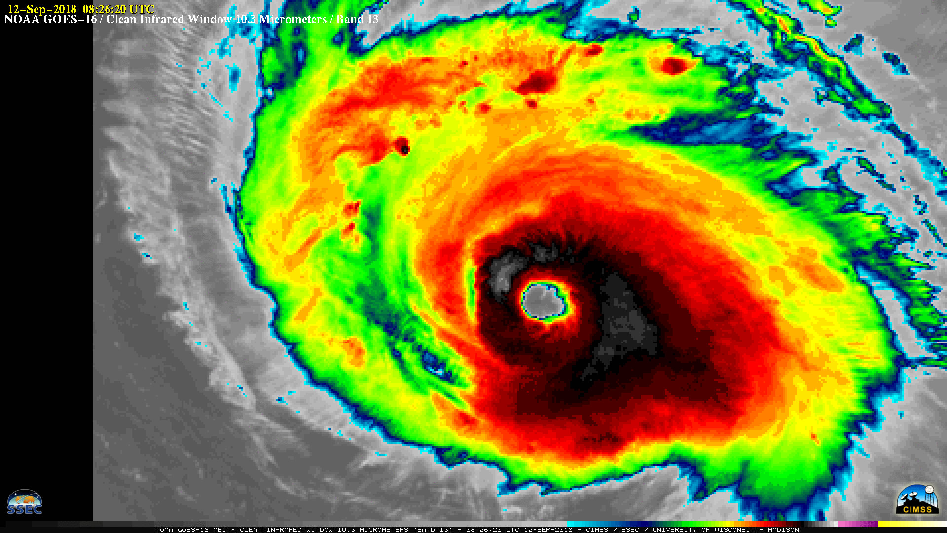
1-minute GOES-16 “Clean” Infrared Window (10.3 µm) images, from 0000-2015 UTC [click to play MP4 animation]
![Suomi NPP VIIRS Day/Night Band and Infrared Window images [click to enlarge]](https://cimss.ssec.wisc.edu/satellite-blog/wp-content/uploads/sites/5/2018/09/180912_0616utc_suomiNPP_DayNightBand_InfraredWindow_Florence_anim.gif)
Suomi NPP VIIRS Day/Night Band (0.7 µm) and Infrared Window (11.45 µm) images [click to enlarge]
![NOAA-20 VIIRS Day/Night Band and Infrared Window images [click to enlarge]](https://cimss.ssec.wisc.edu/satellite-blog/wp-content/uploads/sites/5/2018/09/180912_0706utc_noaa20_DayNightBand_InfraredWindow_Florence_anim.gif)
NOOA-20 VIIRS Day/Night Band (0.7 µm) and Infrared Window (11.45 µm) images [click to enlarge]
![Infrared Window images from Terra MODIS (11.0 µm) and Suomi NPP VIIRS (11.45 µm) [click to enlarge]](https://cimss.ssec.wisc.edu/satellite-blog/wp-content/uploads/sites/5/2018/09/180912_modis_viirs_infrared_Florence_anim.gif)
Infrared Window images from Terra MODIS (11.0 µm) and Suomi NPP VIIRS (11.45 µm) [click to enlarge]
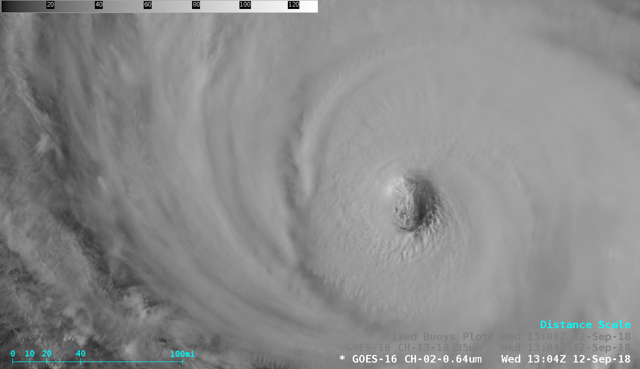
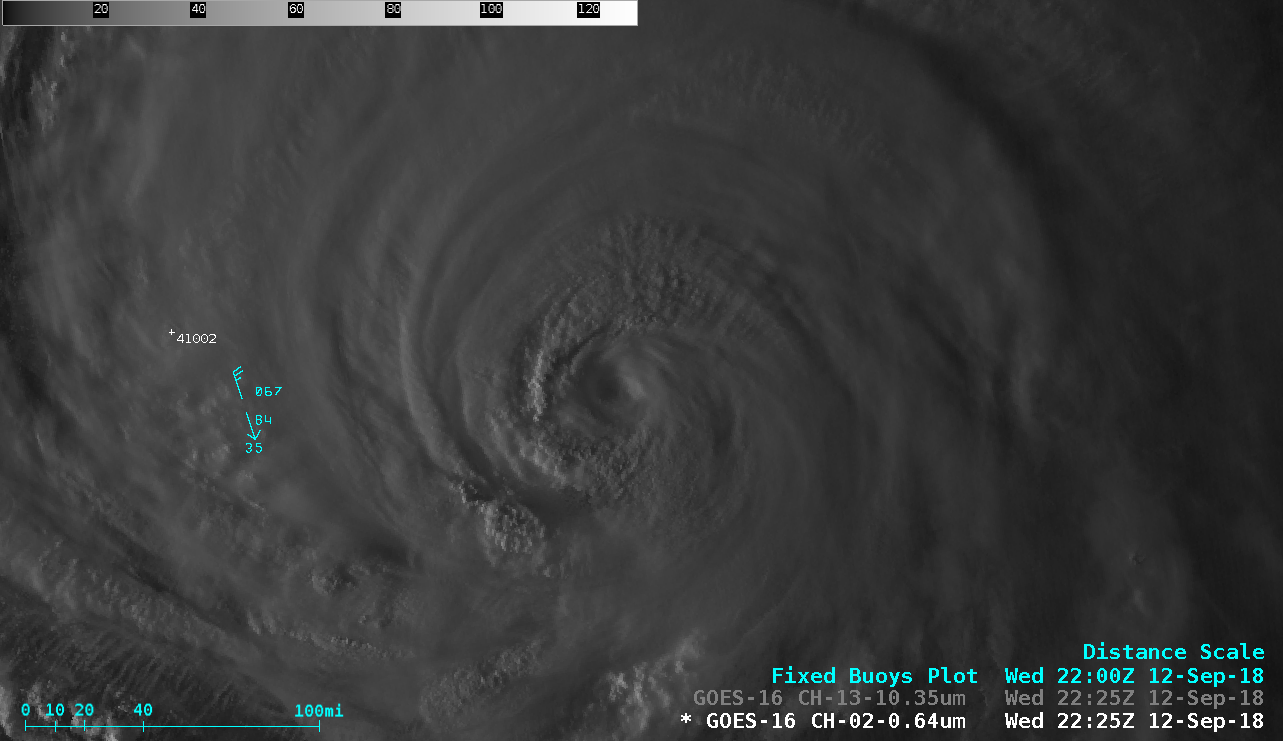
GOES-16 “Red” Visible (0.64 µm) images [click to play MP4 animation]
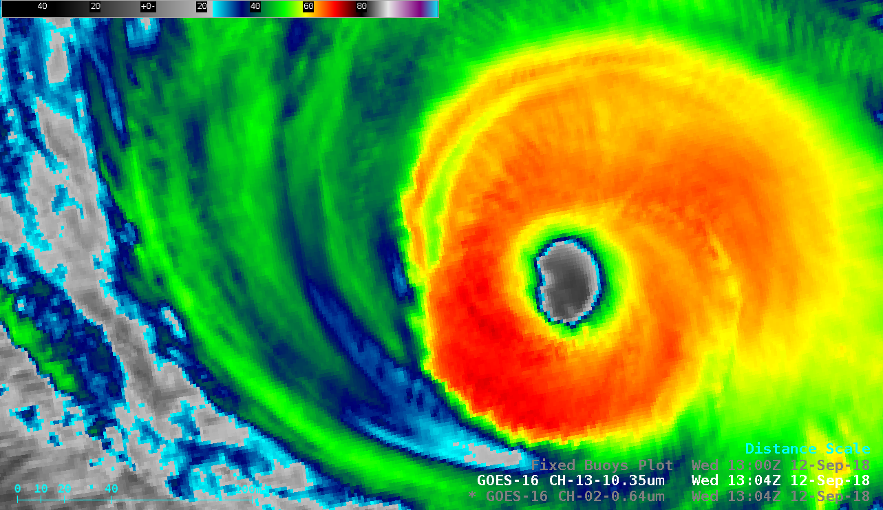
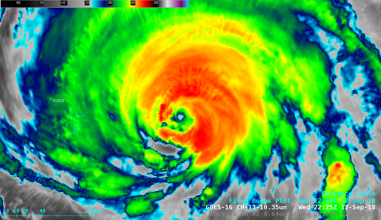
GOES-16 “Clean” Infrared Window (10.3 µm) images [click to play MP4 animation]
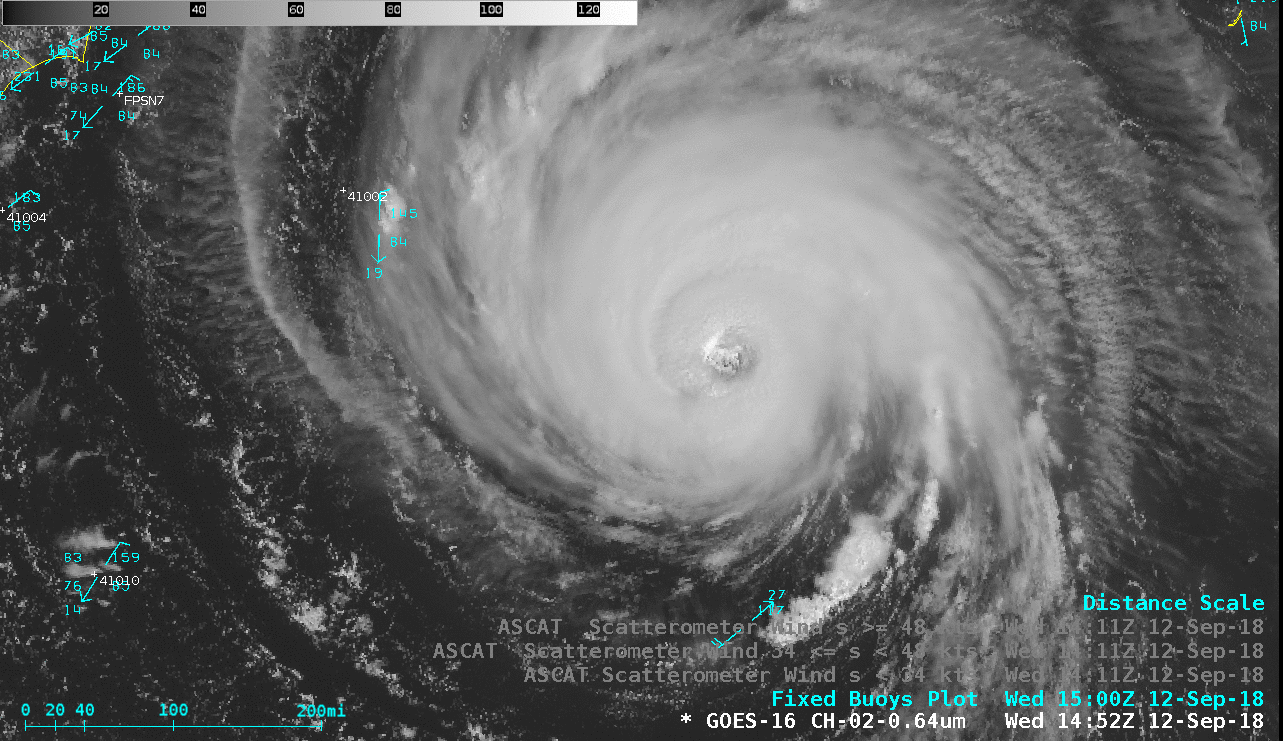
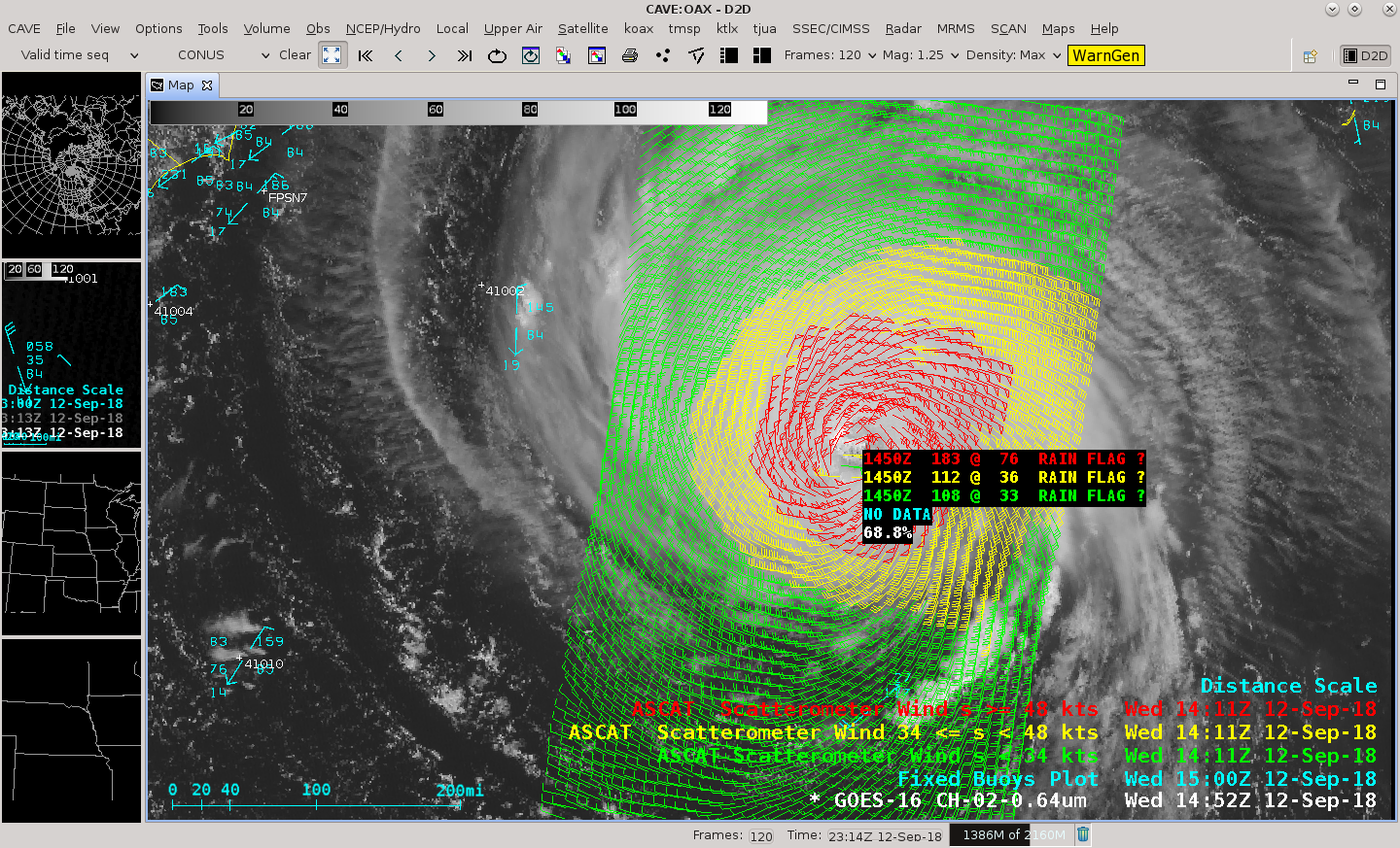
GOES-16 “Red” Visible (0.64 µm) image with Metop-A ASCAT surface scatterometer winds [click to enlarge]
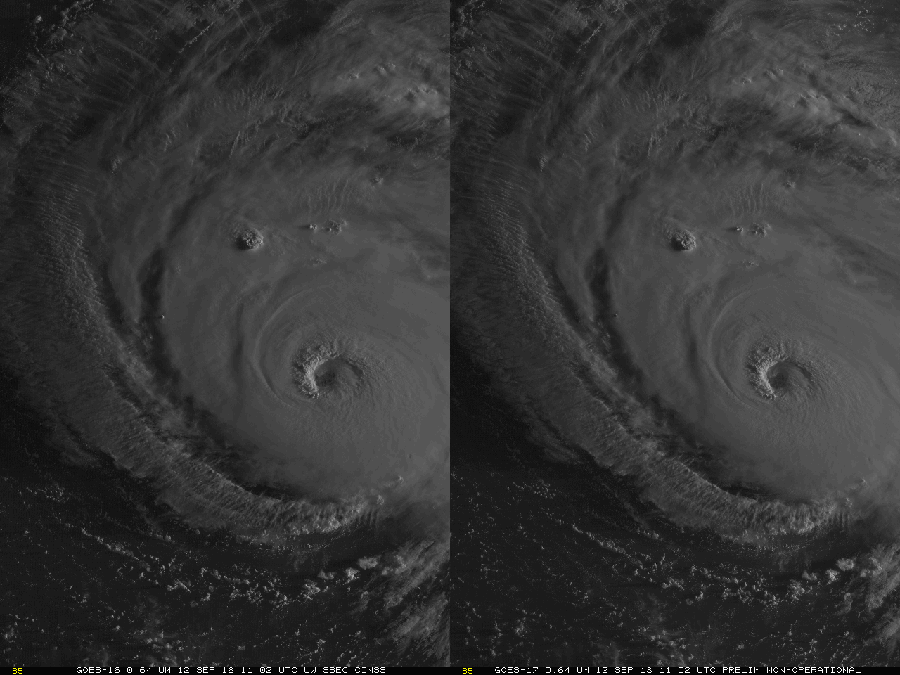
Stereoscopic animation using GOES-16 and GOES-17 “Red” Visible (0.64 µm) imagery [click to play animation]
GOES-16 “Red” Visible (0.64 µm) images [click to play MP4 animation]
GOES-16 “Clean” Infrared Window {10.3 µm) images [click to play MP4 animation]
![MIMIC Total Precipitable Water product [click to enlarge]](https://cimss.ssec.wisc.edu/satellite-blog/wp-content/uploads/sites/5/2018/09/180912_mimic_tpw_Florence_anim.gif)
MIMIC Total Precipitable Water product [click to enlarge]