Hurricane Florence continues to approach the southeastern US
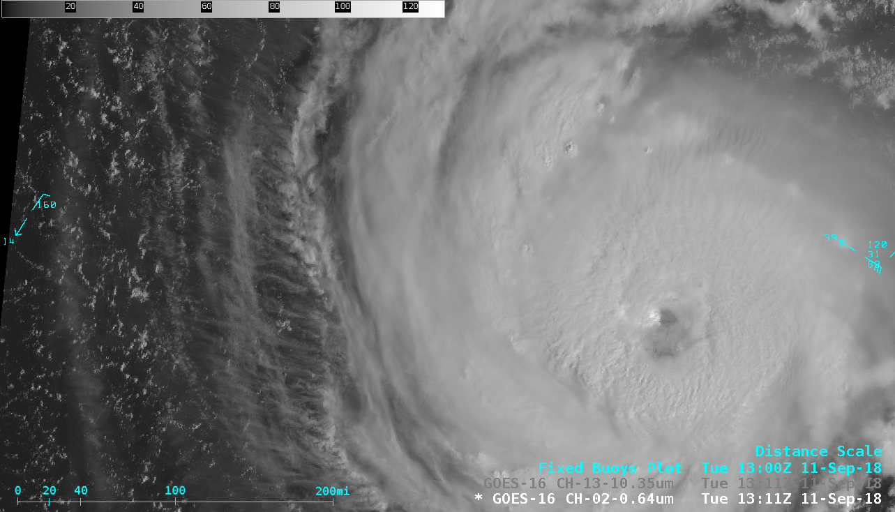
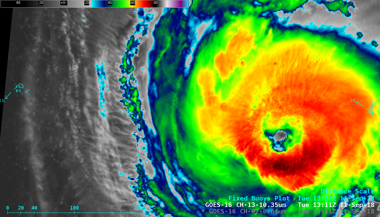
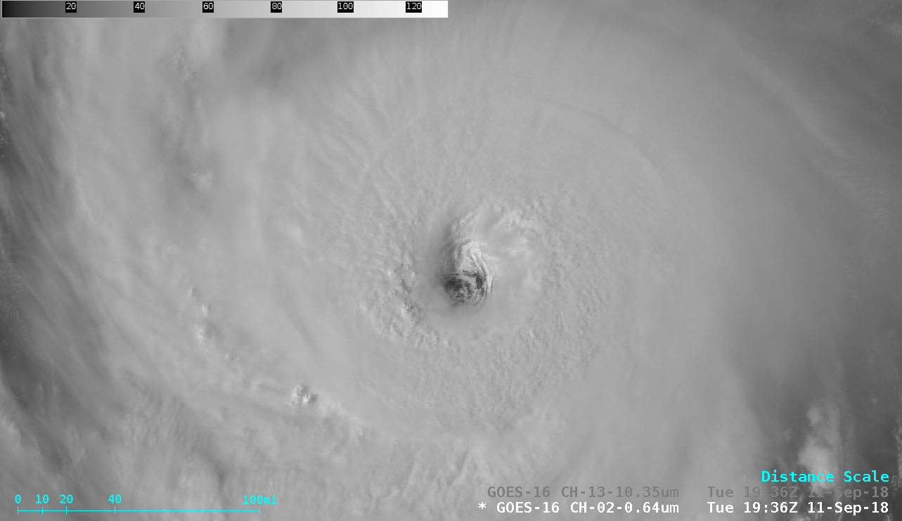
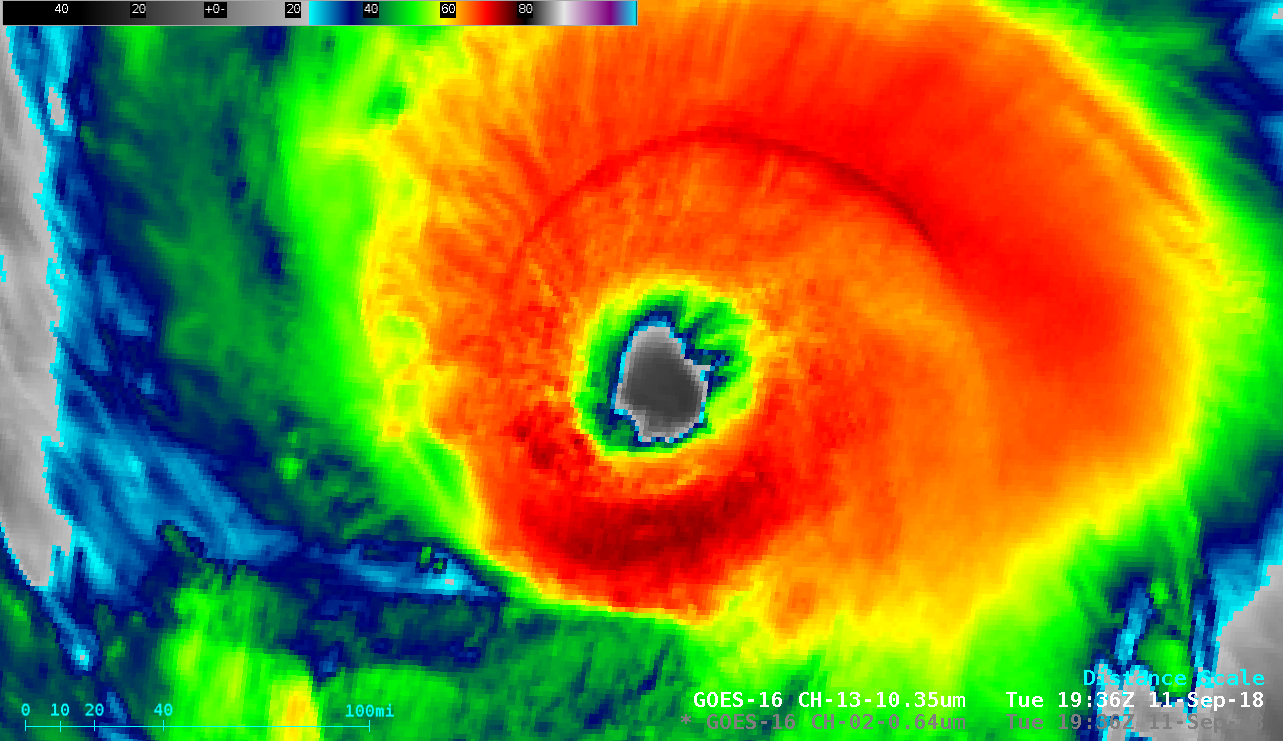
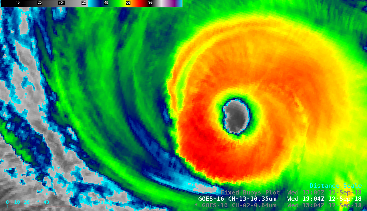
Hurricane Florence maintained Category 4 intensity on the morning of 11 September 2018 — and 1-minute (initially 30-second, until 1345 UTC) Mesoscale Domain Sector GOES-16 (GOES-East) “Red” Visible (0.64 µm) images (above) and “Clean” Infrared Window (10.3 µm) images (below) showed improving eye structure after the tropical cyclone completed an eyewall replacement cycle during the preceding nighttime hours (MIMIC TC). A distinct pattern of transverse banding was also evident within the northern semicircle of Florence on Infrared imagery. DMSP-18 SSMIS Microwave (85 GHz) imagery from the CIMSS Tropical Cyclones site (below) showed a large eye at 1015 UTC, and also at 1103 UTC.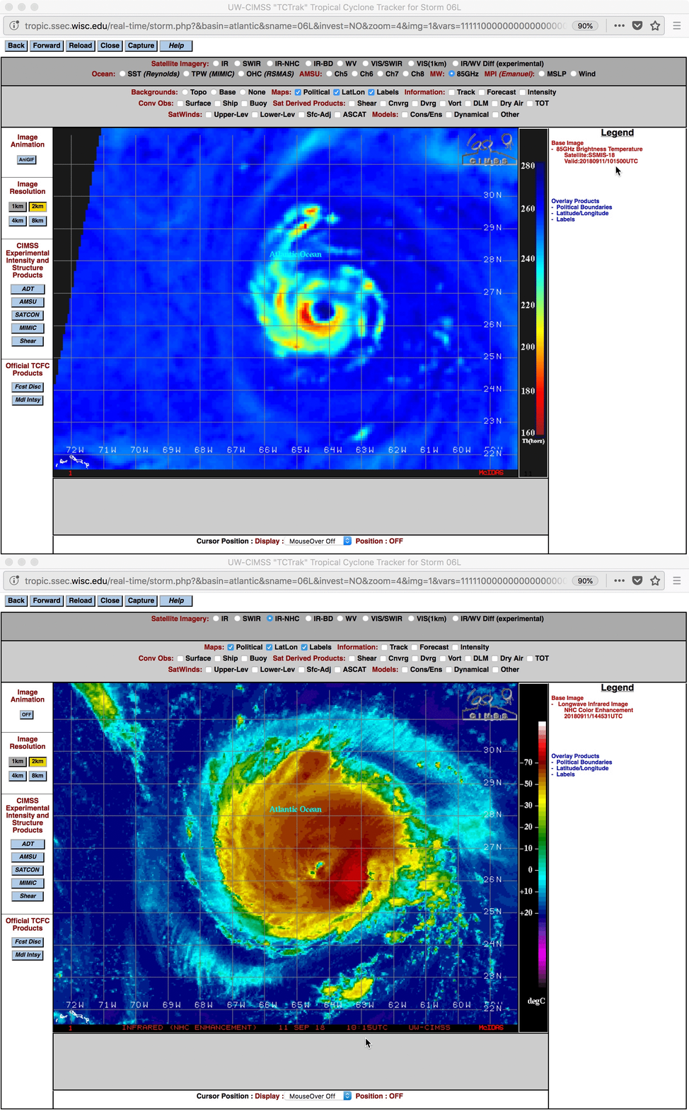
DMSP-18 SSMIS Microwave (85 GHz) and GOES-16 “Clean” Infrared Window (10.3 µm) images at 1015 UTC [click to enlarge]
![GOES-16 Upper-level Water Vapor (6.2 µm) images, with Derived Motion Winds [click to play MP4 animation]](https://cimss.ssec.wisc.edu/satellite-blog/wp-content/uploads/sites/5/2018/09/florence_wv_winds-20180911_115713.png)
GOES-16 Upper-level Water Vapor (6.2 µm) images, with Derived Motion Winds [click to play MP4 animation]
===== 12 September Update =====
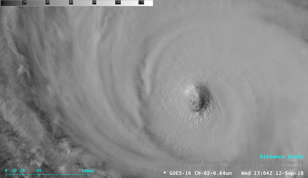
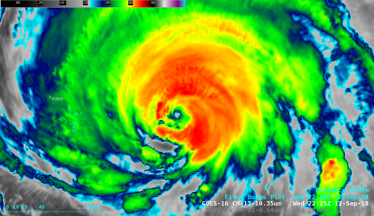
Florence remained at Category 4 intensity early in the day as it continued its northwestward motion toward the southeast coast of the US on 12 September. A 20-hour period of 1-minute GOES-16 Infrared images (from 0000-2015 UTC) is shown below.
1-minute GOES-16 “Clean” Infrared Window (10.3 µm) images, from 0000-2015 UTC [click to play MP4 animation]
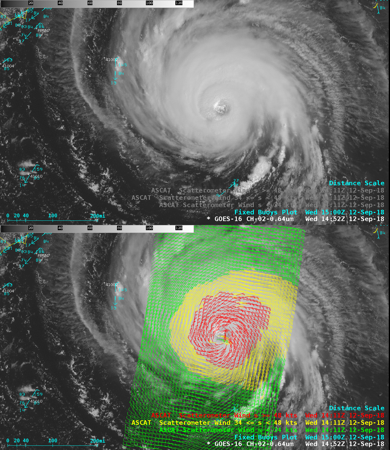
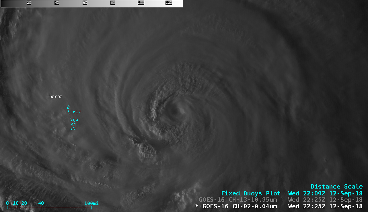
GOES-16 “Red” Visible (0.64 µm) image with Metop-A ASCAT surface scatterometer winds [click to enlarge]
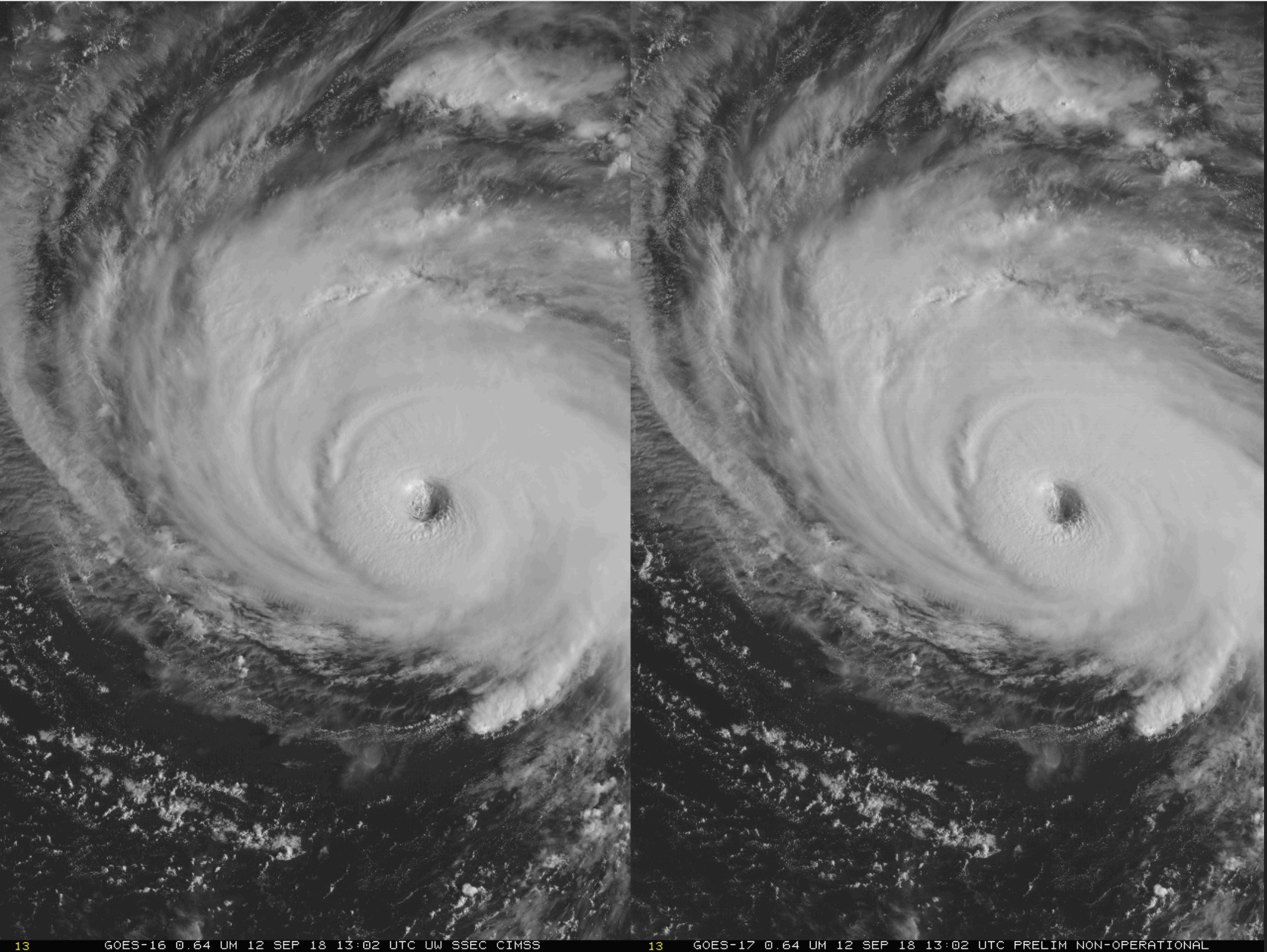
Stereoscopic animation using GOES-16 and GOES-17 “Red” Visible (0.64 µm) imagery [click to play animation]


![GOES-16 natural color RGB images [click to play MP4 animation]](https://cimss.ssec.wisc.edu/satellite-blog/wp-content/uploads/sites/5/2018/09/180911_1300utc_goes16_truecolor_Florence.jpeg)
![Suomi NPP VIIRS Day/Night Band and Infrared Window images [click to enlarge]](https://cimss.ssec.wisc.edu/satellite-blog/wp-content/uploads/sites/5/2018/09/180912_0616utc_suomiNPP_DayNightBand_InfraredWindow_Florence_anim.gif)
![NOAA-20 VIIRS Day/Night Band and Infrared Window images [click to enlarge]](https://cimss.ssec.wisc.edu/satellite-blog/wp-content/uploads/sites/5/2018/09/180912_0706utc_noaa20_DayNightBand_InfraredWindow_Florence_anim.gif)
![Infrared Window images from Terra MODIS (11.0 µm) and Suomi NPP VIIRS (11.45 µm) [click to enlarge]](https://cimss.ssec.wisc.edu/satellite-blog/wp-content/uploads/sites/5/2018/09/180912_modis_viirs_infrared_Florence_anim.gif)
![MIMIC Total Precipitable Water product [click to enlarge]](https://cimss.ssec.wisc.edu/satellite-blog/wp-content/uploads/sites/5/2018/09/180912_mimic_tpw_Florence_anim.gif)