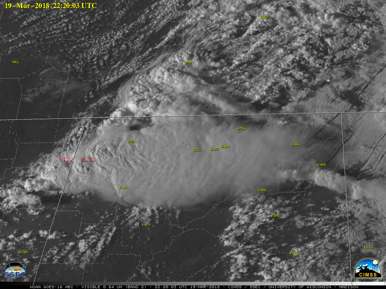

GOES-16 “Red” Visible (0.64 µm) images, with airport identifiers plotted in yellow and SPC storm reports plotted in red [click to play MP4 animation]
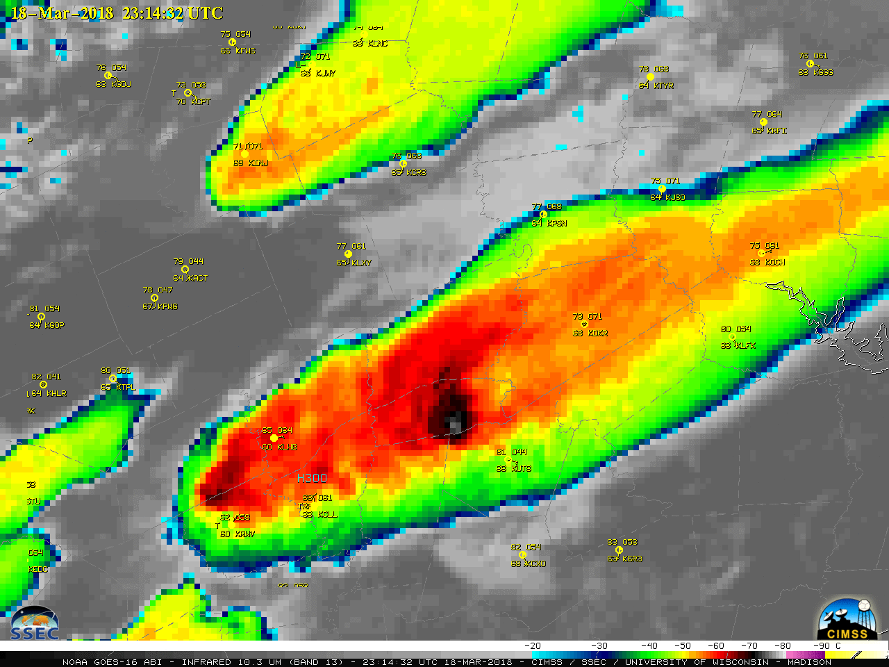
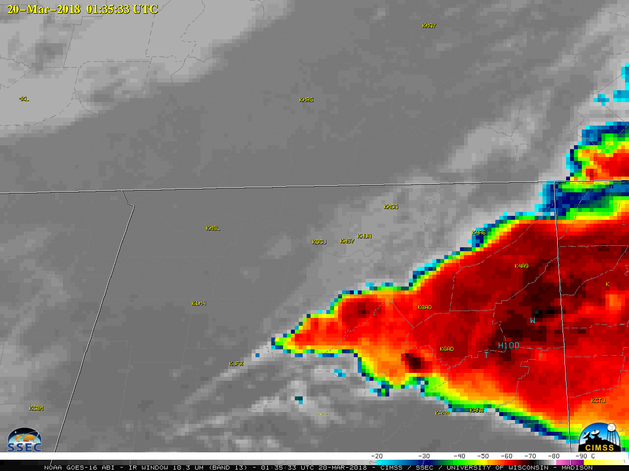
In the corresponding GOES-16 “Clean” Infrared Window (10.3 µm) images (below), cloud-top infrared brightness temperatures of some overshooting tops were around -70 ºC (black enhancement).
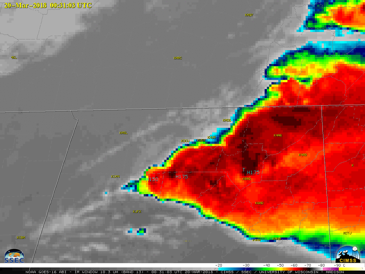
GOES-16 “Clean” Infrared Window (10.3 µm) images, with airport identifiers plotted in yellow and SPC storm reports plotted in cyan [click to play MP4 animation]
UPDATE/CORRECTED: the damage survey continues, and based on an assessment of structures in the vicinity of Jacksonville State University the tornado intensity has been UPGRADED to an EF-3 with winds around 140mph.
— NWS Birmingham (@NWSBirmingham) March 20, 2018
After 306 consecutive days without an F3/EF3+ tornado in the United States, the remarkable drought has come to an end. This is the longest such streak since NOAA records began in the 1950s. pic.twitter.com/gPPqGWRTYP
— Steve Bowen (@SteveBowenWx) March 20, 2018
Additional animations are available on the Satellite Liaison Blog.
View only this post Read Less

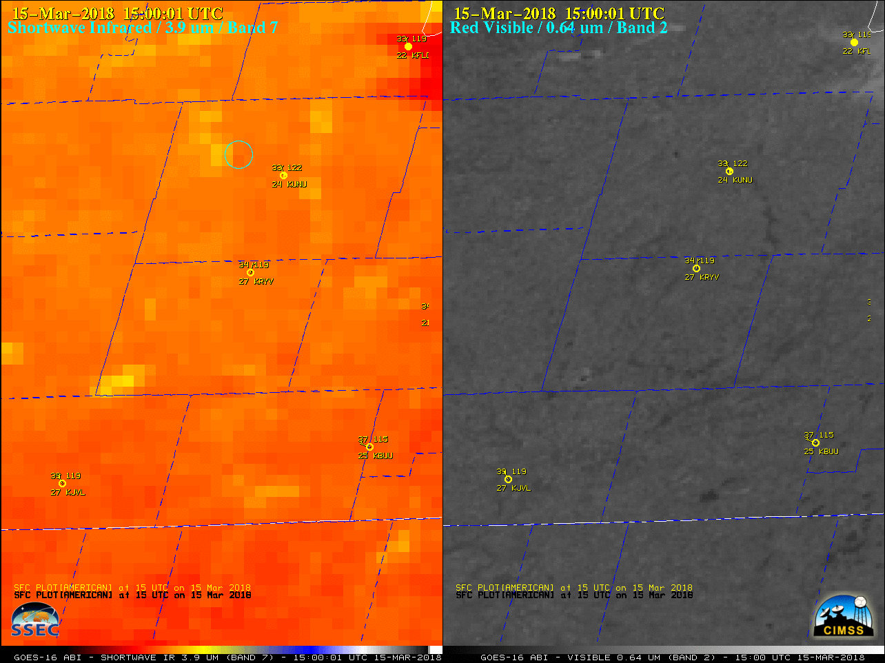
![GOES-16 Shortwave Infrared (3.9 µm, left) and Near-Infrared (2.24 µm, right) images, with station identifiers plotted in cyan [click to play animation]](https://cimss.ssec.wisc.edu/satellite-blog/wp-content/uploads/sites/5/2018/03/180317_goes16_ShortwaveInfrared_NearInfrared_SFO_fire_anim.gif)
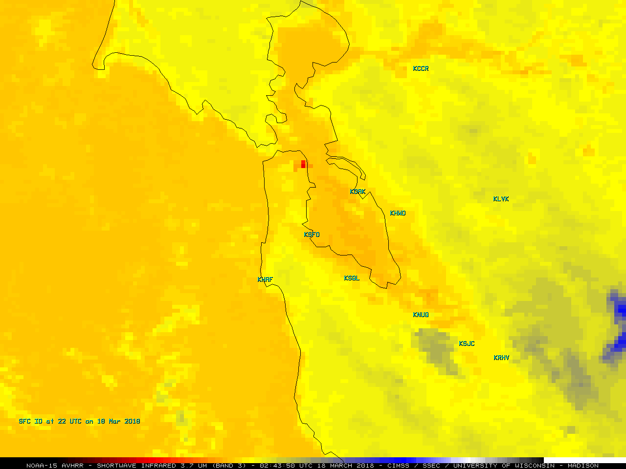
![NOAA-15 Shortwave Infrared (3.7 µm) image [click to enlarge]](https://cimss.ssec.wisc.edu/satellite-blog/wp-content/uploads/sites/5/2018/03/180318_0243UTC_NOAA15_SWIR_SFO_FIRE.GIF)
