Matthew along the east coast of Florida
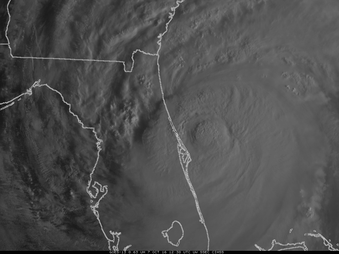
GOES-13 Visible (0.63 µm) Imagery, 1230-1337 UTC (Click to enlarge)
Hurricane Matthew is on a path that parallels the coast of Florida, with the center remaining just offshore. GOES-13 Visible imagery from a 1-hour time period this morning, above, shows the continued development of convection around the eyewall and the motion of convective bands inland. GOES-13 Visible images with hourly surface winds and wind gusts (in knots) are shown below. The highest wind gust recorded along the central Florida coast was 107 mph (NWS Melbourne PNS).
![GOES-13 Visible (0.63 um) images, with hourly surface winds and gusts in knots [Click to play animation]](https://cimss.ssec.wisc.edu/satellite-blog/wp-content/uploads/sites/5/2016/10/161007_goes13_visible_winds_Matthew_anim.gif)
GOES-13 Visible (0.63 um) images, with hourly surface winds and gusts in knots [Click to play animation]
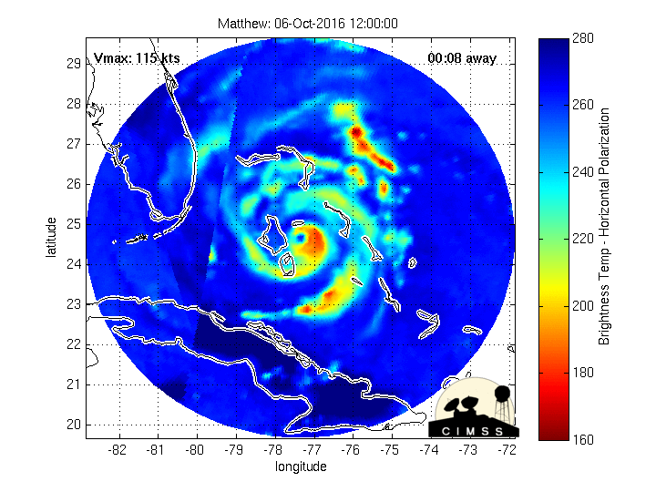
Morphed Microwave Imagery of Matthew showing Strongest Convection, 1200 UTC 06 October to 1100 UTC 07 October 2016 (Click to enlarge)
Infrared imagery from GOES-13, below, also shows the coldest cloud tops to the east of the eye (indicated by the arrow in the image).
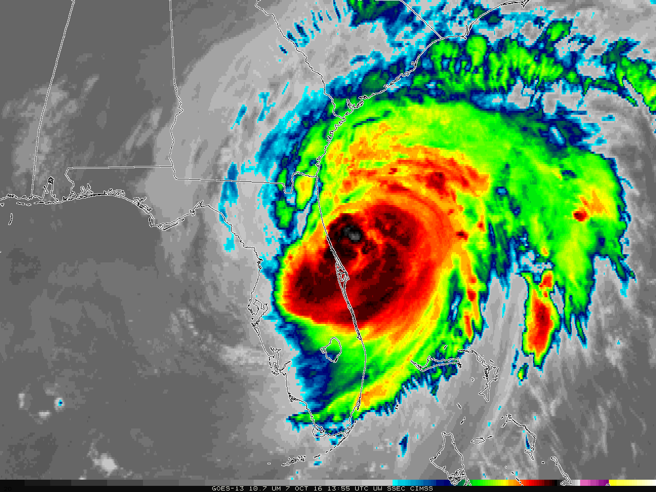
GOES-13 Infrared (10.7 µm) Imagery, 1355 UTC. The flashing arrow points to Matthew’s eye (Click to enlarge)
A longer animation of GOES-13 Infrared Window (10.7 um) images with hourly surface winds and wind gusts (in knots) is shown below (MP4 | animated GIF).
![GOES-13 Infrared Window (10.7 um) images [Click to play animation]](https://cimss.ssec.wisc.edu/satellite-blog/wp-content/uploads/sites/5/2016/10/161007_goes13_infrared_winds_Matthew_anim.gif)
GOES-13 Infrared Window (10.7 um) images [Click to play animation]
![Suomi NPP VIIRS Visible (0.64 um) and Infrared Window (11.45 um) images [Click to enlarge]](https://cimss.ssec.wisc.edu/satellite-blog/wp-content/uploads/sites/5/2016/10/161007_1751utc_suomi_npp_viirs_visible_infrared_Matthew_anim.gif)
Suomi NPP VIIRS Visible (0.64 um) and Infrared Window (11.45 um) images [Click to enlarge]