Detection of River Flooding in Alaska
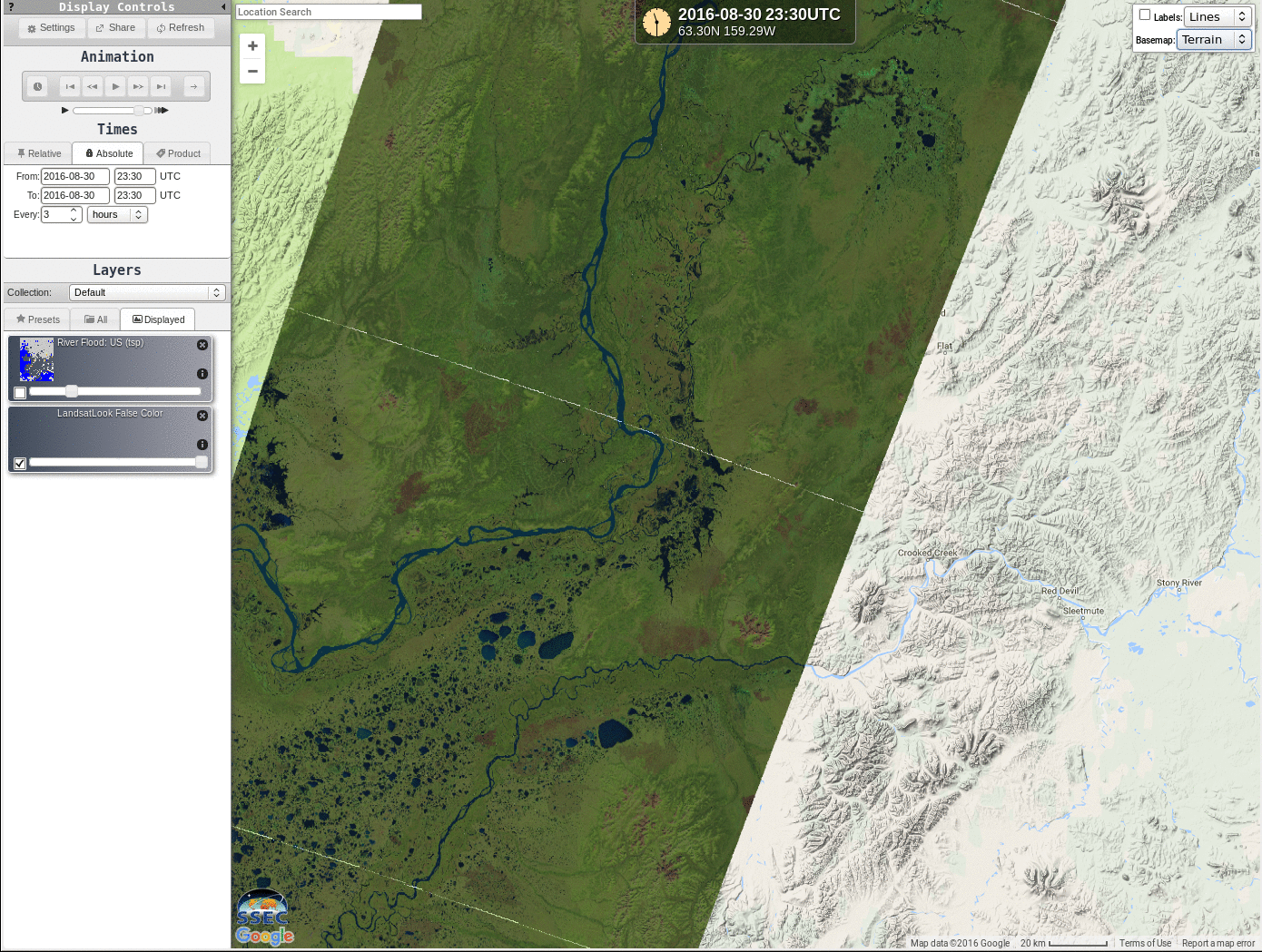
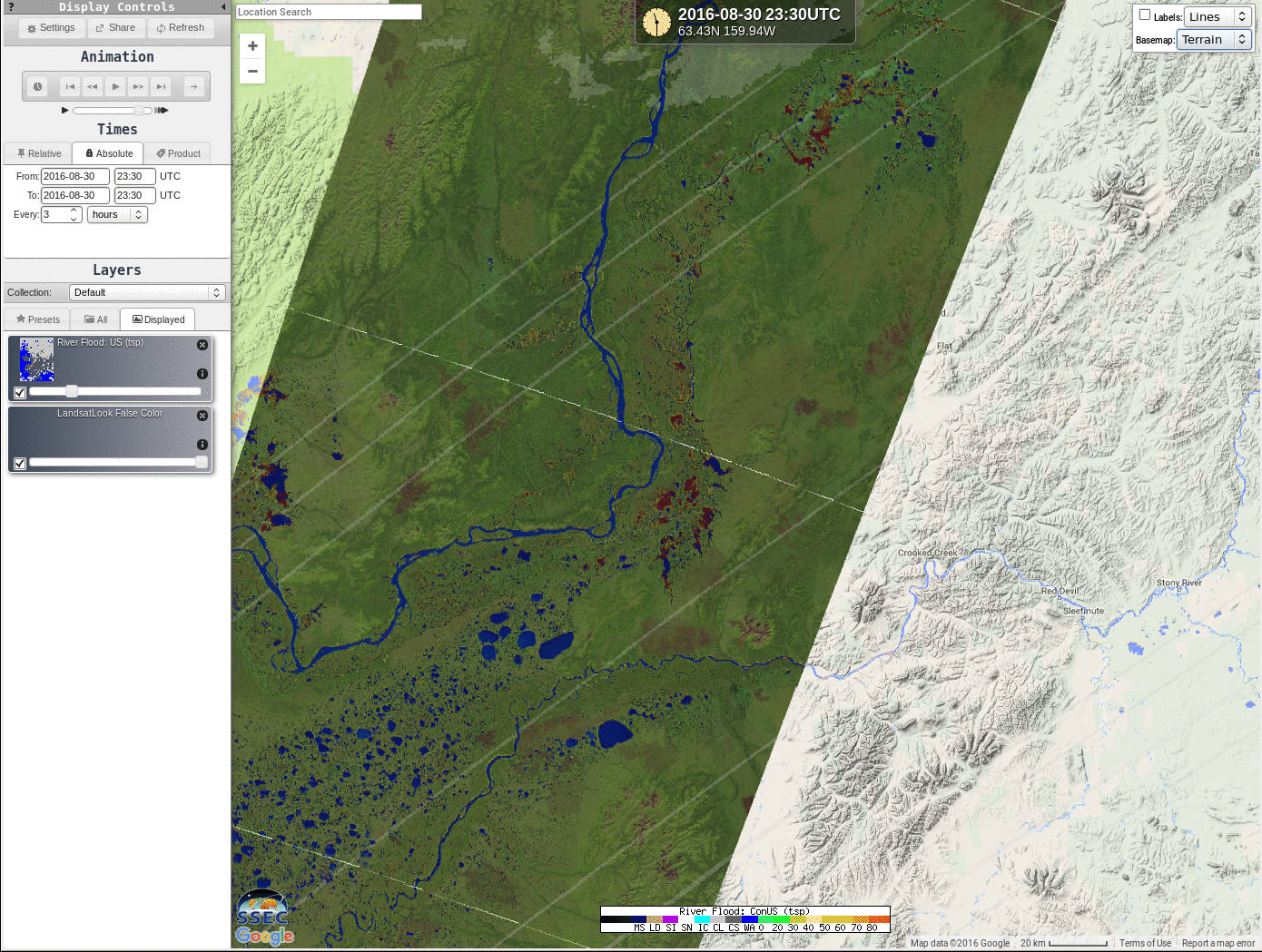
![Google Maps of west central Alaska, the JPSS River Flood Product and Landsat-8 False Color Imagery, 30 August 2016 [click to enlarge]](https://cimss.ssec.wisc.edu/satellite-blog/wp-content/uploads/sites/5/2016/08/AK_30August2016_5imagetoggle.gif)
Google Maps of west central Alaska, the JPSS River Flood Product and Landsat-8 False Color Imagery, 30 August 2016 [click to enlarge]
Swampy conditions near the meandering Innoko River, a tributary to the Yukon River in Alaska, have been diagnosed by the JPSS River Flood Product near the Innoko’s mouth on the Yukon. (August has been very wet over parts of Alaska) A timely Landsat-8 overpass, in clear skies, on 30 August 2016 allows for excellent validation of the Flood Product. The animation above (using Images from RealEarth) cycles between the Google Maps terrain and satellite views of the region, the JPSS Flood Product (developed by a group led by Sanmei Li at George Mason University, which product uses reflective channels on JPSS (I01, I02, and I03, 0.64 µm, 0.86 µm and 1.61 µm, respectively) and I05, the 11.45 µm channel) and the Landsat-8 False Color overpass. Diagnosed floods in the JPSS Product are distinctly captured in the Landsat-8 False Color product.