Using VIIRS and ABI to Monitor Northern California Flooding in RealEarth
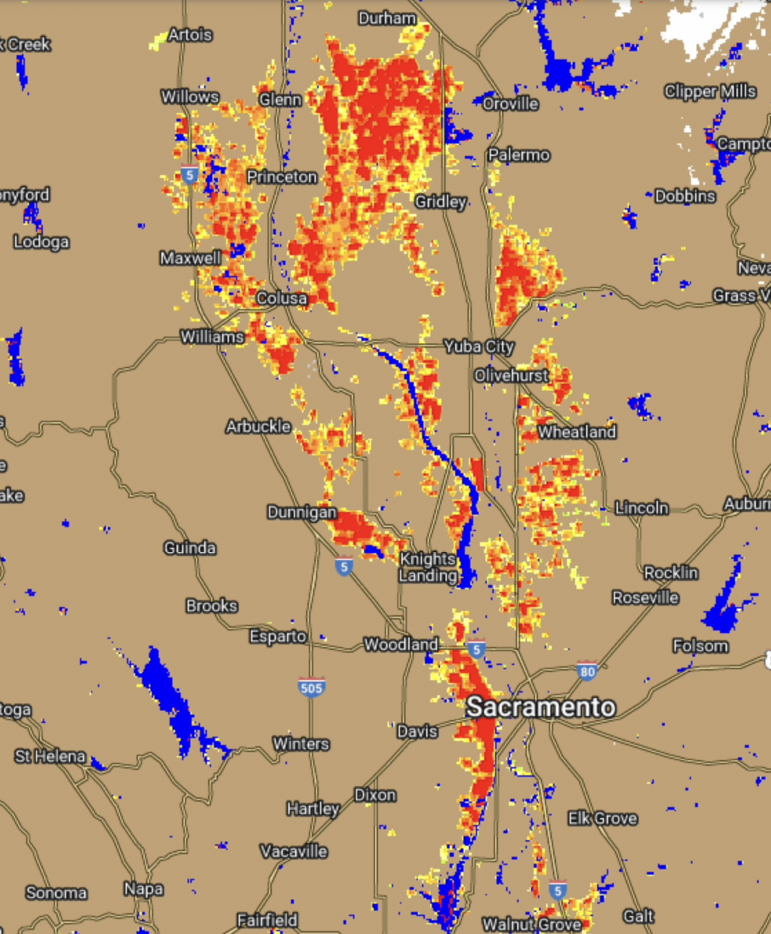
Using a combined LEO/GEO approach, ABI and VIIRS retrievals are used to estimate flooding from a satellite perspective. Individual flood products from VIIRS and ABI (or AHI, depending on location) are blended to create the NOAA LEO/GEO Flood Mapping Product.An example is shown below over the... Read More
