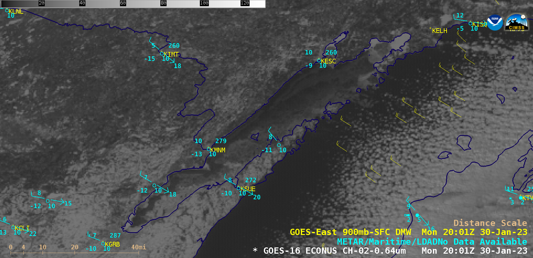
Transport of ice floes from Green Bay into Lake Michigan

GOES-16 “Red” Visible (0.64 µm) images, with GOES-16 Derived Motion Winds plotted in yellow and hourly METAR surface reports plotted in cyan [click to play animated GIF | MP4]
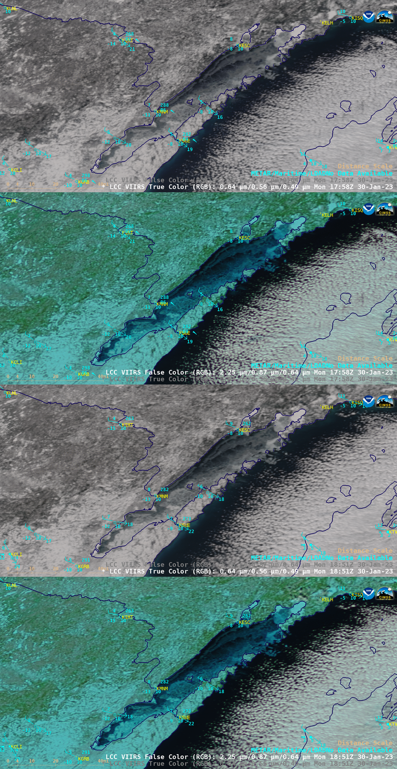
VIIRS True Color RGB and False Color RGB images from NOAA-20 and Suomi-NPP (below) confirmed that these features were ice floes (snow and ice appear as shades of cyan in the False Color RGB images). The VIIRS data were downloaded and processed by the SSEC/CIMSS Direct Broadcast ground station.
The emergence of ice floes into Lake Michigan can also be seen in a comparison of RADARSAT Synthetic Aperture Radar (SAR) wind data (source) at 1208 UTC and 2332 UTC (below). Ice features are very reflective in SAR wind data, and appear as brighter shades of yellow to red in these 2 images.


