This website works best with a newer web browser such as Chrome, Firefox, Safari or Microsoft Edge. Internet Explorer is not supported by this website.

Archive: Fri Jan 2023

30-second imagery of mountain waves over the Mid-Atlantic states

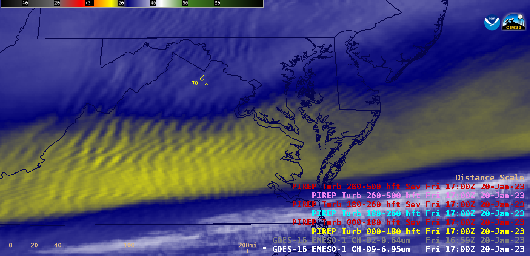
Overlapping 1-minute Mesoscale Domain Sectors provided GOES-16 (GOES-East) imagery at 30-second intervals over the Mid-Atlantic states on 20 January 2023 — and Mid-level Water Vapor (6.9 µm) images (above) revealed widespread mountain waves east of the Appalachians (produced by strong westerly flow interacting with the terrain). There were numerous pilot reports of light to moderate... Read More

Disturbed weather in the tropics near American Samoa

GOES-18 Clean window infrared imagery (10.3 µm, displayed at full resolution in a special sector over American Samoa, in the latest AWIPS build) shows an area of convection, within a region of abundant moisture (GOES-18 Total Precipitable water values are close to 2.5″), approaching the Samoan islands (that are located... Read More

Severe convective winds over Ohio

The Storm Prediction Center’s Convective Outlooks for late afternoon on 19 January 2023 contained a region of Enhanced Probabilities for Severe weather (primarily for wind) over portions of Ohio, as shown above. The chief difference between the 1630 and 2000 UTC outlooks was the extension of the Enhanced region to... Read More