Heavy rainfall and flooding in eastern Kentucky
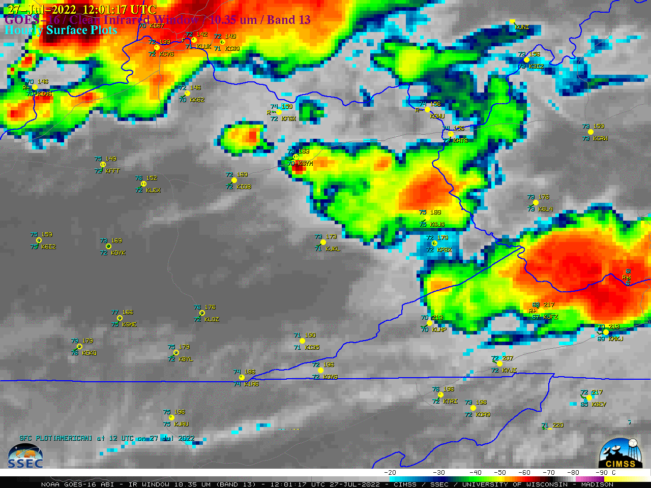
GOES-16 “Clean” Infrared Window (10.35 µm) images, with hourly surface plots; Interstates are plotted in gray [click to play animated GIF | MP4]
In a toggle between NOAA-20 VIIRS Infrared Window (11.45 µm) images valid at 0634 UTC and 0814 UTC (below) the coldest cloud-top infrared brightness temperature was -83ºC (just northeast of Hazard, Kentucky at 0814 UTC). These NOAA-20 images were downloaded and processed using the SSEC/CIMSS Direct Broadcast ground station, before being displayed n AWIPS.

NOAA-20 VIIRS Infrared Window (11.45 µm) images valid at 0634 UTC and 0814 UTC [click to enlarge]