This website works best with a newer web browser such as Chrome, Firefox, Safari or Microsoft Edge. Internet Explorer is not supported by this website.

Archive: Jun 2022

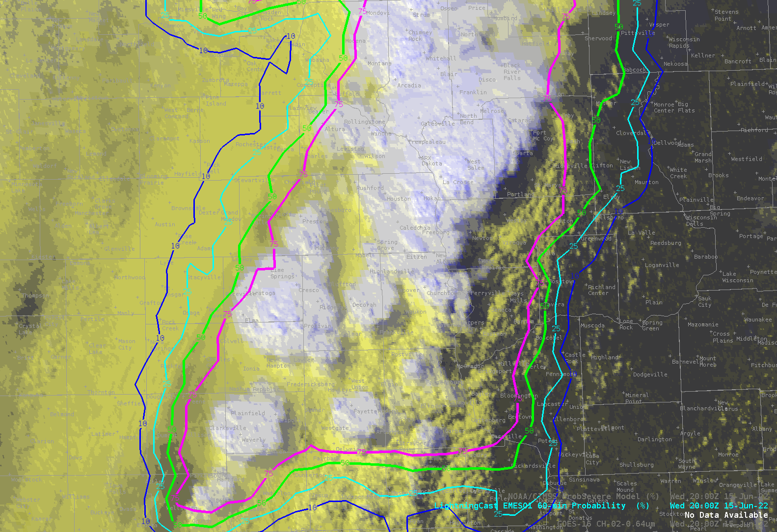
Severe thunderstorms across Iowa, Wisconsin and Michigan

1-minute Mesoscale Domain Sector GOES-16 (GOES-East) “Red” Visible (0.64 µm) images (above) include time-matched SPC Storm Reports — and showed the development severe thunderstorms across parts of Iowa, Wisconsin and Upper Michigan during the afternoon and early evening hours on 15 June 2022. Boundary layer feeder band clouds could be seen flowing north-northeastward into some of the growing thunderstorms —... Read More

2 pyrocumulonimbus clouds produced by the Calf Canyon/Hermit’s Peak Fire in New Mexico

1-minute Mesoscale Domain Sector GOES-17 (GOES-West) “Red” Visible (0.64 µm), Shortwave Infrared (3.9 µm), “Clean” Infrared Window (10.35 µm) and Cloud Top Temperature derived product images (above) showed that the Calf Canyon Fire/Hermits Peak Fire in northeastern New Mexico produced a pair of pyrocumulonimbus (pyroCb) clouds on 14 June 2022. Extreme fire behavior was aided by surface wind gusts as high as 60 mph and very... Read More