This website works best with a newer web browser such as Chrome, Firefox, Safari or Microsoft Edge. Internet Explorer is not supported by this website.

Archive: Jun 2022

Alaskan wildfire smoke

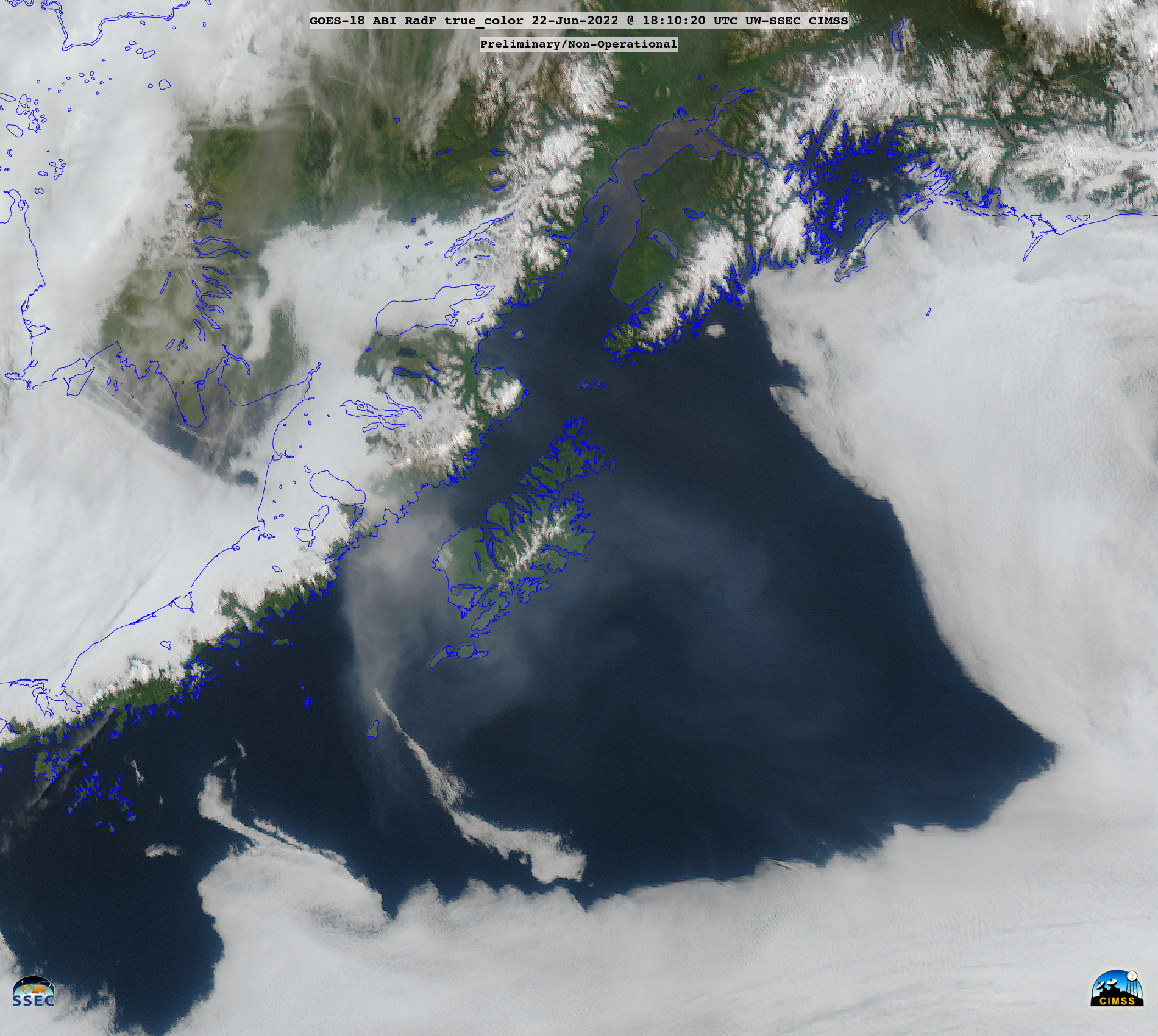
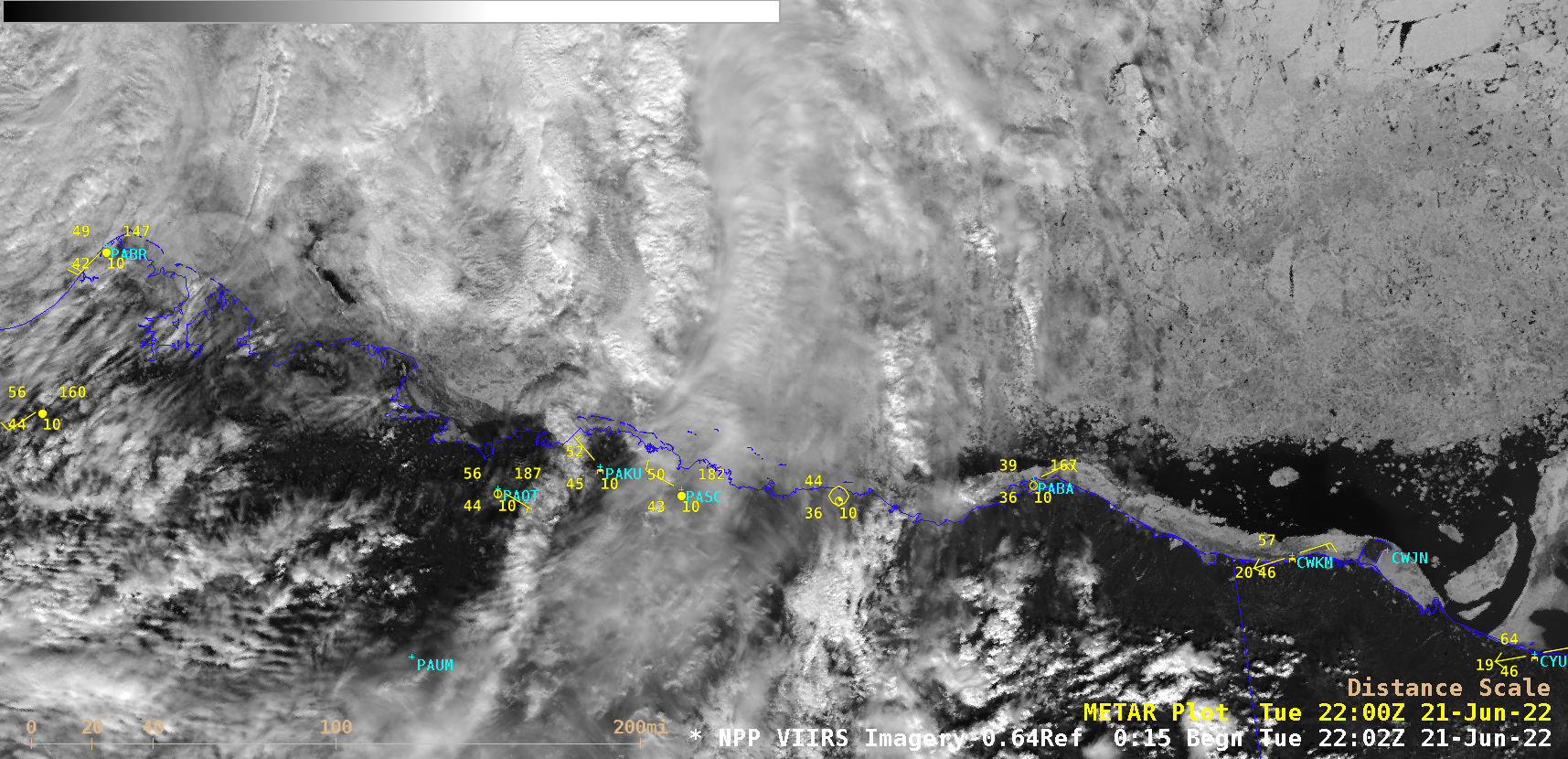
GOES-18 images in this blog post are preliminary and non-operational GOES-18 True Color RGB images created using Geo2Grid (above) showed smoke from Alaskan wildfires that had been transported southward over Kodiak Island and the northern Gulf of Alaska. Most of this smoke remained aloft — note that although Kodiak began... Read More

Nearshore ice motion in the Beaufort Sea

Suomi-NPP VIIRS Visible (0.64 µm) images (above) showed a variety of Beaufort Sea ice floe motion within the nearshore waters of Alaska and Yukon during the 20-21 June 2022 period. Just north of Utqiavik (or Barrow, PABR), a sharp “shear line” was seen on 20 June — with a narrow... Read More

Cross-sections using gridded NUCAPS data in AWIPS

Gridded NUCAPS data, available from NOAA-20 data within AWIPS, can be used to construct cross-sections in AWIPS. The image above includes an editable baseline J-J’ (one of 10 different lines that can be used for data in AWIPS) from Minnesota into Indiana, roughly perpendicular to a line of broken cumulus... Read More