Hurricane Douglas in the East Pacific Ocean
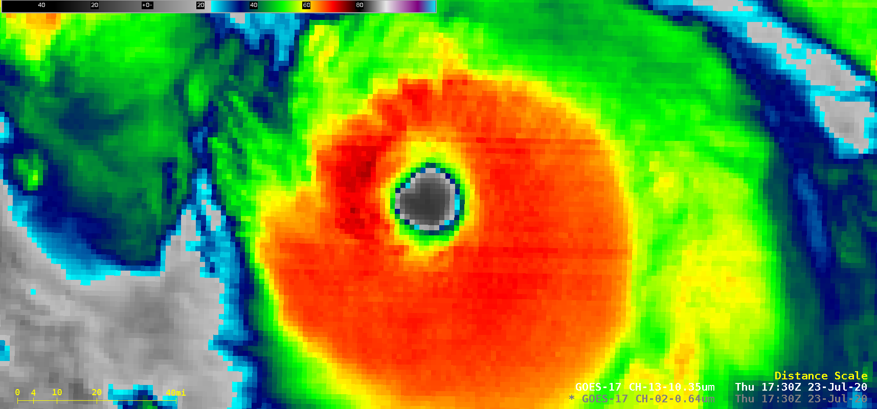
1-minute Mesoscale Domain Sector GOES-17 (GOES-West) “Red” Visible (0.64 µm) and “Clean” Infrared Window (10.35 µm) images (above) showed the formation of Hurricane Douglas — the first hurricane of the 2020 season in the East Pacific Ocean — on 22 July 2020. Douglas was the 4th latest formation of the first hurricane on record in this... Read More

