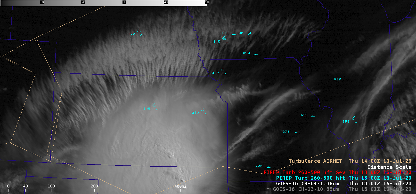
Turbulence associated with transverse banding

GOES-16 “Clean” Infrared Window (10.35 µm) and Near-Infrared “Cirrus” (1.38 µm) images [click to play animation | MP4]
A GOES-16 Turbulence Probability product (below) did show scattered pockets of 25-35% probability in the transverse banding region. However, this product is designed to diagnose turbulence potential in the vicinity of features such as fronts and fields of convection.
![GOES-16 Turbulence Probability product, with plots of PIREPs and AIRMETs [click to play animation | MP4]](https://cimss.ssec.wisc.edu/satellite-blog/images/2020/07/200716_1230utc_goes16_turbulenceProbability_pireps_airmets.png)
GOES-16 Turbulence Probability product, with plots of PIREPs and AIRMETs [click to play animation | MP4]

