This website works best with a newer web browser such as Chrome, Firefox, Safari or Microsoft Edge. Internet Explorer is not supported by this website.

Archive: Jul 2020

Microwave Estimates of Total Precipitable Water

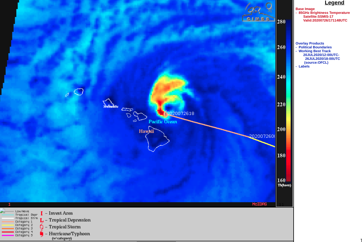
https://cimss.ssec.wisc.edu/satellite-blog/wp-content/uploads/sites/5/2020/07/MIMICTPW_LastTenDaysEPAC_end27July2020.rockanim.mp4 MIMIC TPW rocking animations from 17-27 July 2020 (and back) [click to play mp4 animation] Morphed Microwave Imagery at CIMSS (MIMIC) estimates of Total Precipitable Water are derived from microwave sensors such as AMSU and ATMS on different polar-orbiting platforms. MIRS retrievals are used to estimate Total Precipitable Water from each polar swath, and those swaths are then advected... Read More

Hurricane Douglas moves just north of Hawai’i

1-minute Mesoscale Domain Sector GOES-17 (GOES-West) “Red” Visible (0.64 µm) and “Clean” Infrared Window (10.35 µm) images (above) showed  Category 1 Hurricane Douglas as it moved just north of Hawai’i during the day on 26 July 2020 (the boundary of the Mesoscale Sector was abruptly shifted westward at 1658 UTC). The coldest cloud-top infrared brightness temperatures were around -80ºC.The apparent storm... Read More