Wildfire in the Oklahoma Panhandle
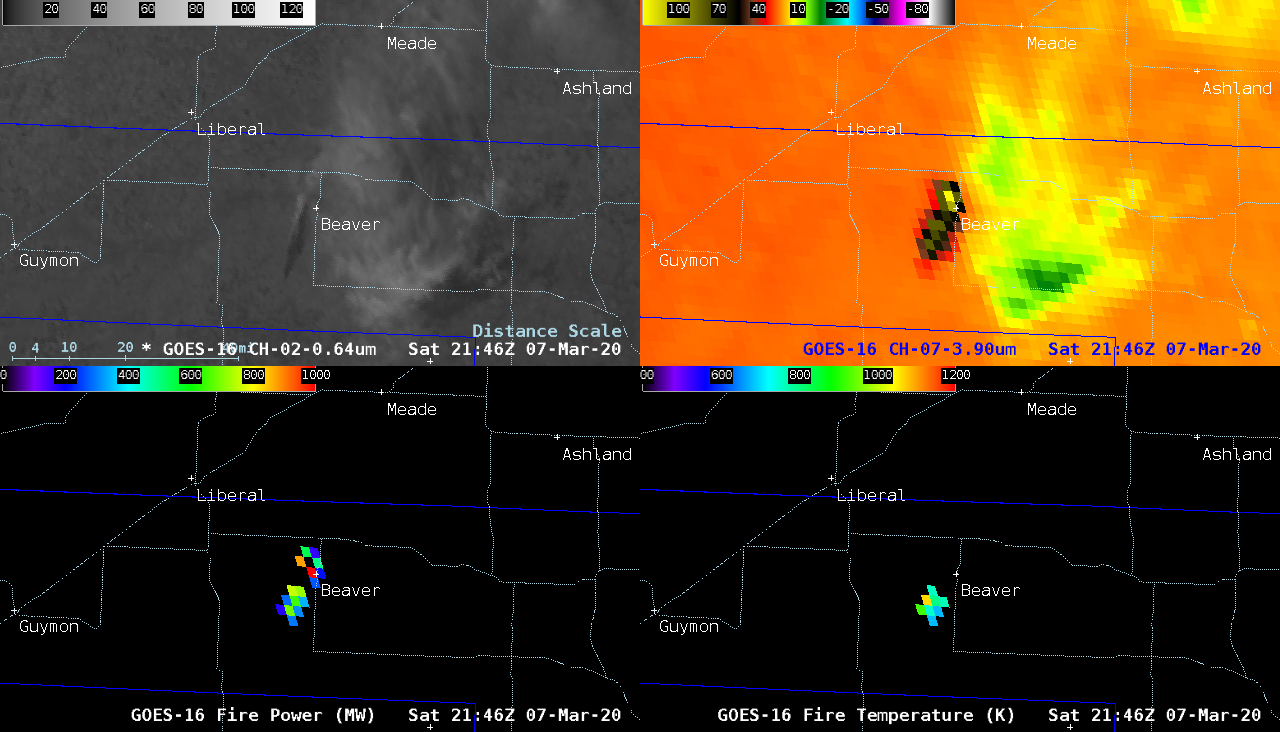
1-minute Mesoscale Domain Sector GOES-16 (GOES-East) “Red” Visible (0.64 µm) and Shortwave Infrared (3.9 µm) images along with 5-minute Fire Power and Fire Temperature products (which are components of the GOES Fire Detection and Characterization Algorithm (SHyMet | ATBD) showed the rapid northeastward run (as fast as 103 feet per minute) of the 13,000 acre “Beaver Fire” (also known as the... Read More
