The effect of snow cover on boundary layer cloud development
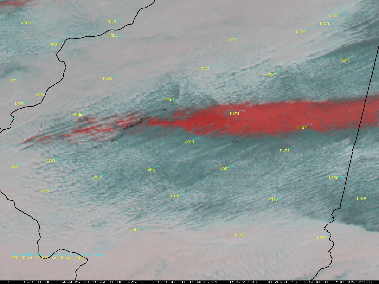
GOES-16 (GOES-East) “Snow/Cloud Discrimination” Red-Green-Blue (RGB) images (above) revealed a west-to-east oriented band of fresh snow cover (1-4 inches, shades of red) across central Illinois on 15 March 2020. With a low-level northeasterly flow of cold air across the region, boundary layer cumulus clouds began to develop as solar heating warmed the surface... Read More
