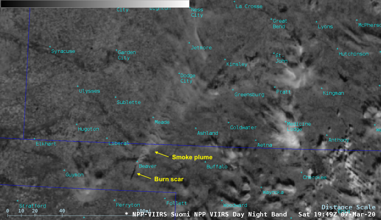
Wildfire in the Oklahoma Panhandle
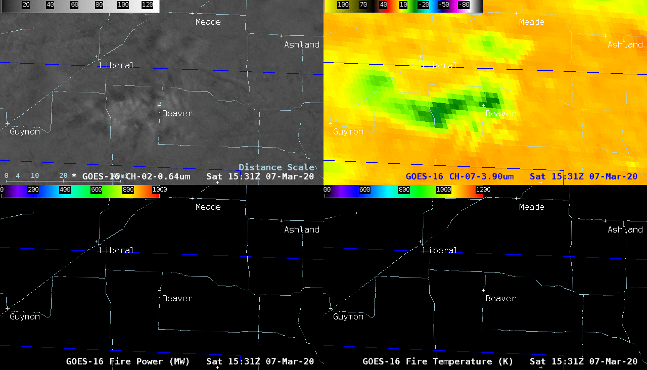
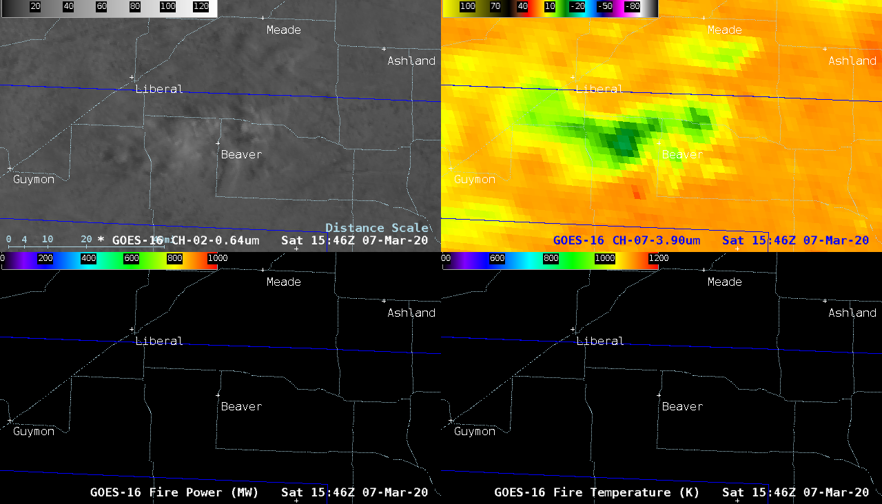
GOES-16 “Red” Visible (0.64 µm, top left), Shortwave Infrared (3.9 µm, top right), Fire Power (bottom left) and Fire Temperature (bottom right) [click to play animation | MP4]
@NWSDodgeCity @NWSAmarillo photos taken at 4:49 4:53 and 4:55 PM about 4 miles N of the KS-OK State line. Best view of the pyroCu I’ve had. pic.twitter.com/j2nQyGqd6a
— C W (@wilscale) March 7, 2020
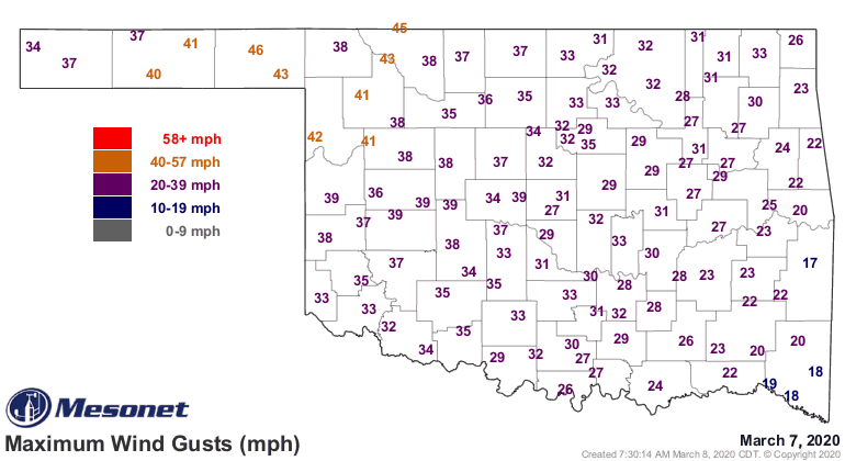
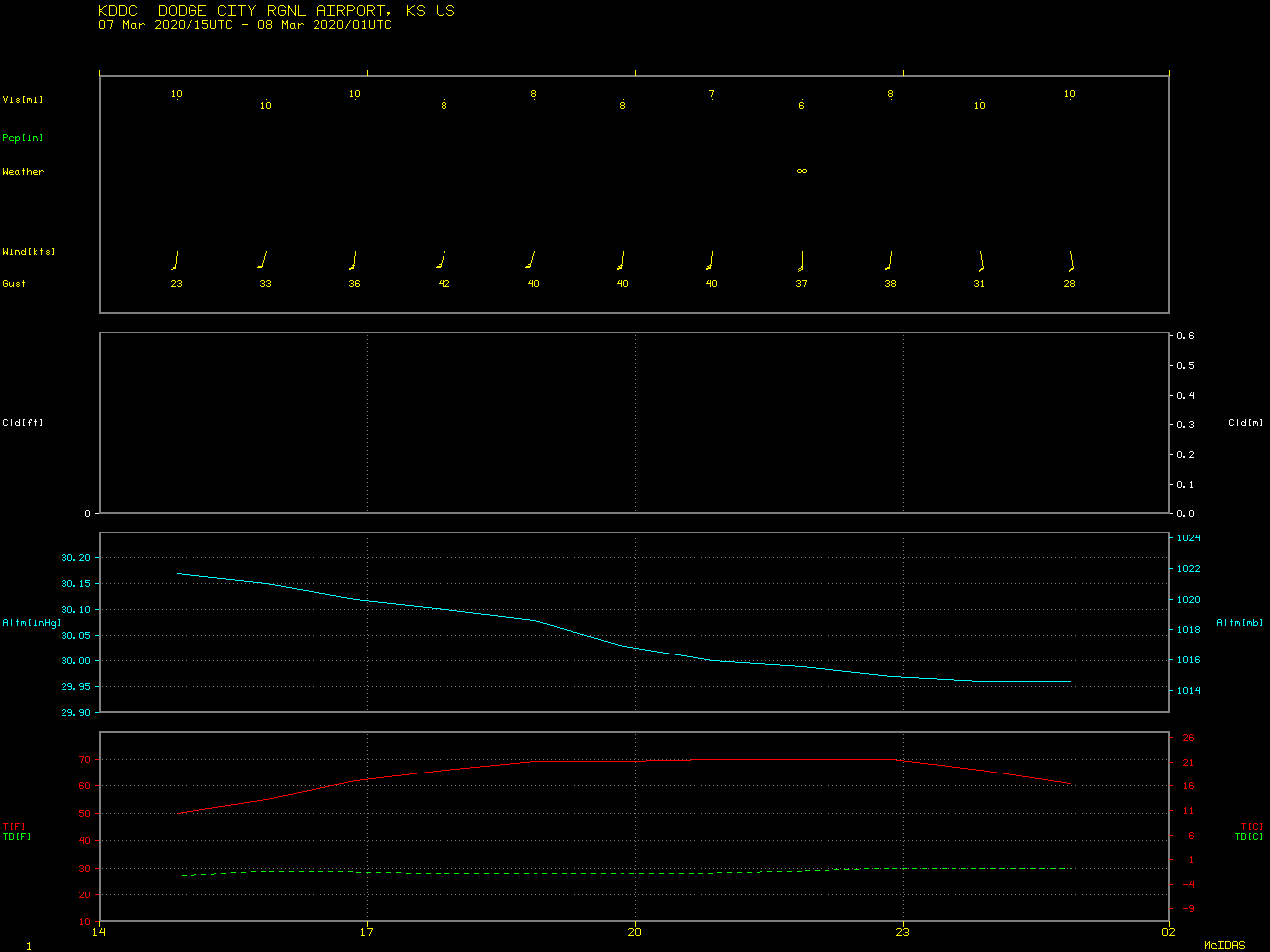
Extreme fire behavior was aided by anomalously-strong winds across the southern Plains. The peak wind gust at Beaver, Oklahoma was 46 mph; south of the fire, surface winds were gusting to 43 mph at Perryton (in far the northern Texas Panhandle), and west of the fire winds gusted to 42 mph at Guymon (in the Oklahoma Panhandle). A large-scale animation of 1-minute GOES-16 Visible images from the AOS site (below) indicated that the smoke plume was transported northeastward across Kansas and eventually moved over south-central Nebraska. Smoke reduced the surface visibility to 6 miles at Dodge City as it moved across southwestern Kansas.

GOES-16 “Red” Visible (0.64 µm) images [click to play animation | MP4]
![Shortwave Infrared images from MODIS (3.7 µm) and VIIRS (3.74 µm) [click to enlarge]](https://cimss.ssec.wisc.edu/satellite-blog/images/2020/03/200307_viirs_modis_shortwaveInfrared_Beaver_Fire_OK_anim.gif)
Shortwave Infrared images from MODIS (3.7 µm) and VIIRS (3.74 µm) [click to enlarge]
===== 08 March Update =====
![NOAA-20 VIIRS Day/Night Band (0.7 µm) and Shortwave Infrared (3.74 µm) images at 0857 UTC [click to enlarge]](https://cimss.ssec.wisc.edu/satellite-blog/images/2020/03/200308_0857utc_viirs_dayNightBand_shortwaveInfrared_OK_fire_anim.gif)
NOAA-20 VIIRS Day/Night Band (0.7 µm) and Shortwave Infrared (3.74 µm) images at 0857 UTC [click to enlarge]
===== 09 March Update =====
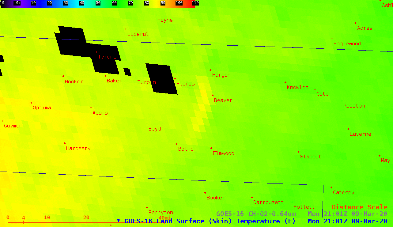
GOES-16 Land Surface Temperature product and “Red” Visible (0.64 µm) image [click to enlarge]