Severe thunderstorms in North Dakota and South Dakota
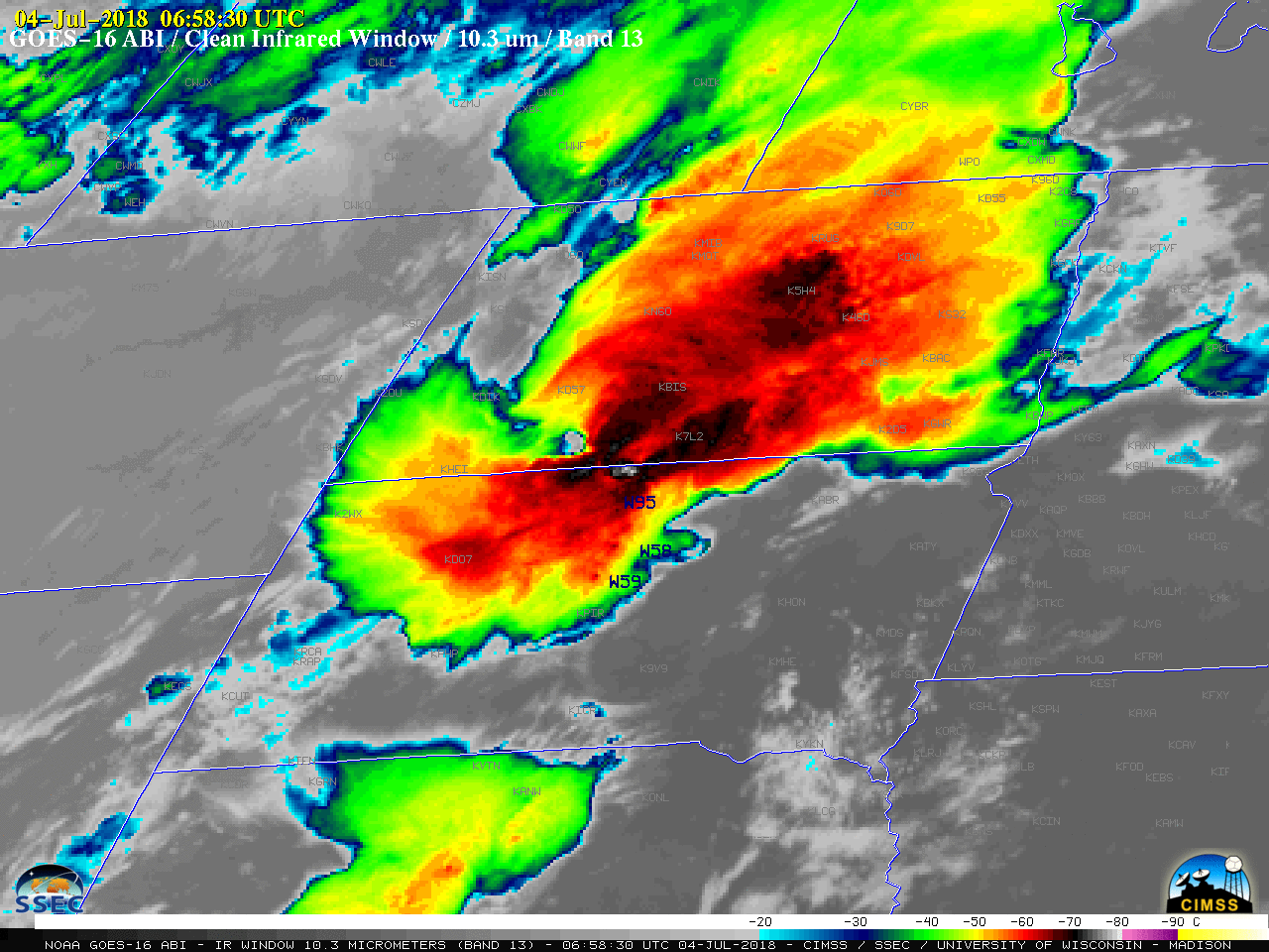
1-minute Mesoscale Domain Sector GOES-16 (GOES-East) “Clean” Infrared Window (10.3 µm) images (above) showed the merger of two Mesoscale Convective Systems over North Dakota and South Dakota during the nighttime (pre-sunrise) hours on 04 July 2018. In addition to hail of 1.00-2.00 inches in diameter, these thunderstorms produced widespread damaging winds up to 95 mph in... Read More
