![GOES-16 Total Precipitable Water product [click to play animation | MP4]](http://cimss.ssec.wisc.edu/satellite-blog/wp-content/uploads/2018/07/New_England_tpw-20180724_150219.png)
GOES-16 Total Precipitable Water product [click to play animation | MP4]
![]() ![]() |
|
Fog/stratus along the New England coast
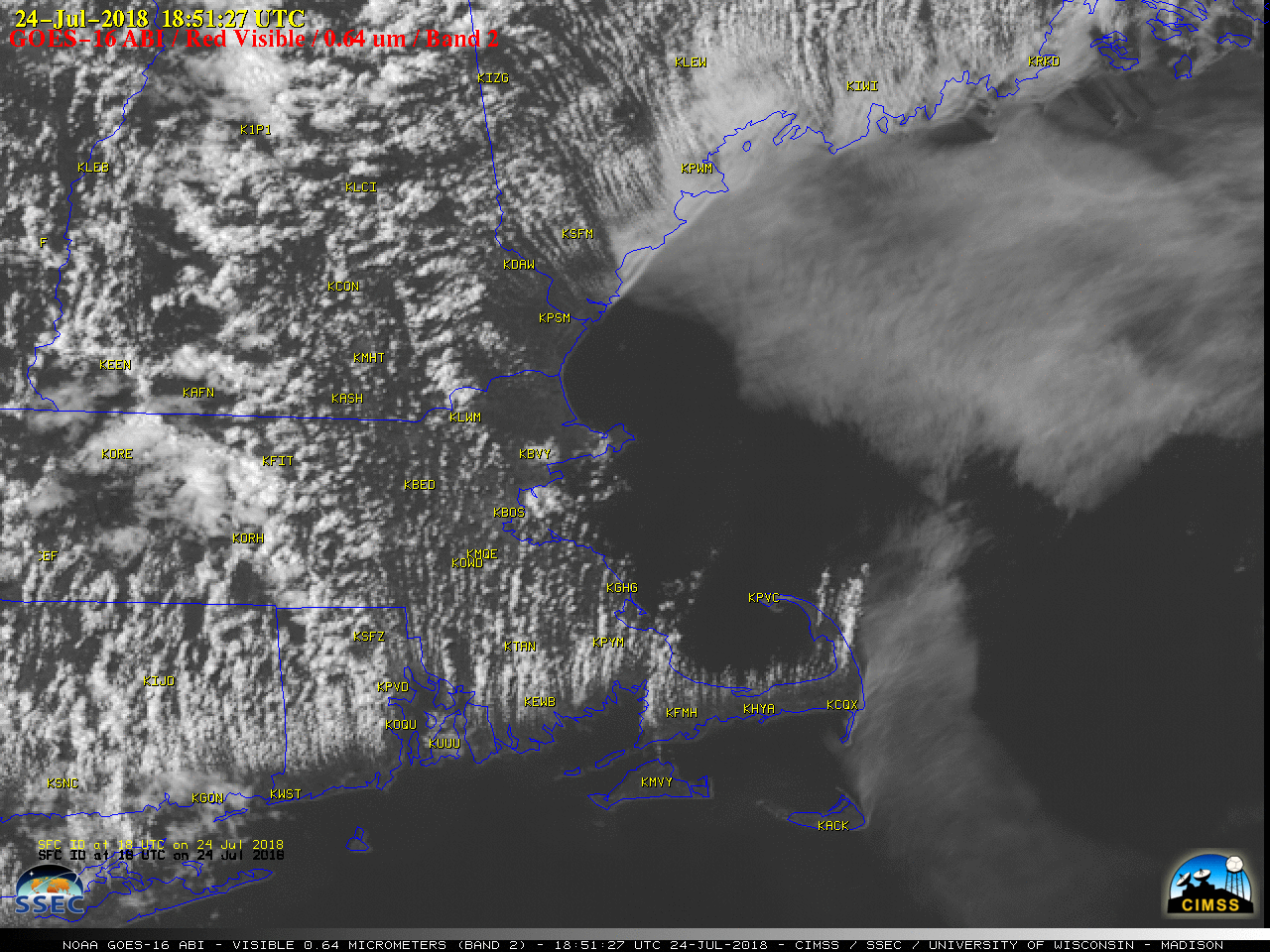
July 24th, 2018 | Scott Bachmeier![]() GOES-16 Total Precipitable Water product [click to play animation | MP4] Wildfires in GreeceJuly 24th, 2018 | Scott Bachmeier![]() Suomi NPP VIIRS Shortwave Infrared (3.75 µm), Near-Infrared (1.61 and 2.25 µm) and Day/Night Band (0.7 µm) images [click to enlarge] Similar images from an overpass of the NOAA-20 satellite 50 minutes later are shown below. Over 70 deaths have resulted from these fast-moving wildfires, which were driven by strong winds (below). VIIRS images courtesy of William Straka, CIMSS. |
|