Satellite signatures of the JPSS-1 launch
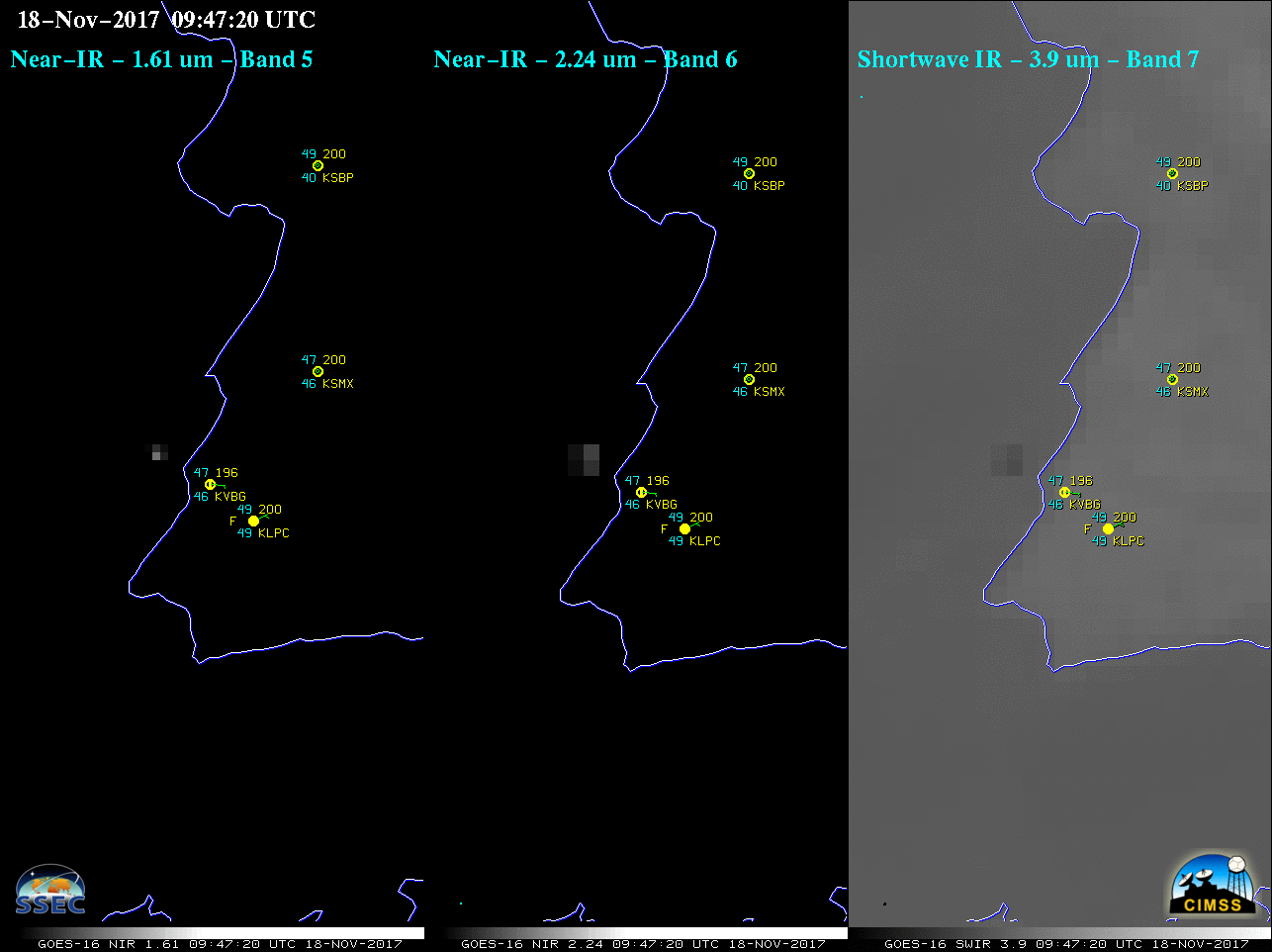
The JPSS-1 satellite was successfully launched at 0947 UTC (1:47 AM local time) on 18 November 2017 from Vandenberg Air Force Base, California (Spaceflight Now). A Suomi NPP VIIRS Day/Night Band (0.7 µm) image about 22 minutes prior to launch (above; courtesy of William Straka, CIMSS) showed light emitted by the... Read More