Hurricane Force low over the Atlantic Ocean
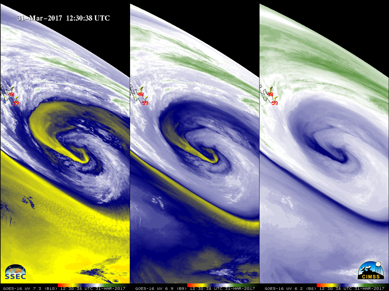
** The GOES-16 data posted on this page are preliminary, non-operational data and are undergoing testing. **GOES-16 Lower-Level (7.3 µm), Mid-Level (6.9 µm) and Upper-Level (6.2 µm) Water Vapor images (above; also available as an MP4 animation) revealed the circulation associated with a Hurricane Force low over the North Atlantic Ocean (centered southeast of... Read More
