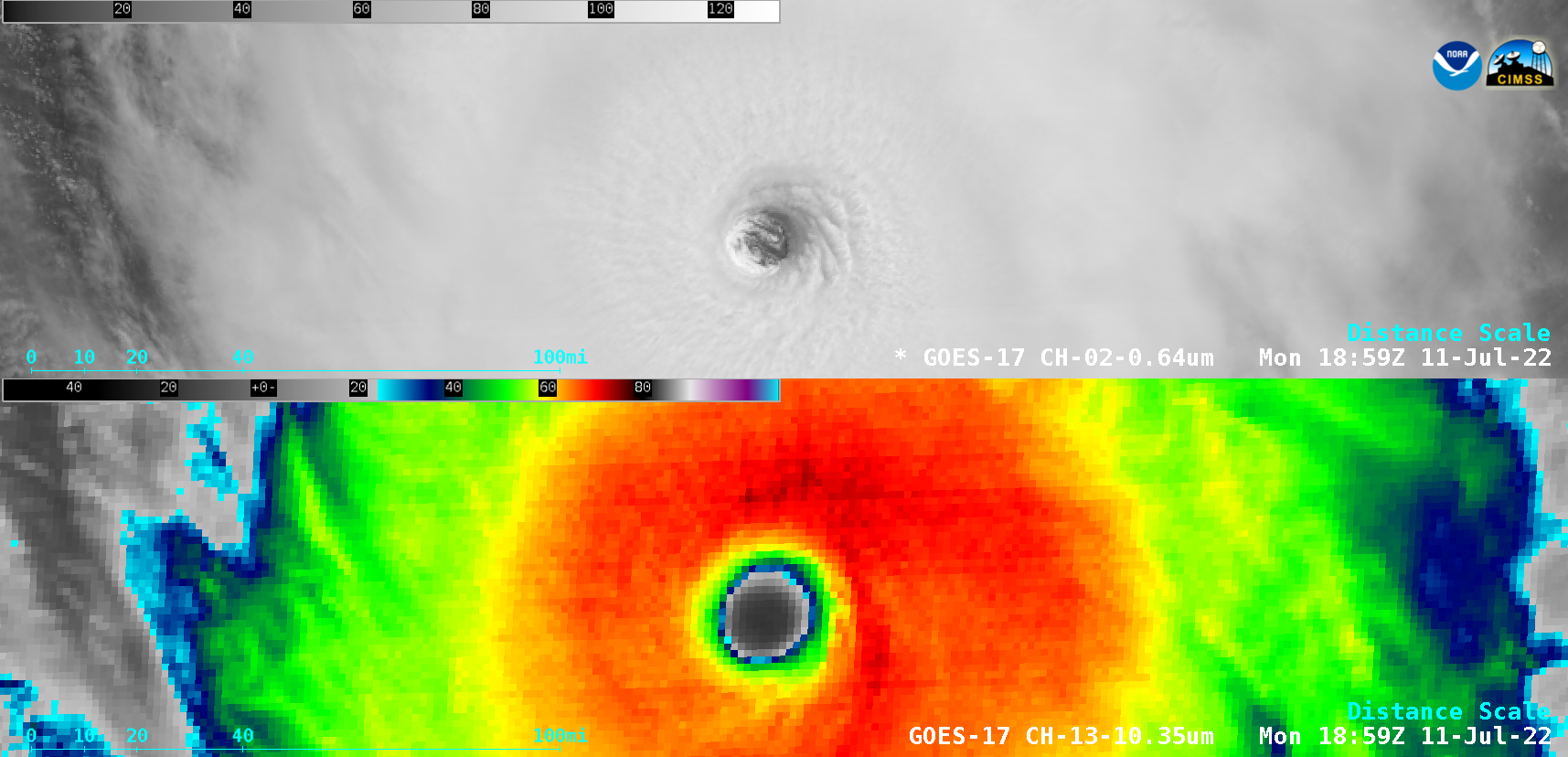
Tropical Cyclone Gabrielle in the Coral Sea
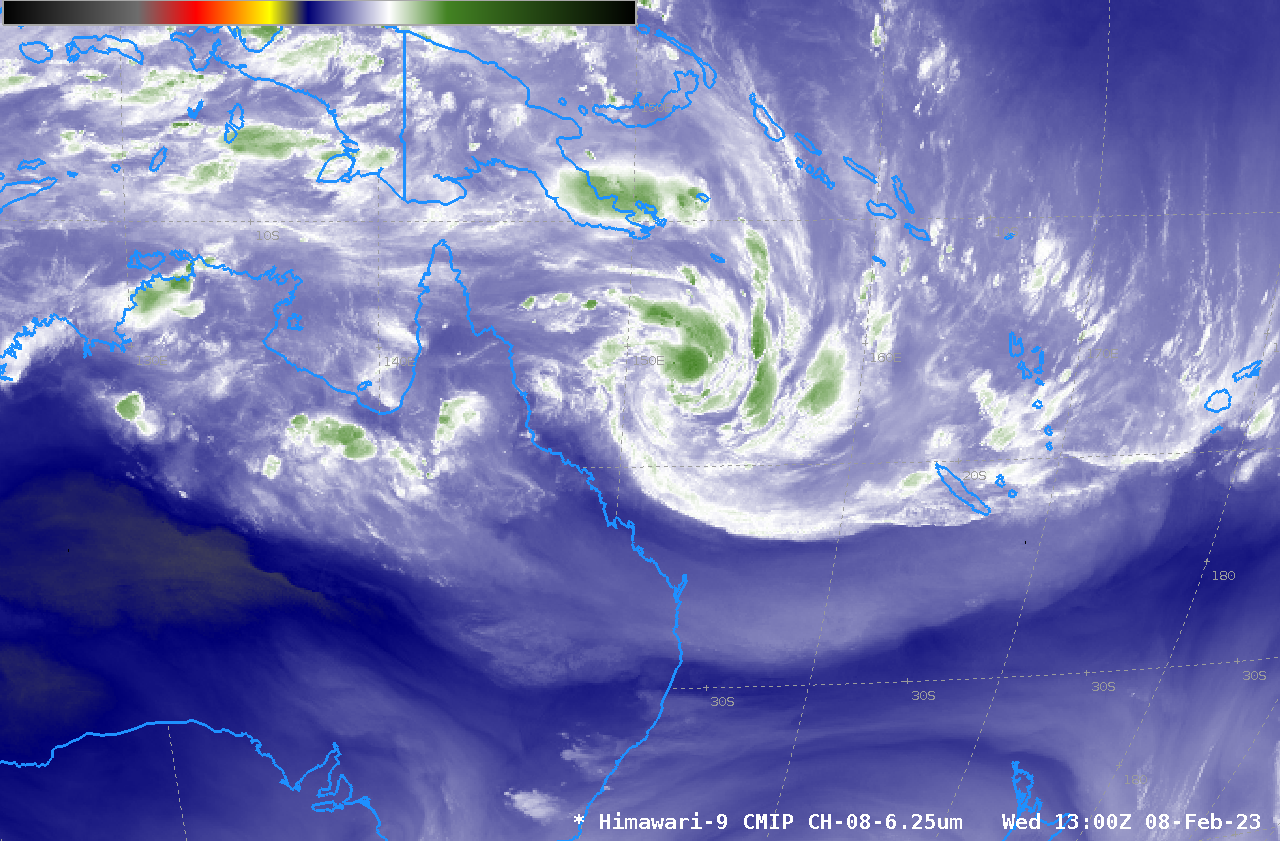
Himawari-9 Upper Level Water Vapor infrared (6.25 µm) imagery for the 8 hours ending 1300 UTC on 8 February 2023 show the nighttime blossoming of convection near the center of developing tropical cyclone Gabrielle to the east of Australia in the tropical southwest Pacific. The environment of the storm is... Read More