SAR data over Hurricane Fiona

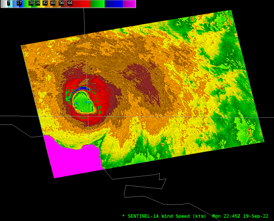
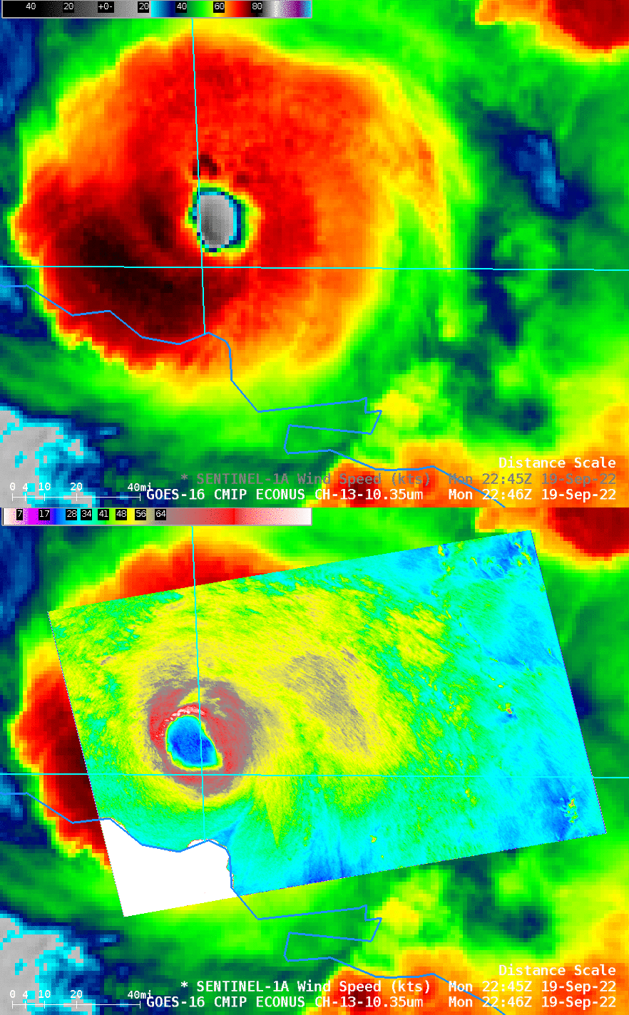
NOAA/NESDIS STAR is producing occasional SAR imagery over Hurricane Fiona (link). NetCDF files can be imported into AWIPS and displayed, as shown above (color-enhanced with Beaufort Scaling), in an image from late on 19 September when Fiona was just north of Hispaniola. The strongest winds were associated with the northern eyewall of the storm, and an asymmetry in the storm is apparent (The NHC discussion from 2100 UTC on 19 September (here), and the discussion at 0300 UTC on 20 September (here) will give more context). The Radial wind analysis at the SAR link (here) shows the strongest winds in the NW and NE quadrants of the storm, with a peak near 100 knots. The toggle below, from late on 19 September, compares GOES-16 ABI Clean window (10.3 µm) imagery and the Sentinel SAR wind estimates (with a different color enhancement). A parallax shift in the GOES-16 imagery means the two eyes do not overlay.

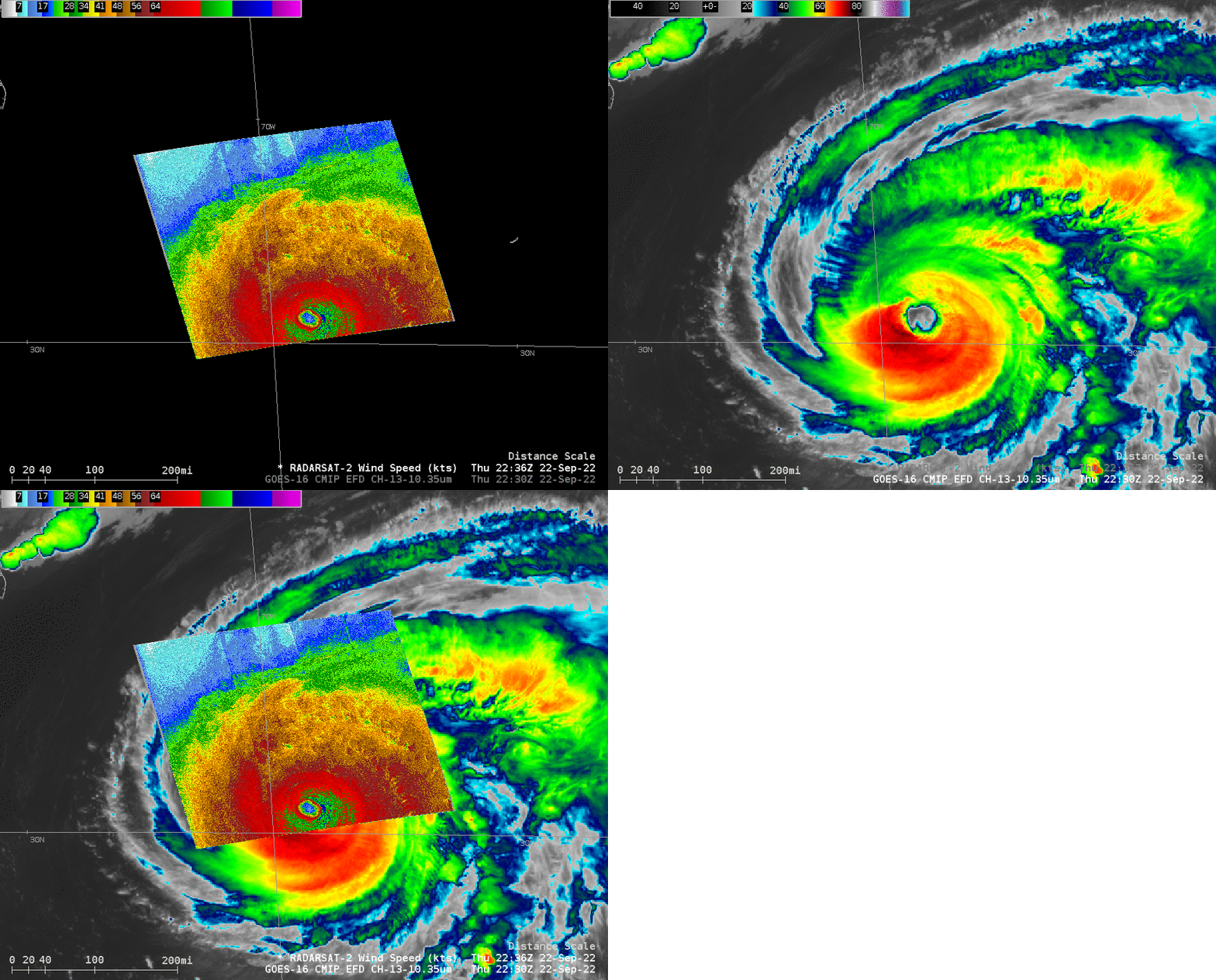
Update on 23 September: RADARSAT-2 overflew Fiona at 2236 UTC on 22 September. The toggle below shows SAR winds estimated at that time, with peak values in the eyewall near 100 knots (for more information on this SAR pass, including a more complete image over the eye, click here). There is a parallax shift in the high clouds of the storm; Fiona at this time was near 30.5oN, 69.3oW, far from the sub-satellite point at 0oN, 75.2oW: the parallax shift for the high clouds will be away from the sub-satellite point. The time difference in the observations — 5 minutes — should not cause a big shift for a storm moving at 17 knots (i.e., 20 mph) to the north-northeast.


