Center-fixing a storm with SAR and SSMIS data

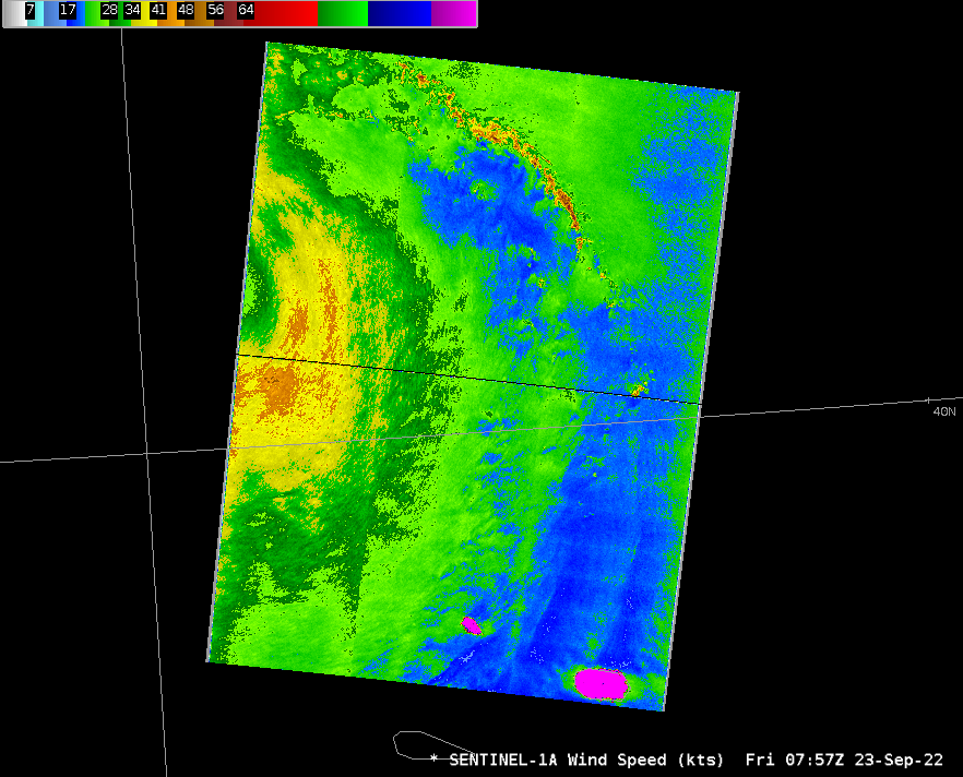
Sentinel overflew Tropical Storm Gaston, northwest of the Azores Islands, shortly before 0800 UTC on 23 September 2022, as shown above. The Beaufort Scale enhancement suggest peak winds derived from SAR observations to be very close to 50 knots in curved bands to the east/southeast of the center, inferred to be just off the edge of observation swath, which is at 40.76o N Latitude, 29.3o W Longitude. GOES-16 satellite imagery spanning this time around sunrise shows an exposed low-level circulation center with stronger convection building along the northern perimeter of the storm (mp4 animation shown here, created with CSPP Geosphere — direct link is here). Because GOES-16 can view the low-level circulation, the parallax shift of the center in the animation is small (smaller than the parallax shift in the SAR/GOES-16 imagery shown here Fiona) even though Gaston is near the satellite limb.
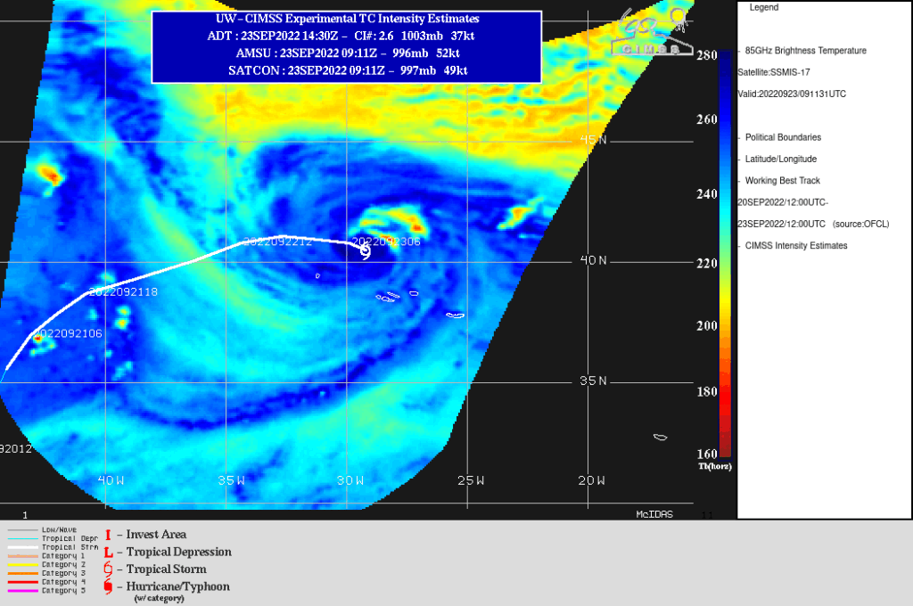
DMSP-17 carries the SSMIS (Special Sensor Microwave Imager/Sensor) and overflew Gaston just after 0900 UTC, as shown below in an image from the SSEC Tropical Website. The estimated wind speed from this image is 52 knots, close to the SAR values shown above. The 0900 UTC update from the National Hurricane Center showed a center at 40.5oN, 29.6oW and maximum sustained windspeeds at 50 knots.


