Extratropical transition of Hurricane Martin
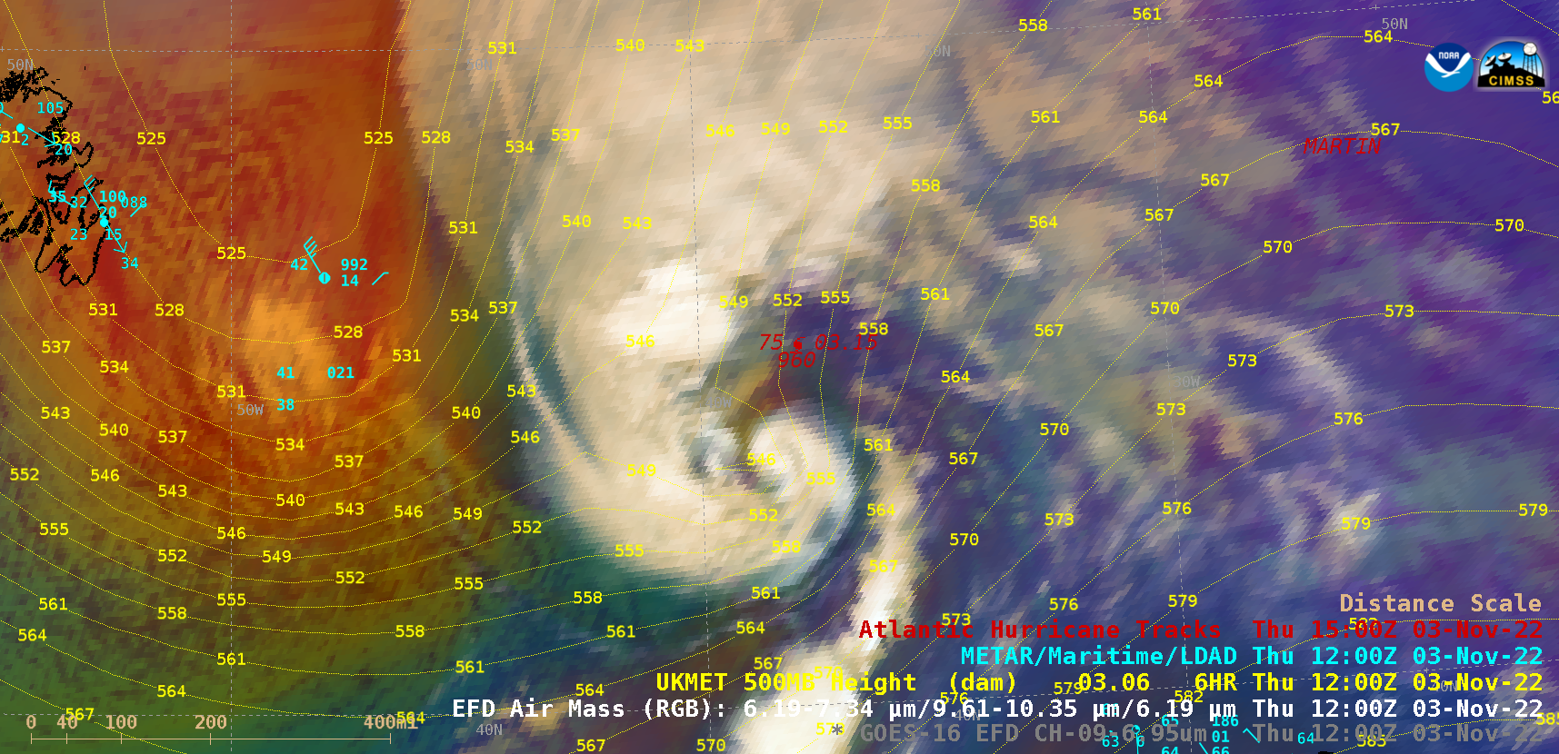
GOES-16 (GOES-East) Mid-Level Water Vapor (6.9 µm) and Air Mass RGB images (above) covered the period 0600-1800 UTC on 03 November 2022 — during which Category 1 Hurricane Martin transitioned to an extratropical cyclone over the North Atlantic Ocean (surface analyses). West of Martin, the large area of orange-to-red hues on the Air Mass... Read More
