Fiona intensifies to a Category 4 hurricane

GOES-16 “Red” Visible (0.64 µm) and “Clean” Infrared Window (10.35 µm) images [click to play animated GIF | MP4]
GOES-16 Infrared images with and without a overlay of GLM Flash Extent Density (below) did reveal isolated brief periods of lightning in the eyewall region of Fiona — but most of the lightning activity was associated with convection well east of the eye.

GOES-16 “Clean” Infrared Window (10.35 µm) images, with and without a overlay of GLM Flash Extent Density [click to play animated GIF | MP4]

GOES-16 Cloud Top Temperature and Cloud Top Height derived products [click to play animated GIF | MP4]
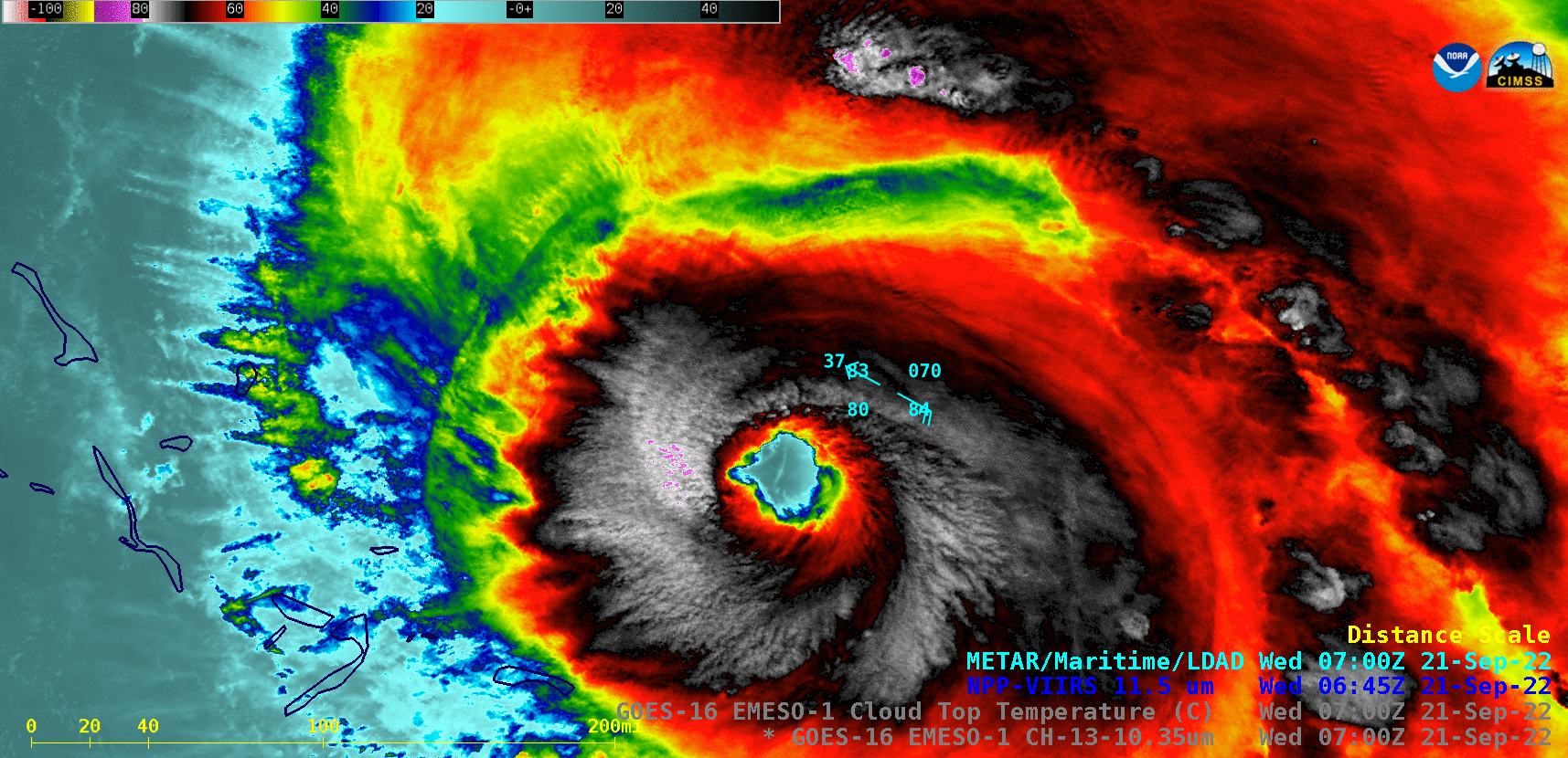
Infrared Window images from Suomi-NPP (11.45 µm) and GOES-16 (10.35 µm) [click to enlarge]
===== 23 September Update =====

GOES-16 “Clean” Infrared Window (10.35 µm) images [click to play animated GIF | MP4]
A DMSP-17 SSMIS Microwave (85 GHz) image at 1053 UTC from the CIMSS Tropical Cyclones site (below) exhibited the eye and eyewall structure about an hour after the peak wind gust at Bermuda.
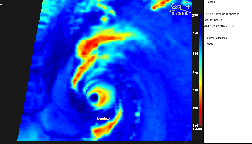
DMSP-17 SSMIS Microwave (85 GHz) image at 1053 UTC [click to enlarge]