Fiona becomes a Hurricane near Puerto Rico
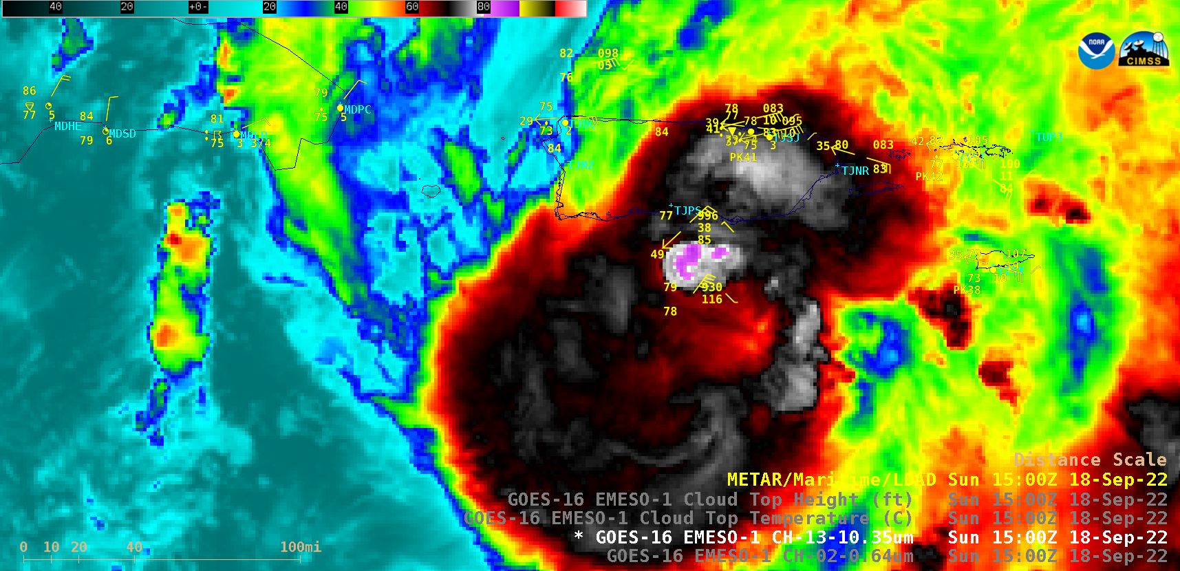
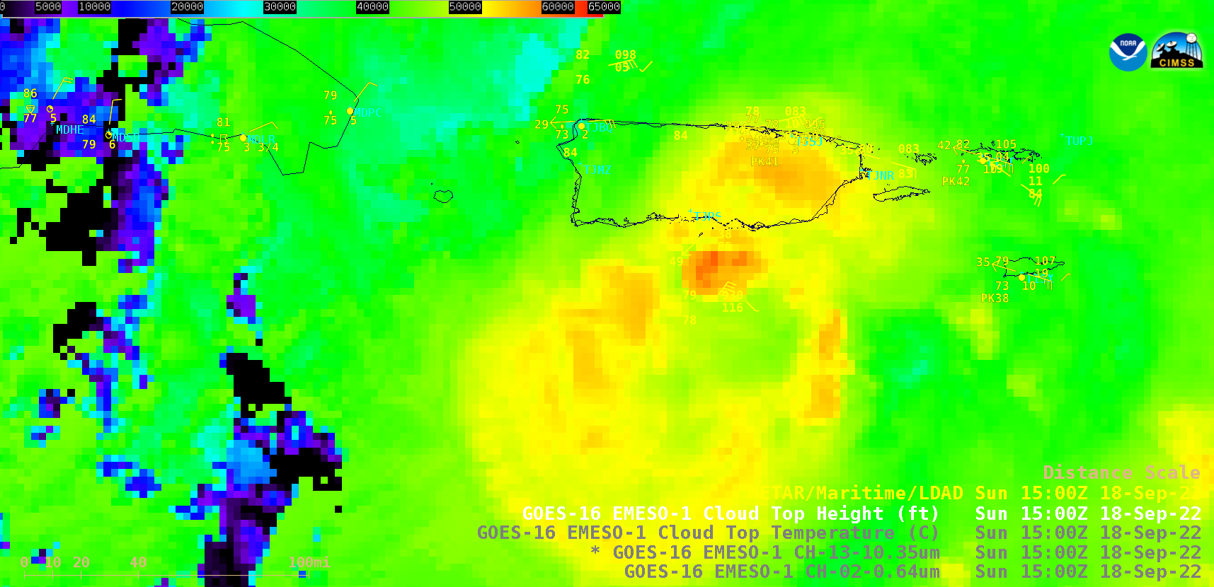
1-minute Mesoscale Domain Sector GOES-16 (GOES-East) “Red” Visible (0.64 µm) and “Clean” Infrared Window (10.35 µm) images (above) showed Fiona as it intensified to a Category 1 Hurricane just south of Puerto Rico during the morning hours on 18 September 2022. The coldest cloud-top 10.35 µm infrared brightness temperatures were around -88ºC.The corresponding 1-minute GOES-16 Cloud Top Temperature and Cloud Top Height derived products are shown below — the coldest Cloud Top Temperature values were around -91ºC, while maximum Cloud Top Height values were around 61,000 feet.
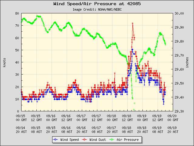
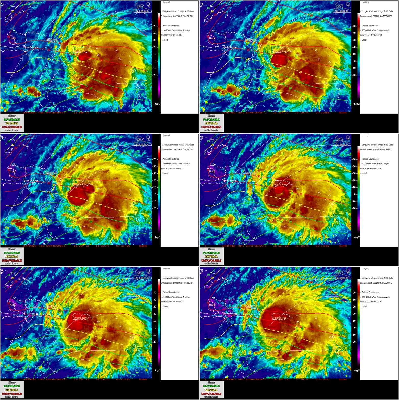
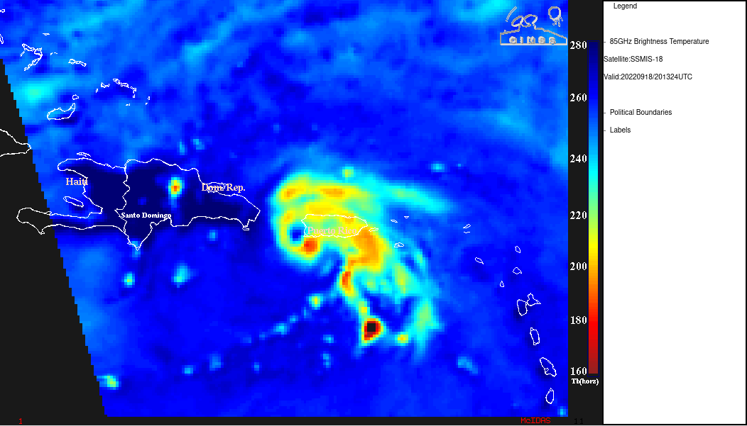
The highest wind gust at Buoy 42085 — located just south of Ponce (station identifier TJPS) — was 72 knots (83 mph) at 16 UTC (below). Although Fiona was moving across relatively warm water, GOES-16 Infrared Window (11.2 µm) images with contours of deep-layer wind shear from the CIMSS Tropical Cyclones site (below) indicated that the storm was moving through an environment of moderate shear. Hurricane Fiona later made landfall in far southwestern Puerto Rico around 1920 UTC — a DMSP-18 image at 2013 UTC (below) showed the eye as it was beginning to move into the Mona Passage. A prolonged period of strong winds and heavy rainfall from Fiona led to widespread power outages and flash flooding across much of Puerto Rico.