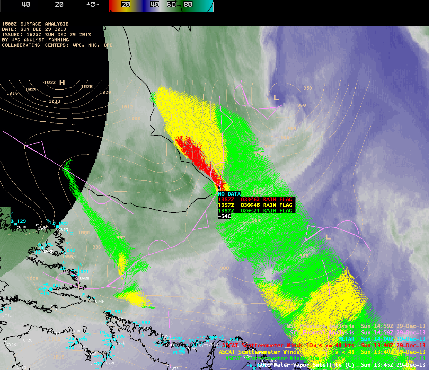
Tehuano wind event in the wake of a strong eastern US winter storm
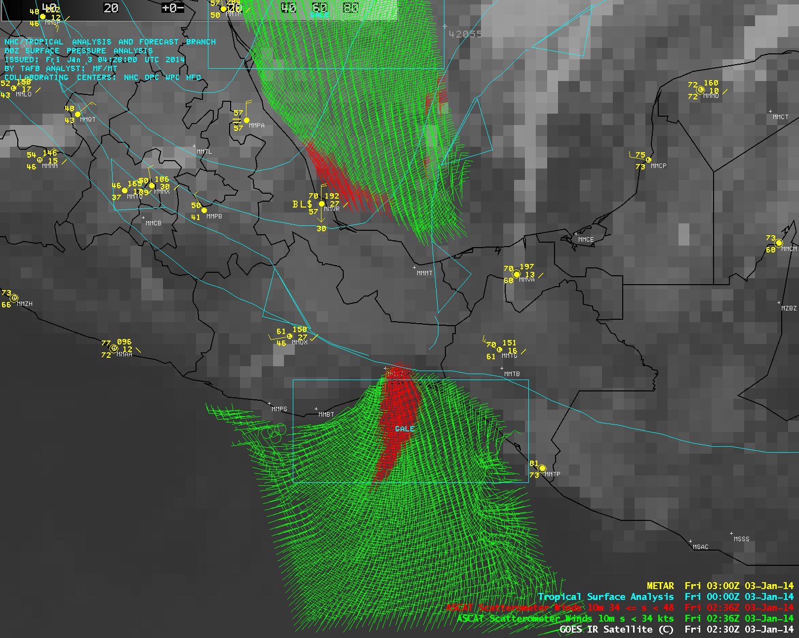
A strong winter storm affected much of the central and eastern US during the 02 January – 03 January 2014 period. A map of SSEC RealEarth 24-hour snowfall totals (above)... Read More