Tropical Storm Gabrielle
1-km resolution GOES-13 0.63 µm visible channel images (above; click image to play animation) revealed a pronounced convective burst associated with Tropical Depression #7, which was centered just southeast of Puerto Rico late in the day on 04 September 2013. On the final visible image before darkness, a pair of small but distinct overshooting tops could be seen, which actually signalled the beginning of another convective burst.
The corresponding 4-km resolution GOES-13 10.7 µm IR channel images (below; click image to play animation) showed that there were a series 3 well-defined convective bursts (2 more followed after darkness), each exhibiting areas with cloud-top IR brightness temperatures of -80º C or colder (violet color enhancement). On the final image in the animation (at 02:45 UTC), the coldest IR brightness temperature was -86º C This was about the time that Tropical Depression #7 was upgraded to Tropical Storm Gabrielle.
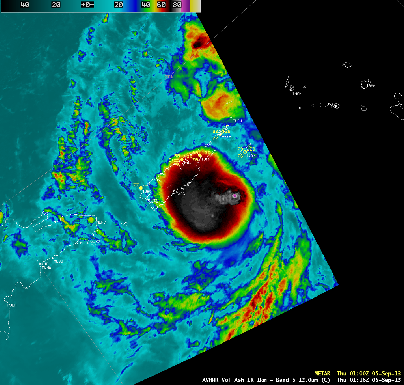
A 1-km resolution POES AVHRR 12.0 µm IR image at 01:16 UTC (below) showed one overshooting top that exhibited an IR brightness temperature of -90º C (dark violet enhancement).
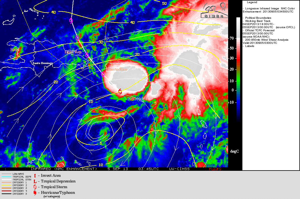
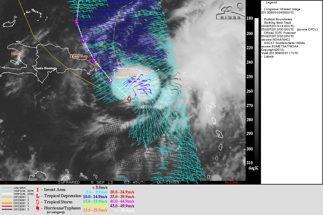
Two GOES-13 IR images at 03:45 UTC on 05 September from the CIMSS Tropical Cyclones site (below) showed that (1) Gabrielle was in an environment characterized by a light amount (around 10 knots) of deep layer (200-850 hPa) wind shear, and (2) a well-defined low-level cyclonic circulation was difficult to distinguish with the ASCAT surface scatterometer winds at that time.
===== 05 September Update =====
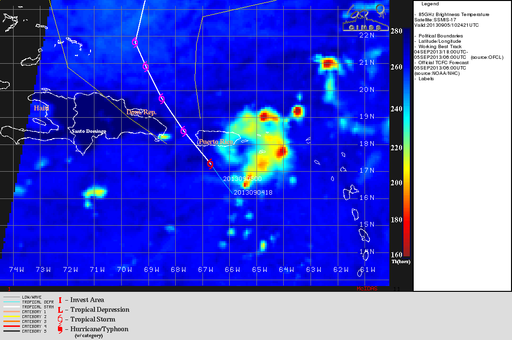
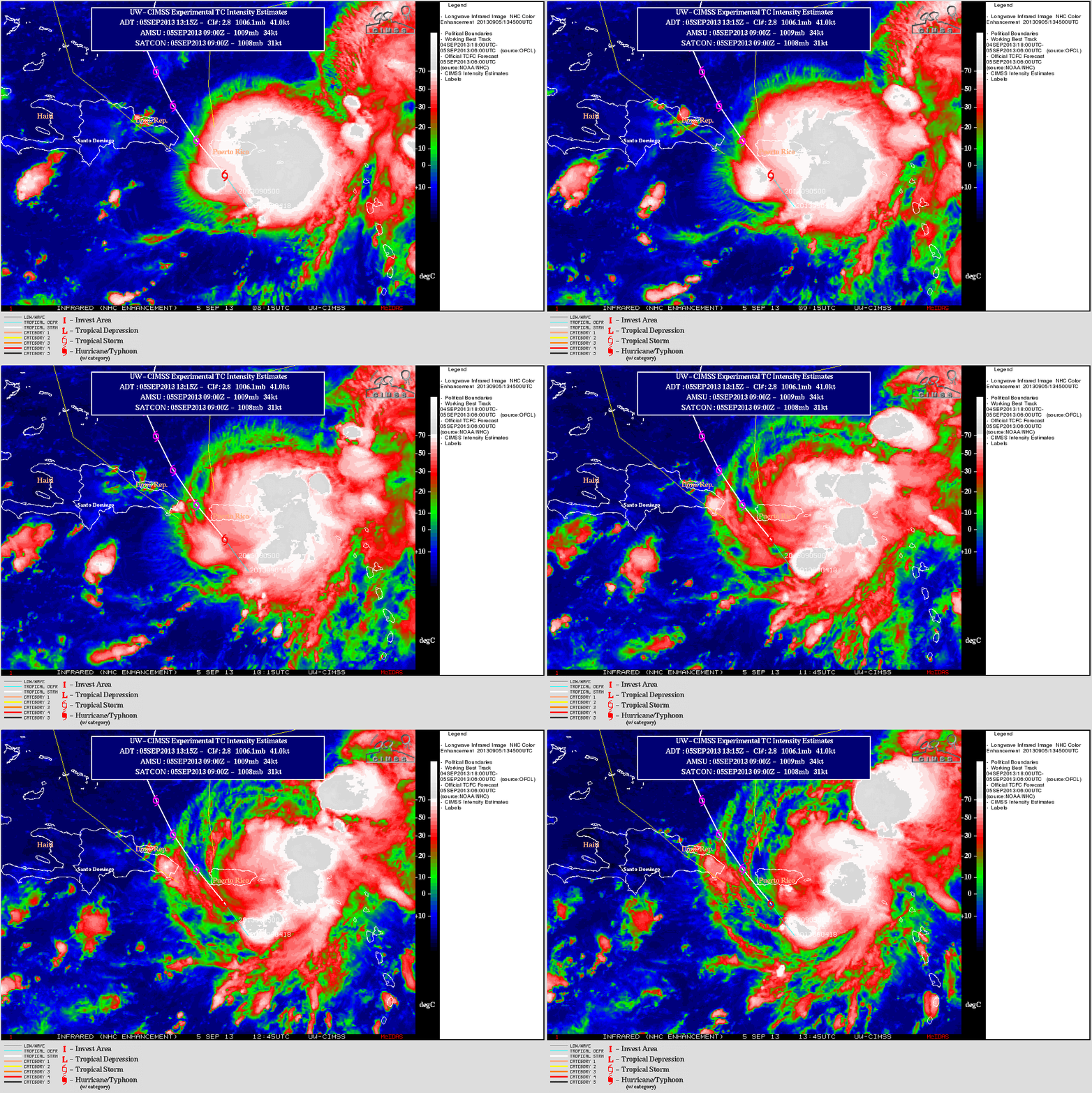
On the morning of 05 September, a DMSP-17 SSMIS 85 GHz microwave brightness temperature image at 10:42 UTC (above) and GOES-13 10.7 µm IR images (below) suggested that the mid-level circulation center of of Gabrielle was reforming well to to the east of the original fix location low-level circulation center. Around the time of the end of the IR image animation, Gabrielle was downgraded to a Tropical Depression.


