Hurricane Henriette
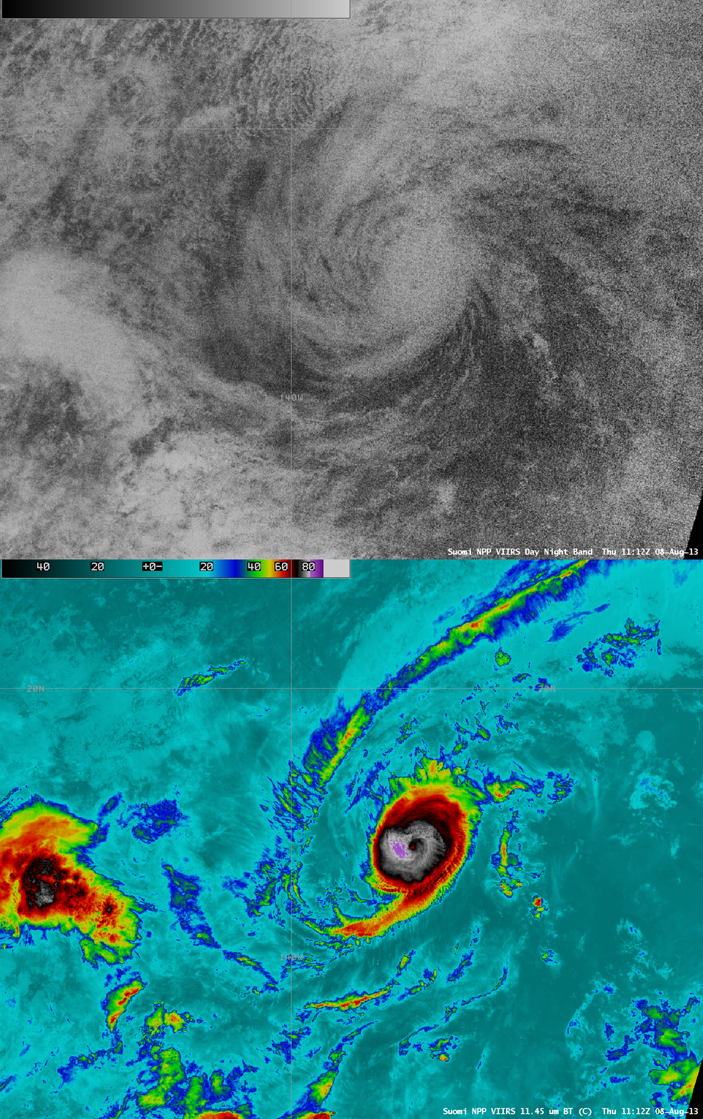
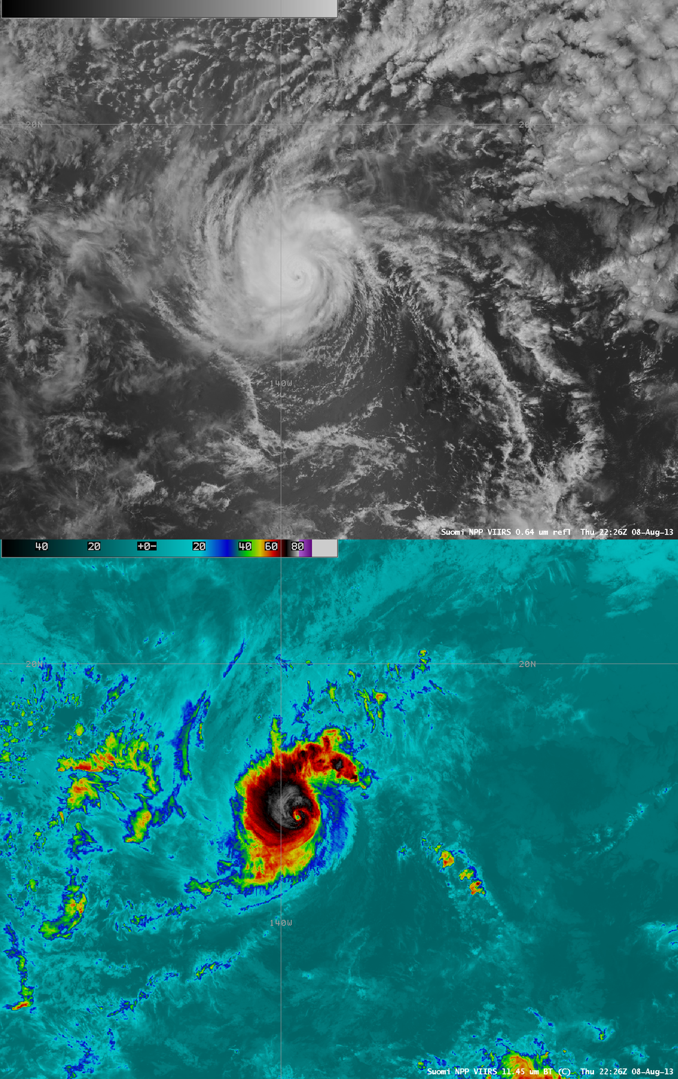
A sequence of three AWIPS images of 1-km resolution Suomi NPP VIIRS 11.45 µm IR data (above) showed the relatively compact cloud structure associated with Hurricane Henriette over the Eastern Pacific Ocean during the 07 August – 08 August 2013 period. Cloud-top IR brightness temperatures were as cold as -83 C (violet color enhancement) on the 08 August/11:12 UTC image. Henriette also exhibited a small eye on the 11:12 UTC and 22:26 UTC images on 08 August.
On a night-time comparison of Suomi NPP VIIRS 0.7 µm Day/Night Band and 11.45 µm IR images at 11:15 UTC (below), it is interesting to point out that the eye could still be faintly identified on the Day/Night Band image, even though there was only a minimal amount of illumination from airglow alone (the Moon was in its early Waxing Crescent phase, at only 1-3% of full, but was actually below the horizon for this particular image).
The compact eye of Henriette was well-defined on a comparison of VIIRS 0.64 µm visible channel and 11.45 µm IR channel images at 22:26 UTC (below). Henriette was near its maximum intensity of 90 knots around this time.
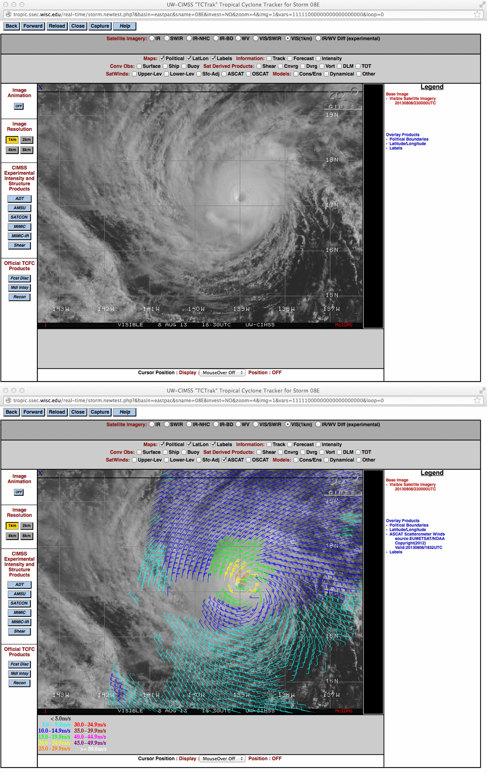
A 1-km resolution GOES-15 0.63 µm visible channel image with an overlay of ASCAT surface scatterometer winds from the CIMSS Tropical Cyclones site (below) also showed a good presentation of the eye and the surface wind flow associated with the Henriette.
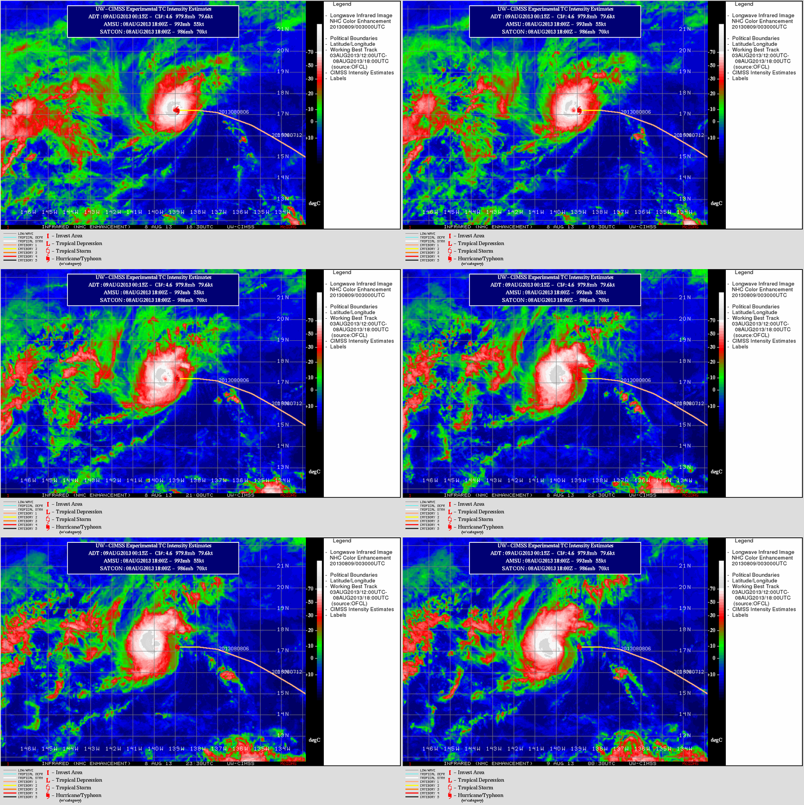
An animation of GOES-15 10.7 µm IR channel images (below) revealed that the eye was becoming less obvious after about 00 UTC on 09 August.


