Blowing dust from Baja California
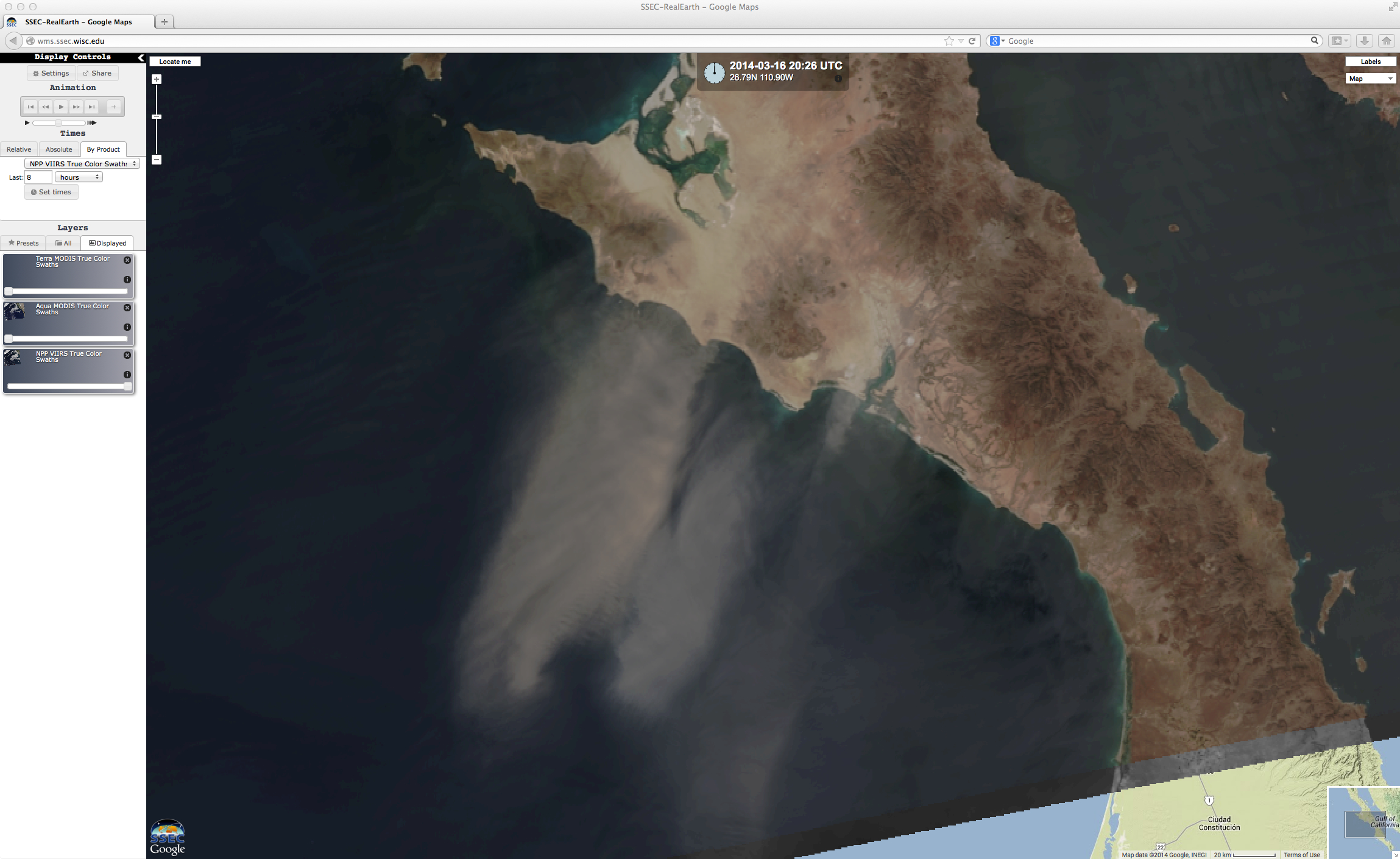
McIDAS images of GOES-15 (GOES-West) 0.63 µm visible channel data (above; click image to play animation) revealed large plumes of blowing dust and sand, which were moving south/southwestward from the coast of Baja California and western Mexico on 16 March 2014. There were... Read More