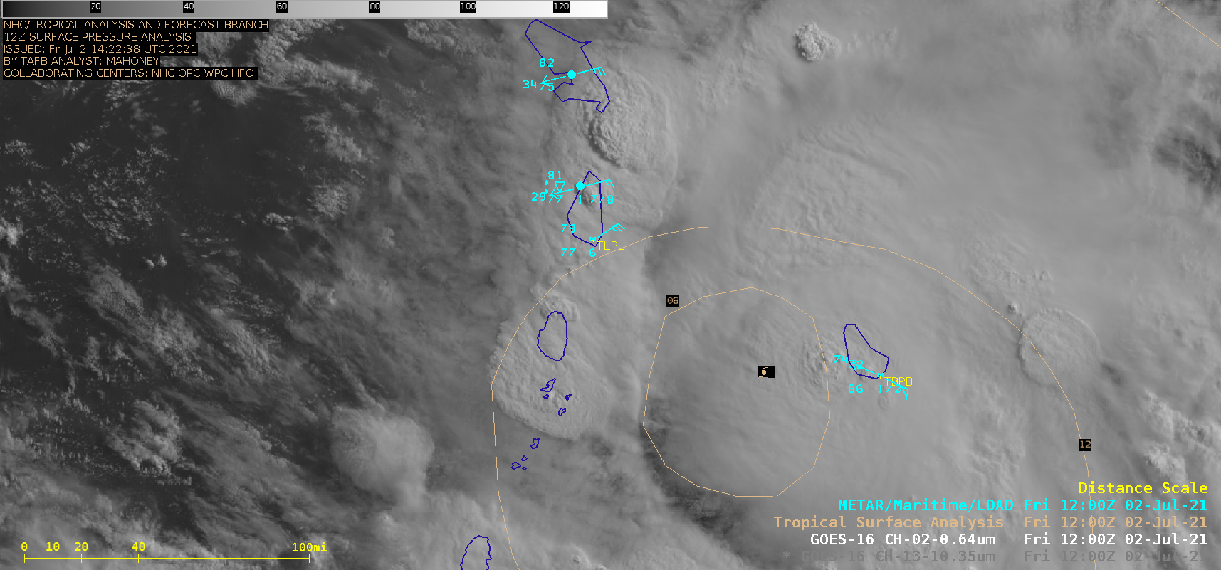
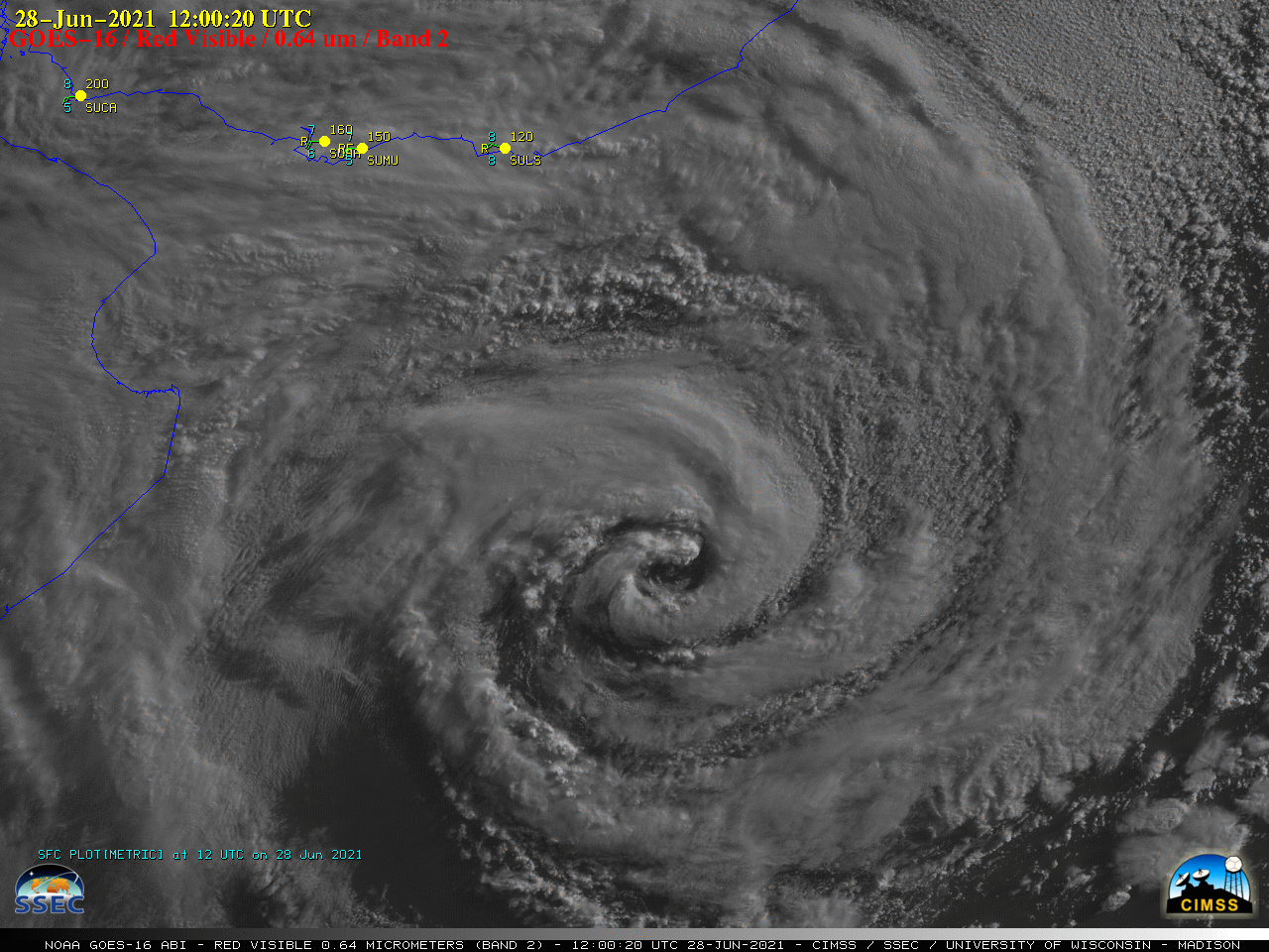
Elsa briefly regains hurricane intensity before making landfall along the Florida coast
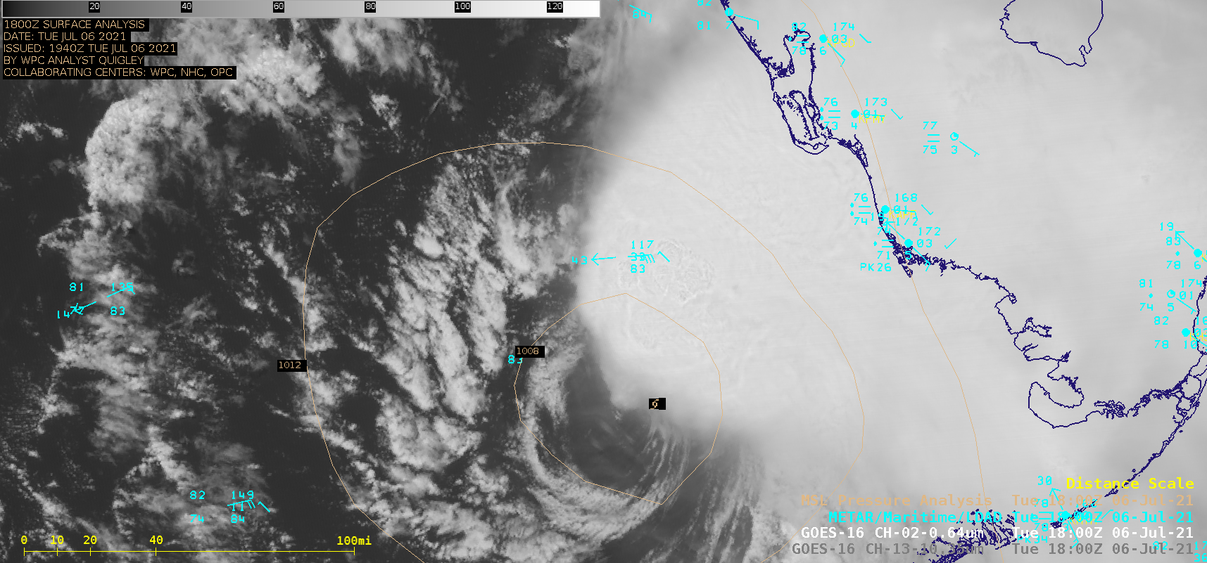
Late in the day on 06 July 2021, Tropical Storm Elsa regained hurricane intensity as of 0000 UTC, just off the west coast of Florida. 1-minute Mesoscale Domain Sector GOES-16 (GOES-East) “Red” Visible (0.64 µm) and “Clean” Infrared Window (10.35 µm) images (above) showed the tropical cyclone during the 1500 UTC to 0000 UTC time period. In the morning, cloud-top infrared brightness temperatures of -80ºC... Read More