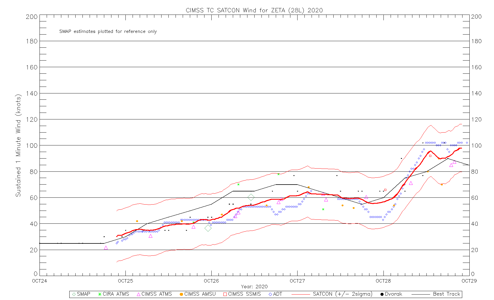
Hurricane Zeta over the Gulf of Mexico
![GOES-16 “Clean” Infrared Window (10.35 µm) images, with an overlay of GLM Flash Extent Density [click to play animation | MP4]](https://cimss.ssec.wisc.edu/satellite-blog/images/2020/10/201027_goes16_infrared_glmFlashExtentDensity_Hurricane_Zeta_anim.gif)
GOES-16 “Clean” Infrared Window (10.35 µm) images, with an overlay of GLM Flash Extent Density [click to play animation | MP4]
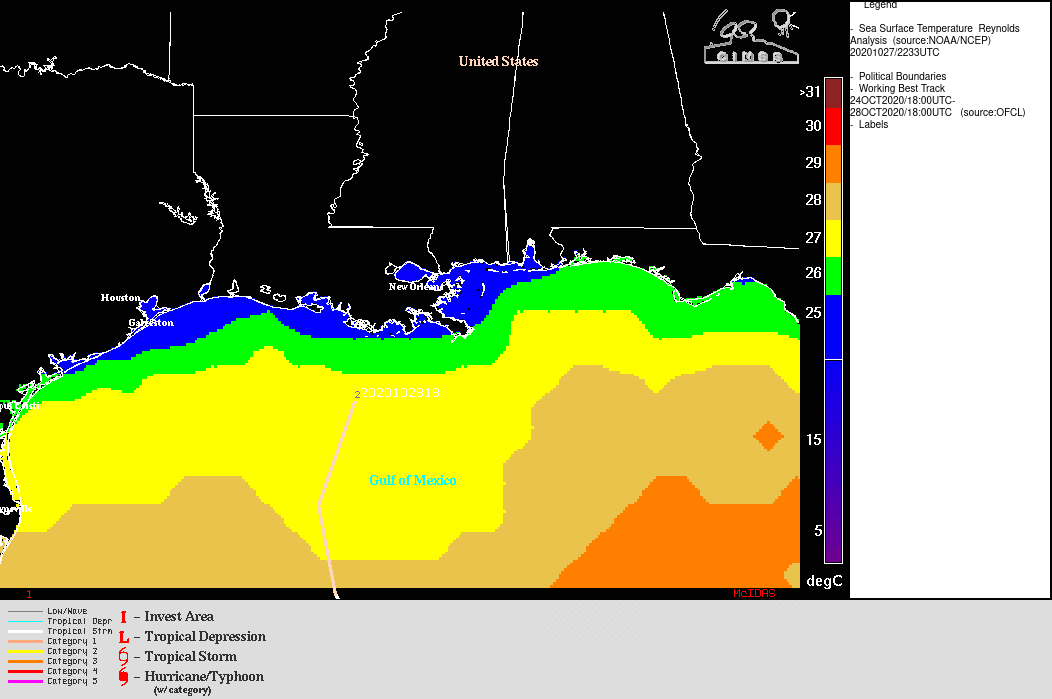
===== 28 October Update =====
![NOAA-20 VIIRS Day/Night Band (0.7 µm) and Infrared Window (11.45 µm) images at 0739 UTC (credit: William Straka, CIMSS) [click to enlarge]](https://cimss.ssec.wisc.edu/satellite-blog/images/2020/10/201028_0739utc_noaa20_dayNightBand_infraredWindow_Hurricane_Zeta_anim.gif)
NOAA-20 VIIRS Day/Night Band (0.7 µm) and Infrared Window (11.45 µm) images at 0739 UTC (credit: William Straka, CIMSS) [click to enlarge]
![GOES-16 “Clean” Infrared Window (10.35 µm) images (with and without an overlay of GLM Flash Extent Density) and “Red” Visible (0.64 µm) images [click to play animation | MP4]](https://cimss.ssec.wisc.edu/satellite-blog/images/2020/10/201028_goes16_infrared_glmFlashExtentDensity_visible_Hurricane_Zeta_anim.gif)
GOES-16 “Clean” Infrared Window (10.35 µm) images (with and without an overlay of GLM Flash Extent Density) and “Red” Visible (0.64 µm) images [click to play animation | MP4]
![GOES-16 Longwave Infrared (11.2 µm) images, with contours of 20 UTC deep-layer wind shear [click to enlarge]](https://cimss.ssec.wisc.edu/satellite-blog/images/2020/10/201028_goes16_infrared_20utc_shear_Zeta_anim.gif)
GOES-16 Longwave Infrared (11.2 µm) images, with contours of 20 UTC deep-layer wind shear [click to enlarge]
![GOES-16 Upper-level Water Vapor (6.2 µm) images, with plots of Derived Motion Winds [click to play animation | MP4]](https://cimss.ssec.wisc.edu/satellite-blog/images/2020/10/201028_goes16_waterVapor_derivedMotionWinds_Zeta_anim.gif)
GOES-16 Upper-level Water Vapor (6.2 µm) images, with plots of Derived Motion Winds [click to play animation | MP4]
===== 29 October Update =====
![GOES-16 True Color RGB images [click to play animation | MP4]](https://cimss.ssec.wisc.edu/satellite-blog/images/2020/10/201029_goes16_trueColorRGB_post_Zeta_snowCover_turbidity_anim.gif)
GOES-16 True Color RGB images [click to play animation | MP4]
A higher-resolution view of the nearshore turbidity was provided by 250-meter resolution Terra MODIS True Color RGB imagery from the MODIS Today site (below). Vigorous mixing of the water by the strong winds of Zeta stirred up a great deal of sediment.
![Terra MODIS True Color RGB image [click to enlarge]](https://cimss.ssec.wisc.edu/satellite-blog/images/2020/10/201029_terra_modis_truecolor_Gulf_Coast.png)
Terra MODIS True Color RGB image [click to enlarge]