Fiona makes landfall in Nova Scotia
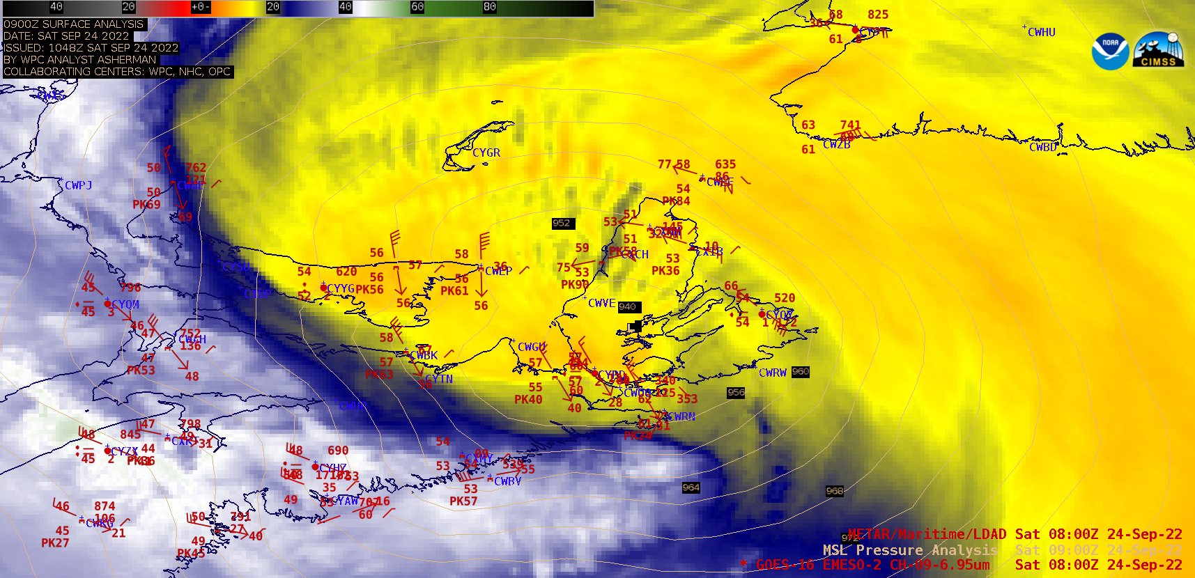
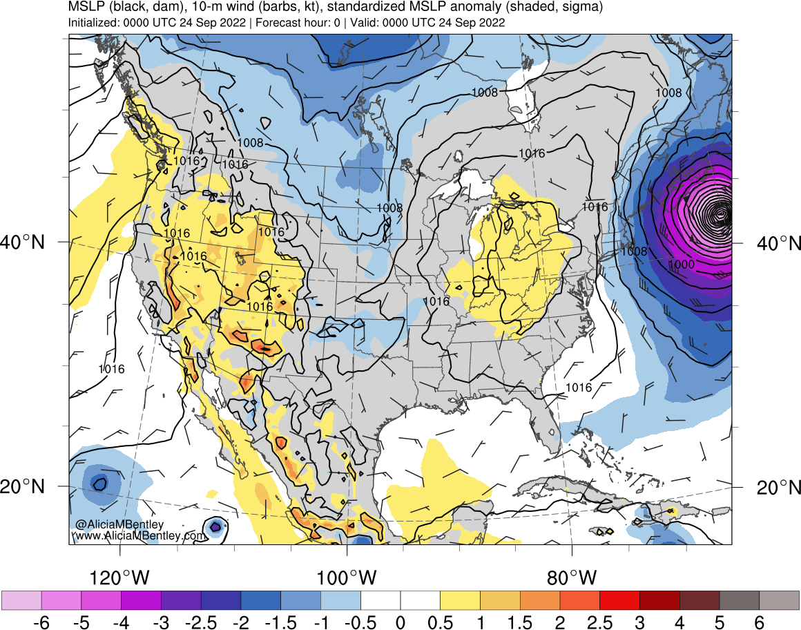
Hurricane Fiona transitioned to a strong post-tropical cyclone just prior to making landfall in Nova Scotia, Canada around 0700 UTC on 24 September 2022 — 1-minute Mesoscale Domain Sector GOES-16 (GOES-East) Mid-level Water Vapor (6.9 µm) images (above) showed the storm during the 0200-1800 UTC period. This anomalously-deep cyclone may have set a new Canadian record... Read More
