SAR views of ice over the Great Lakes

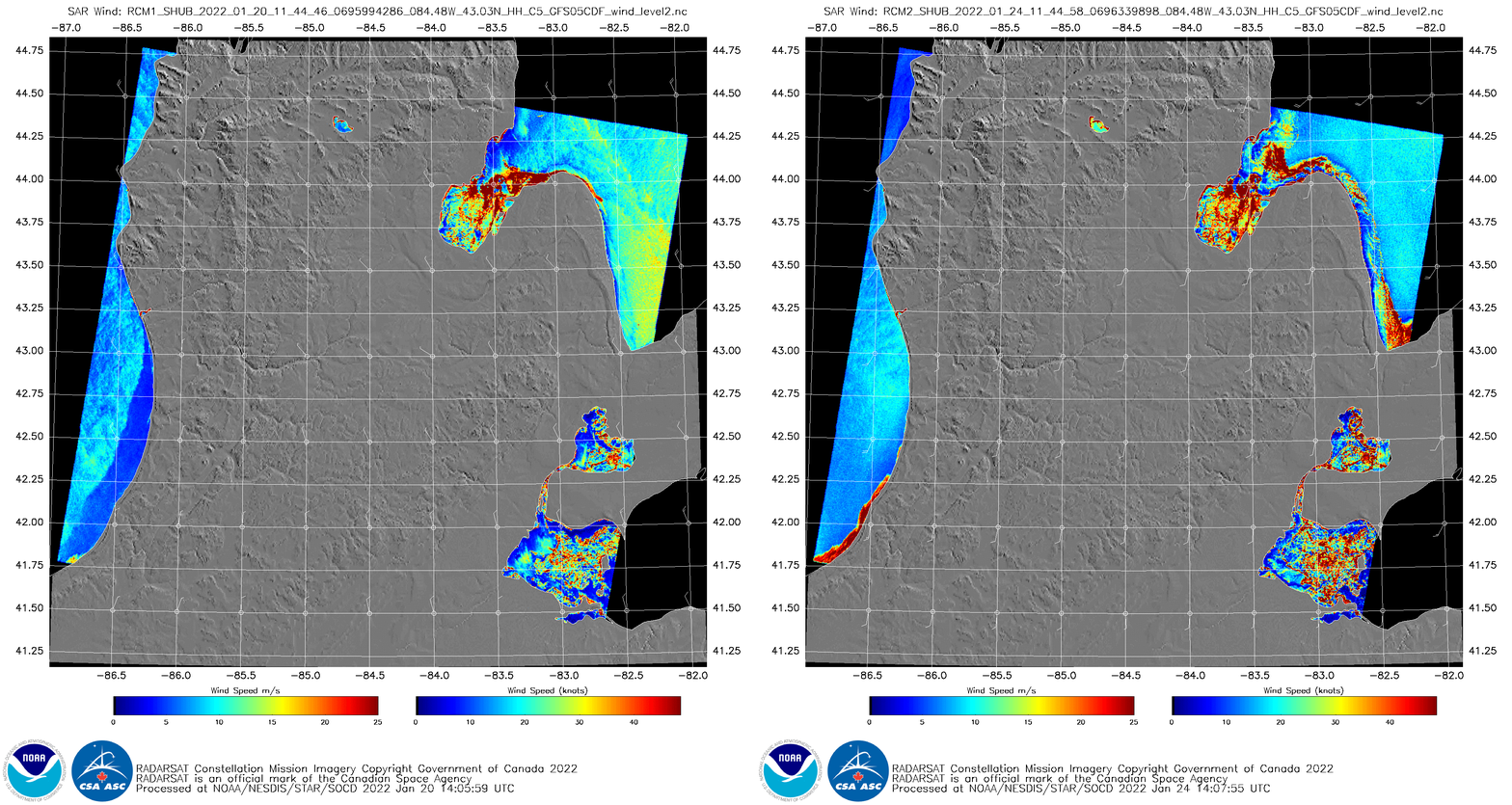
In addition to its use in detecting wind fields over water (link 1, link 2), SAR data can also be used to detect ice. An example is shown above: similar domains on 20 and 24 January 2022 (from this website; this image on 20 January 2022 and this on one 24 January 2022) are toggled. There is a general increase in Lake Michigan shore ice off shore of southwestern Lower Michigan. Ice concentrations have also increased in western Lake Erie, Lake St Clair, Saginaw Bay in Lake Huron, and along the southwestern shore of Lake Huron. Strong winds were occurring over Lake Huron on the 20th as denoted by the yellow enhancement over the Lake.
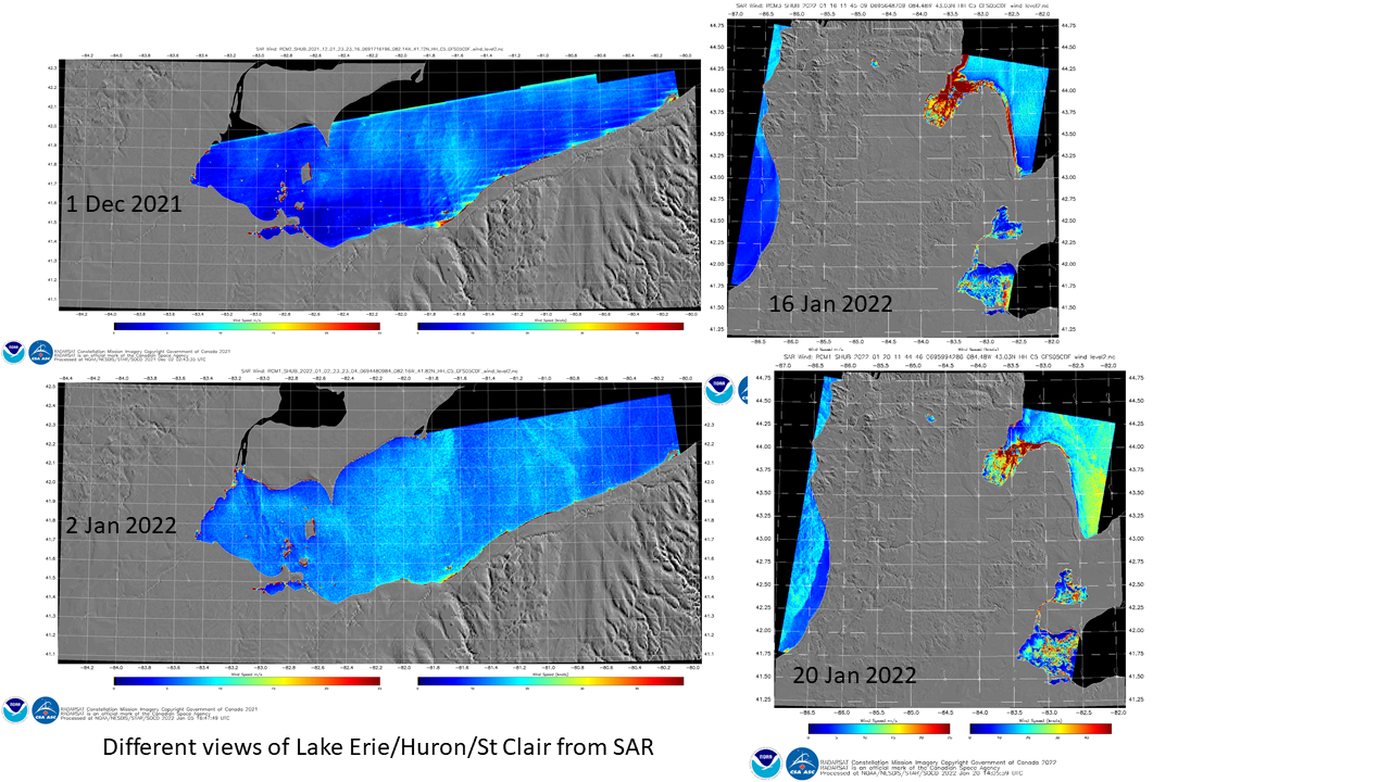
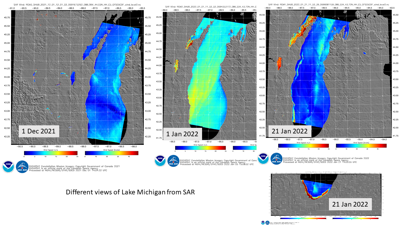
SAR data are best used by viewing them each day. The imagery below shows views on different days in December 2021 and January 2022 over Lakes Erie (below) and Michigan (bottom). Note how ice cover can diminish (for example, over Saginaw Bay between 16 and 20 January) in response (typically) to strong winds that can move ice to the middle of the lake where it will melt.
A similar occurrence is shown in Lake Michigan (bottom): there is a filament of near-shore ice on 21 January that had detached from the shoreline under strong southwesterly flow. On 1200 UTC on 22 January, when strong southwesterlies continued, the ice is gone. It’s also not present on 1208 UTC on 23 January, when winds shift back to northerly. Detachment of ice from the shore can be a hazard to fishermen! The Lake Michigan cases also include very strong southwesterly winds (denoted by the yellow enhancements).


Note that ice in a cloud can also cause strong returns that can be misinterpreted as strong winds. Ice will strongly reflect the microwave signals from the RCM (RADARSat Constellation Mission) satellites. That’s the case in this image over Lake Ontario, and this summertime convection view of Lake Superior. Use caution when you see very strong winds; ask: could this be ice in the cloud, or in the lake?
GOES-16 Visible imagery, below, from 21 January 2022 (more imagery from this date is available here), shows challenges in monitoring ice in single-banded imagery. The detached shoreline ice noted in the SAR imagery becomes more faint with time, suggesting melting. The ice over southern Lake Michigan is apparent. Clouds over western Lake Erie make it very hard to interpret ice coverage there.

Very cold air is forecast to overspread the Great Lakes this week. Check to see if ice coverage increases at this link!

