GOES-16 Cryosphere Level 2 Products
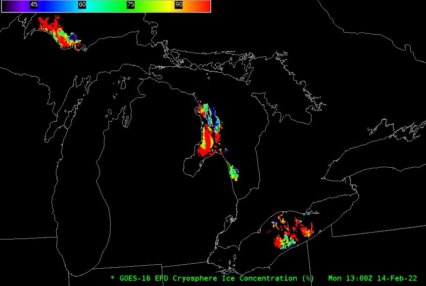
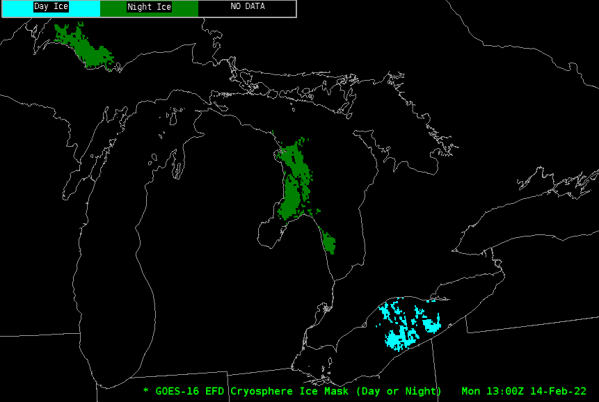
GOES-16 Cryosphere products — Ice Mask, Ice Concentration and Ice Surface Temperature — have been developed and are in a testing phase. The AWIPS screenshot above shows ice concentrations over parts of Lakes Superior, Huron and Erie. These products are created over the Full Disk ABI domain in regions of clear sky only (clouds over Lakes Michigan and Ontario mean Ice Concentration is not computed there at 1300 UTC). The Ice Mask at the same time, below, shows ‘Day Ice’ (cyan) and ‘Night Ice’ (green) flags; cryosphere products are created day and night, but different algorithms are used: Bands 14 and 15 (11.2 µm and 12.2 µm, respectively) are used day and night; the daytime product also uses Bands 2, 3 and 5 (at 0.64 µm, 0.86 µm and 1.61 µm, respectively) as noted in the Advanced Theoretical Basis Document — ATBD — here.
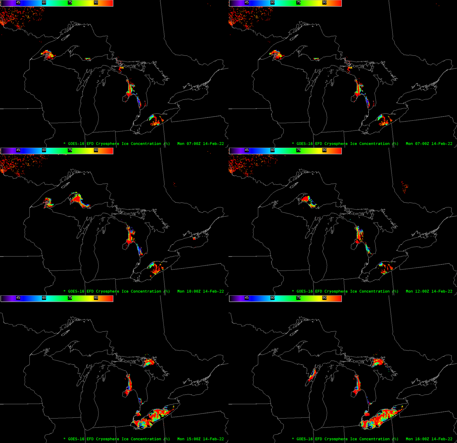
The strength of ABI is frequency (every hour) of observations, so an animation, as shown below, will allow a user multiple views of the lakes; in partly cloudy (or clearing) conditions, values from one hour can augment values from other hours. An example is shown below with Ice Concentration over the Great Lakes. Clearing skies over Lake Erie allow for a more complete description of Lake Ice, whereas increasing clouds over western Ontario and western Lake Superior mean GOES-R Cryosphere observations are lost. In the absence of very strong winds, however, lake ice does not erode quickly, so although the observations are precluded by cloud cover, earlier observations likely remain valid. It is important to know where the clouds are, however, when viewing these products.
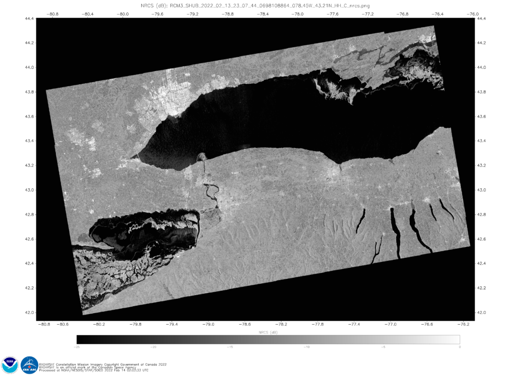
The utility of these clear-sky products with good temporal frequency is augmented in combination with all-sky products that give observations only once or twice daily — such as Synthetic Aperture Radar (SAR) ice observations that available here. For example, the 2307 UTC 13 February Normalized Radar Cross Section (NRCS) image (below) over eastern Lake Erie can be used to fill in information not available from the GOES-16 Cryosphere product.
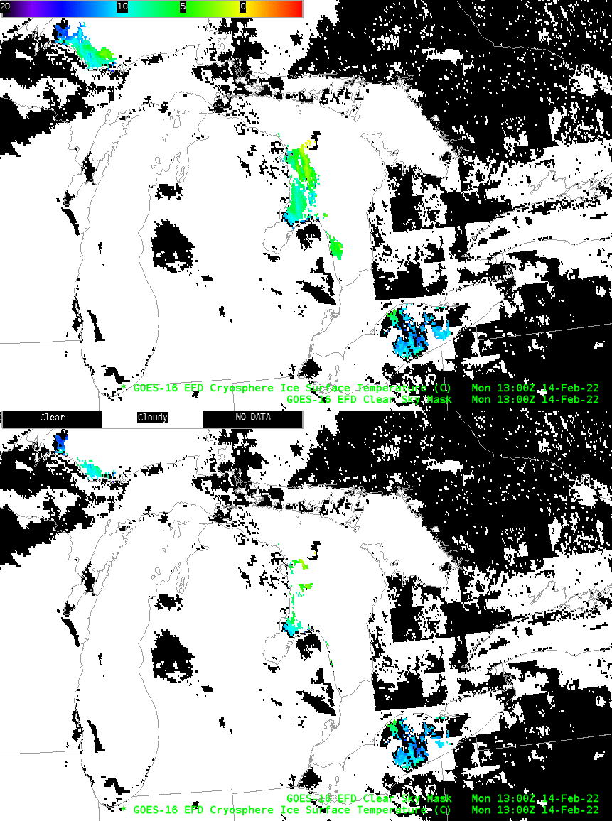
The AWIPS toggle below shows Ice Surface Temperature plotted below and on top of the Binary Cloud Mask. You will note that there are regions where Ice Surface Temperature is computed in regions where the Binary Cloud Mask shows clouds! How can this occur in Clear Sky products such as the Cryosphere products (a similar toggle could be created with Ice Concentration or Ice Mask)?
The Cloud Mask in AWIPS shows regions that are Clear or Cloudy — it is binary. The Cloud Mask actually has 4 different states (as noted here): Clear, Probably Clear, Probably Cloudy and Cloudy. The Cloud Mask in AWIPS assigns ‘Cloudy’ to all pixels that aren’t Clear: that includes ‘Probably Clear’, ‘Probably Cloudy’ and ‘Cloudy’ pixels. In contrast, the Cryosphere products are produced in regions that are both Clear, or Probably Clear (as noted in the ATBD). That’s why Cryosphere products can show up in regions that AWIPS shows are Cloudy.
