Wind and waves over Lake Superior
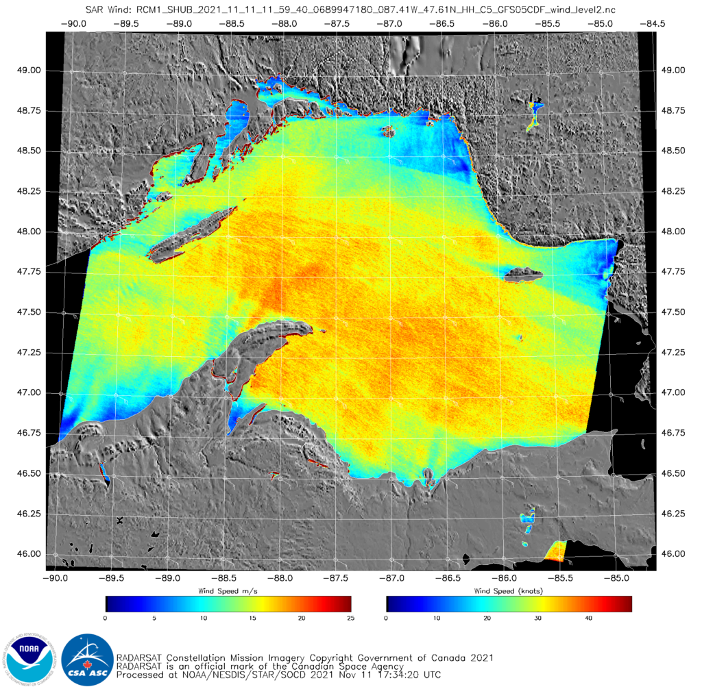
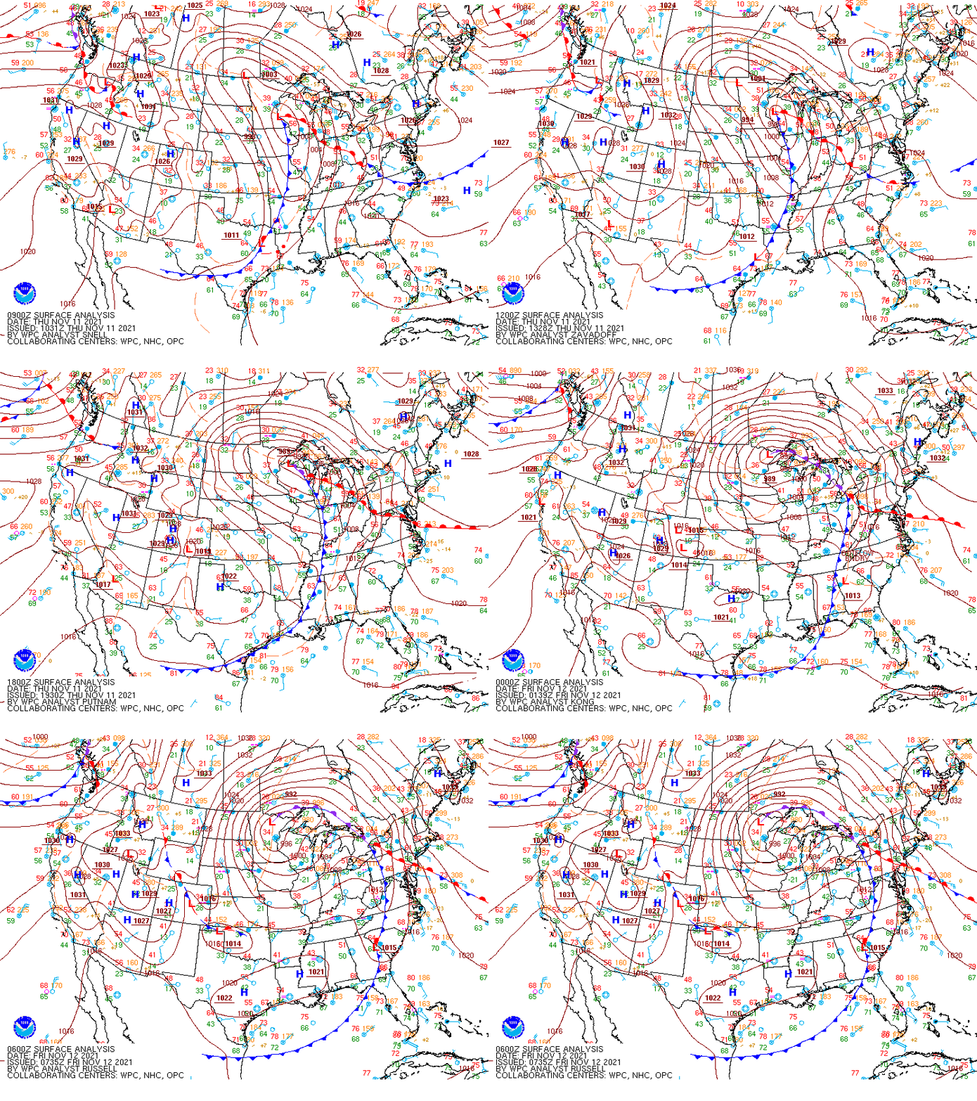
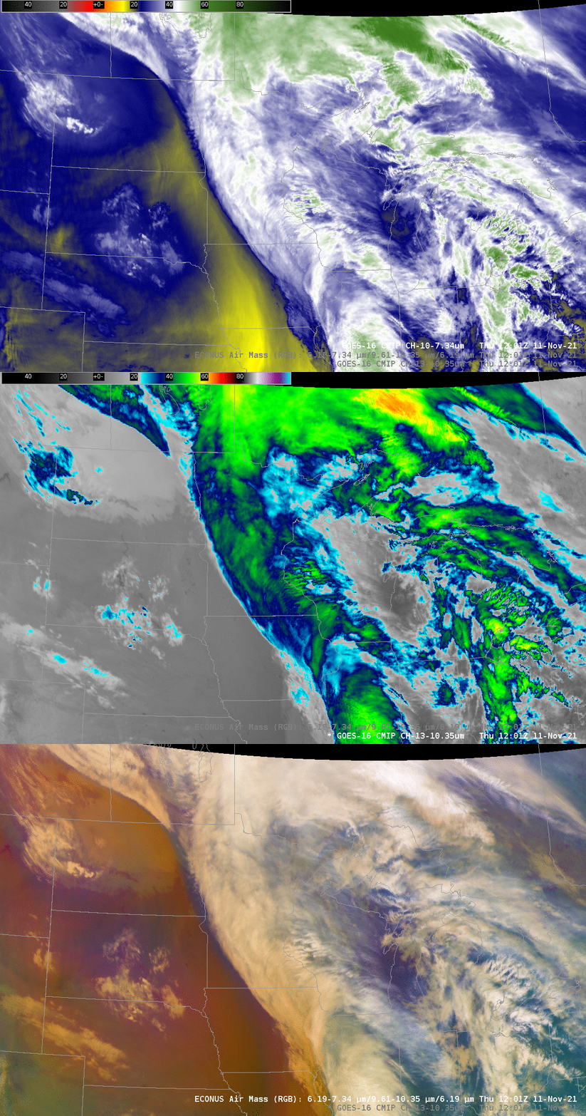
A vigorous extra-tropical cyclone moving towards the western Great Lakes on 11 November 2021 generated significant winds and waves over Lake Superior. RADARSAT winds, above, from RCM1, (available at this website) show a large area of southeasterly winds between 30 and 40 knots at 1159 UTC on 11 November. Regions of lighter winds are present to the lee of both Isle Royale and Michicipoten Island. The animation below steps through the low-level water vapor and clean window infrared channels (Band 10 at 7.34 µm and Band 13 at 10.3 µm, respectively) and the airmass RGB. All three ABI products suggest a negatively-tilted trough moving into the western Great Lakes. Click here to see an animation of 3-hour surface plots from 0900 UTC 11 November through 0600 UTC on 12 November (also shown at the bottom of this post).
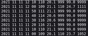
How do the SAR winds above compare to observations? Open-lake observations are scarce during Gales, and the mid-lake buoys (45028, 45006 and 45001, for example) have been retrieved for the season. However, Stannard Rock Lighthouse observations show sustained east-southeast winds near 40 knots at around 1200 UTC, as shown in the capture below, from this website (accessed from here). (Note that Stannard Rock wind observations are 35 m above the Lake surface)
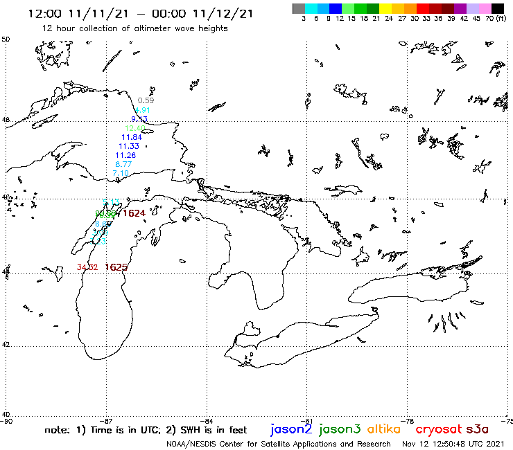
At 1636 UTC, JASON-2 overflew eastern Lake Superior, and Altimetry data (from this website) from that satellite was used to compute wave heights, shown below. Peak Significant Wave Heights (defined as the average of the highest 1/3rd of all waves) under the satellite were in the 11-12 foot range. (Click here for a quick brief on JASON Wave Heights). Lake Superior Wave Heights at 1600 UTC (from this website (linked off here) maintained by GLERL) show rough agreement with the JASON observations.
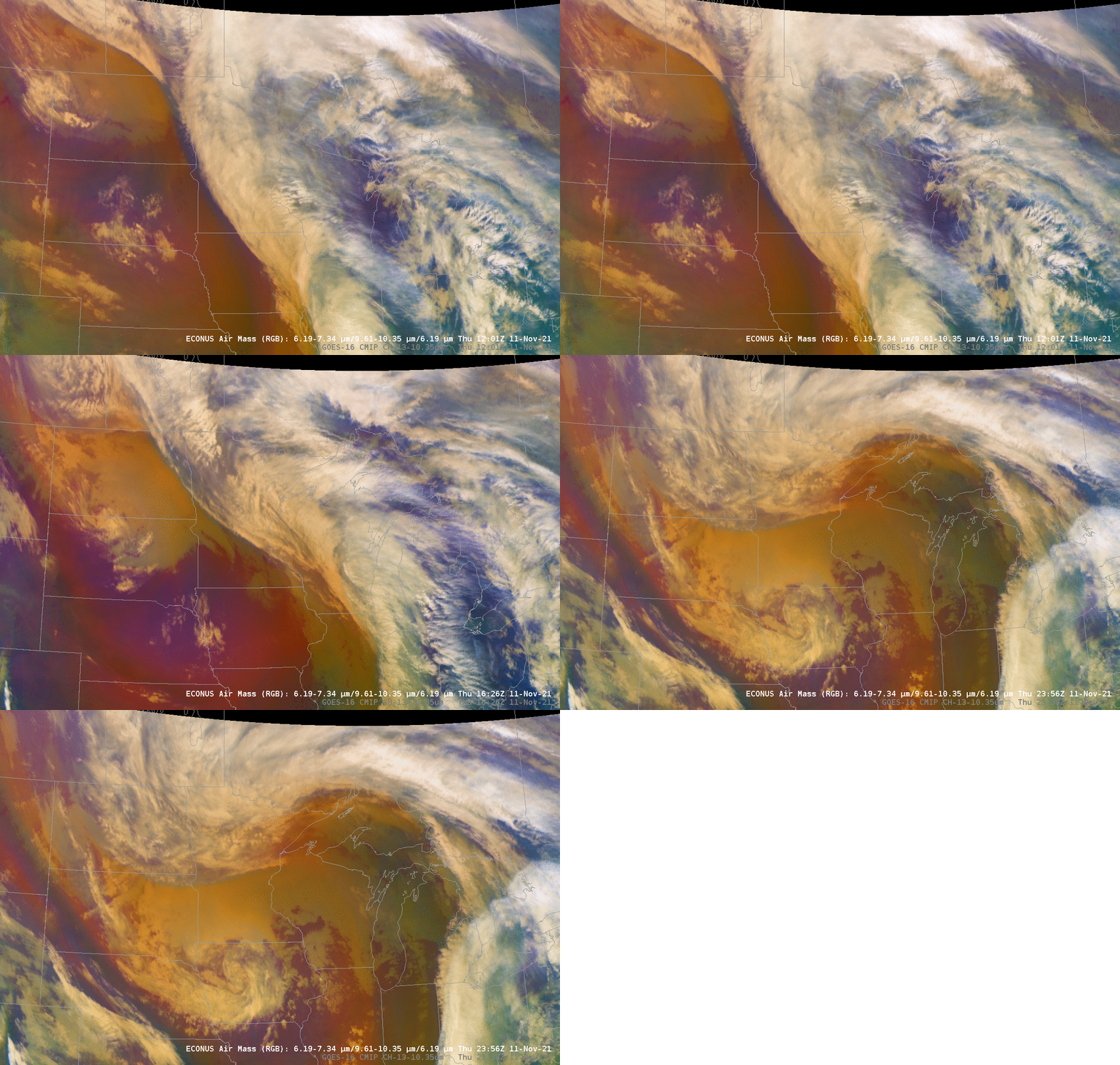
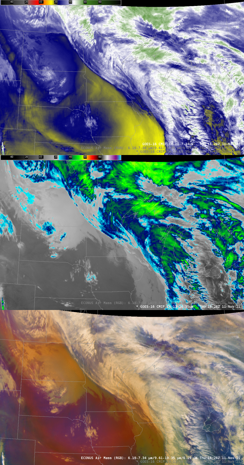
GOES-16 Data at the time of the JASON overpass, below, shows the continued development/amplification of the extratropical cyclone. Note in particular the feature over western Iowa/eastern Nebraska that has dropped down the western side of this developing storm since 1201 UTC imagery, above.
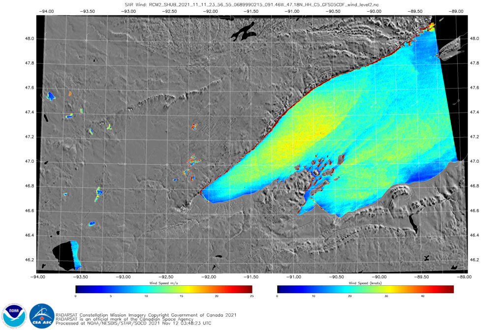
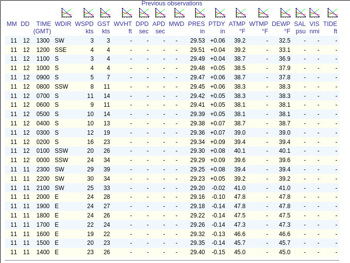
At 2356 UTC on 11 November, RCM2 overflew western Lake Superior, and data at that time shows southwesterly winds between 25 and 30 knots over western Lake Superior. GOES-16 data at the same time, below (and surface data, bottom) show a mature storm to the north of Lake Superior. Data from the Devils Island C-MAN station (link) (see below) show sustained winds at 24 knots with gusts to 34 knots. (Note that the instruments for this reading are 25 m above ground)
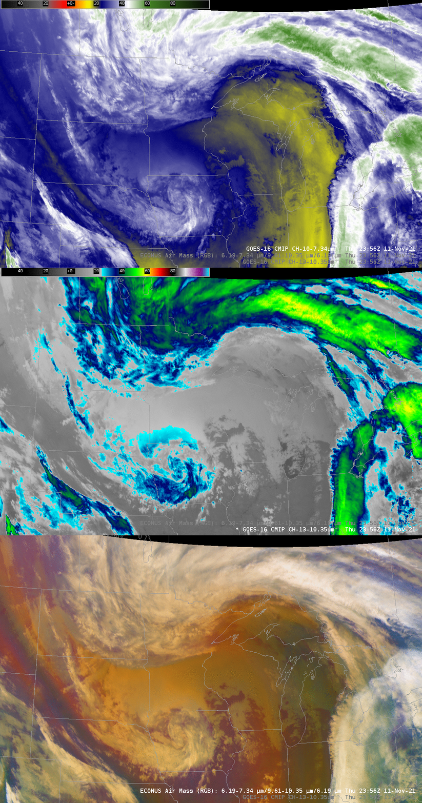
Airmass RGB imagery from 1201, 1626 and 2356 UTC, below, the times of the wind and wave observations above, show the piecewise development of this system. Surface analyses for this system, from 0900 UTC on 11 November through 0600 UTC 12 November, are shown at bottom.
