Rapid ice growth in Lake Erie
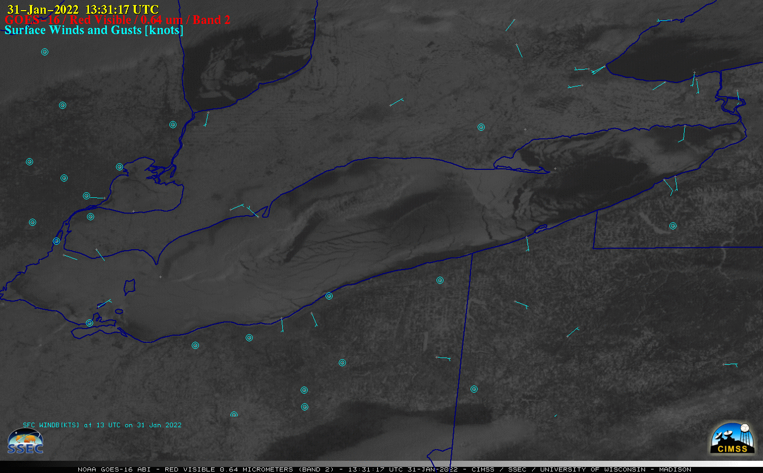
GOES-16 “Red” Visible (0.64 µm) images, with surface wind barbs (knots) plotted in cyan [click to play animated GIF | MP4]
An Aqua MODIS True Color RGB image from the MODIS Today site (below) provided a higher-resolution view of the linear icebreaker paths in the western portion of the lake (where the ice was generally thicker).
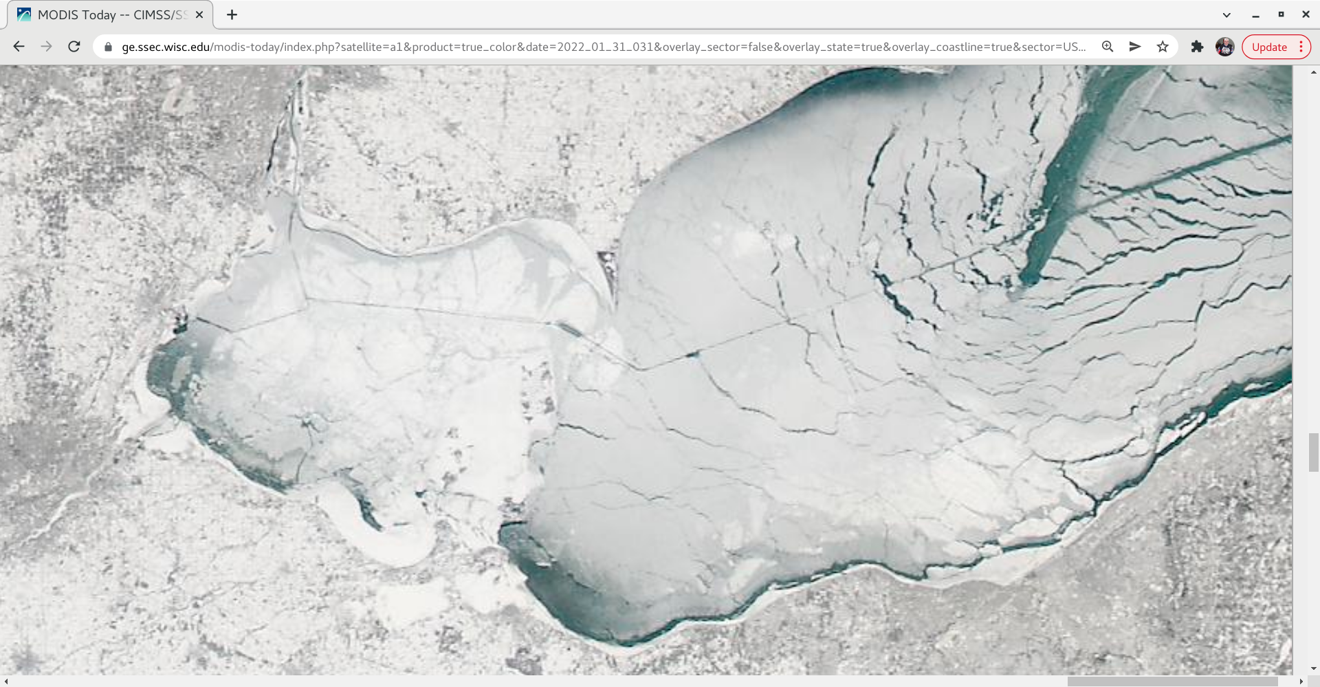
Aqua MODIS True Color RGB image [click to enlarge]
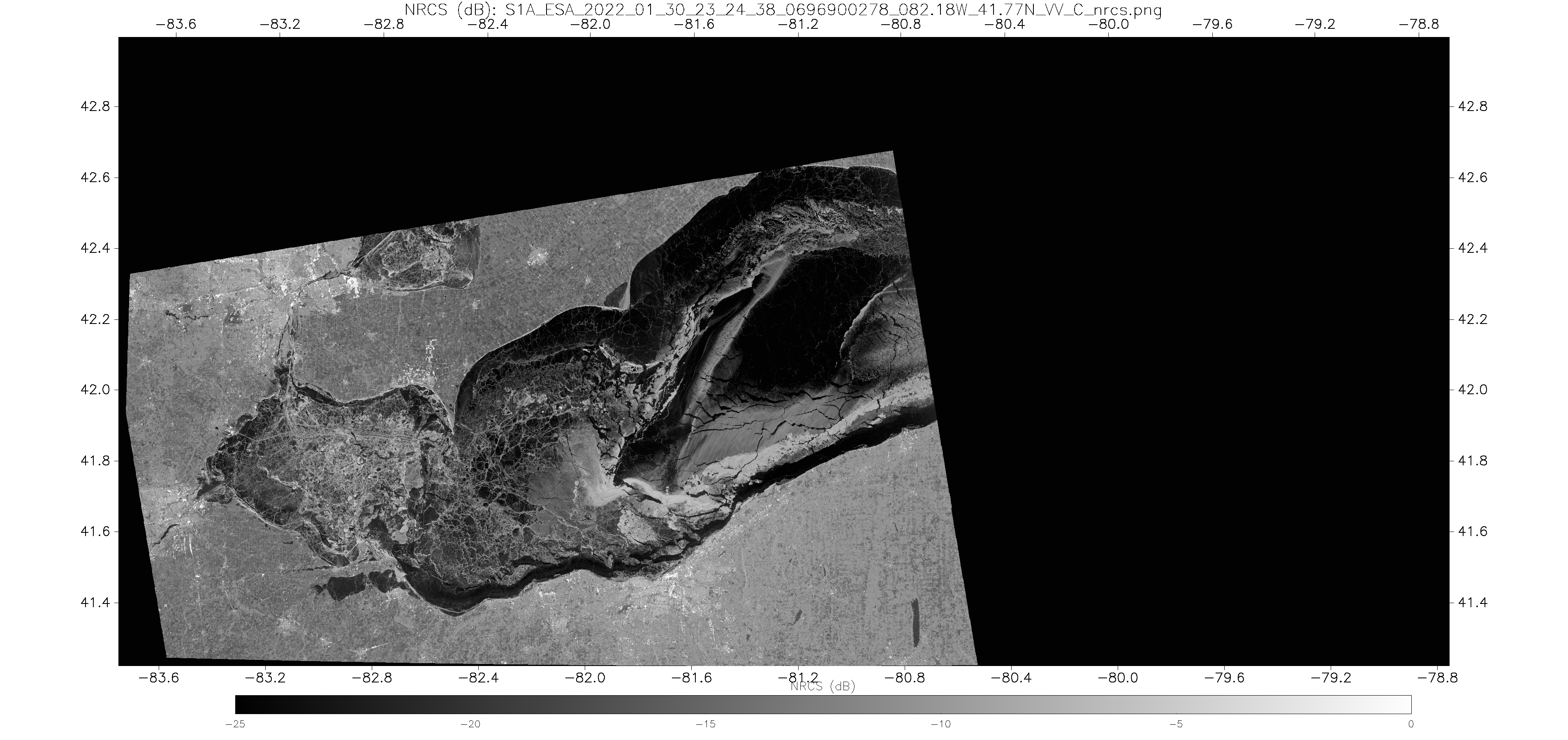
SAR NCRS images from Sentinel-1A at 2324 UTC on 30 January and from RCM-1 at 1136 UTC on 31 January [click to enlarge]
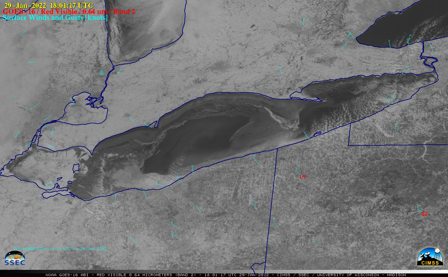
GOES-16 “Red” Visible (0.64 µm) images at 1801 UTC on 29 January and 31 January 2022 [click to enlarge]
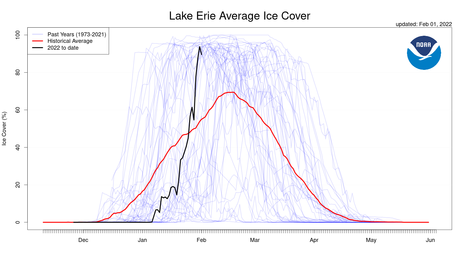
Plot of current Lake Erie ice coverage (black) compared to the historical average (red) [click to enlarge]