Tiger Island Fire in western Louisiana, viewed using GOES-16/GOES-14 and NOAA-20
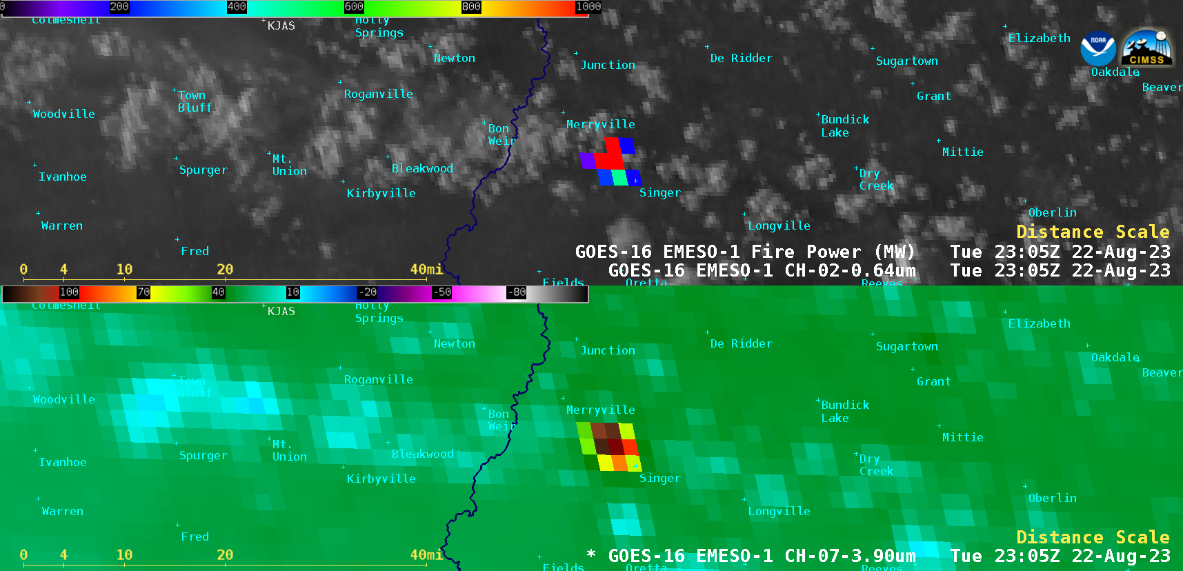
1-minute Mesoscale Domain Sector GOES-16 (GOES-East) “Red” Visible (0.64 µm) + Fire Power derived product (a component of the GOES Fire Detection and Characterization Algorithm FDCA) and Shortwave Infrared (3.9 µm) images (above) showed the thermal signature associated with the Tiger Island Fire in far western Louisiana on 22 August 2023. A combination of mandatory and voluntary evacuations were... Read More