Dry (and dusty) air over the Caribbean
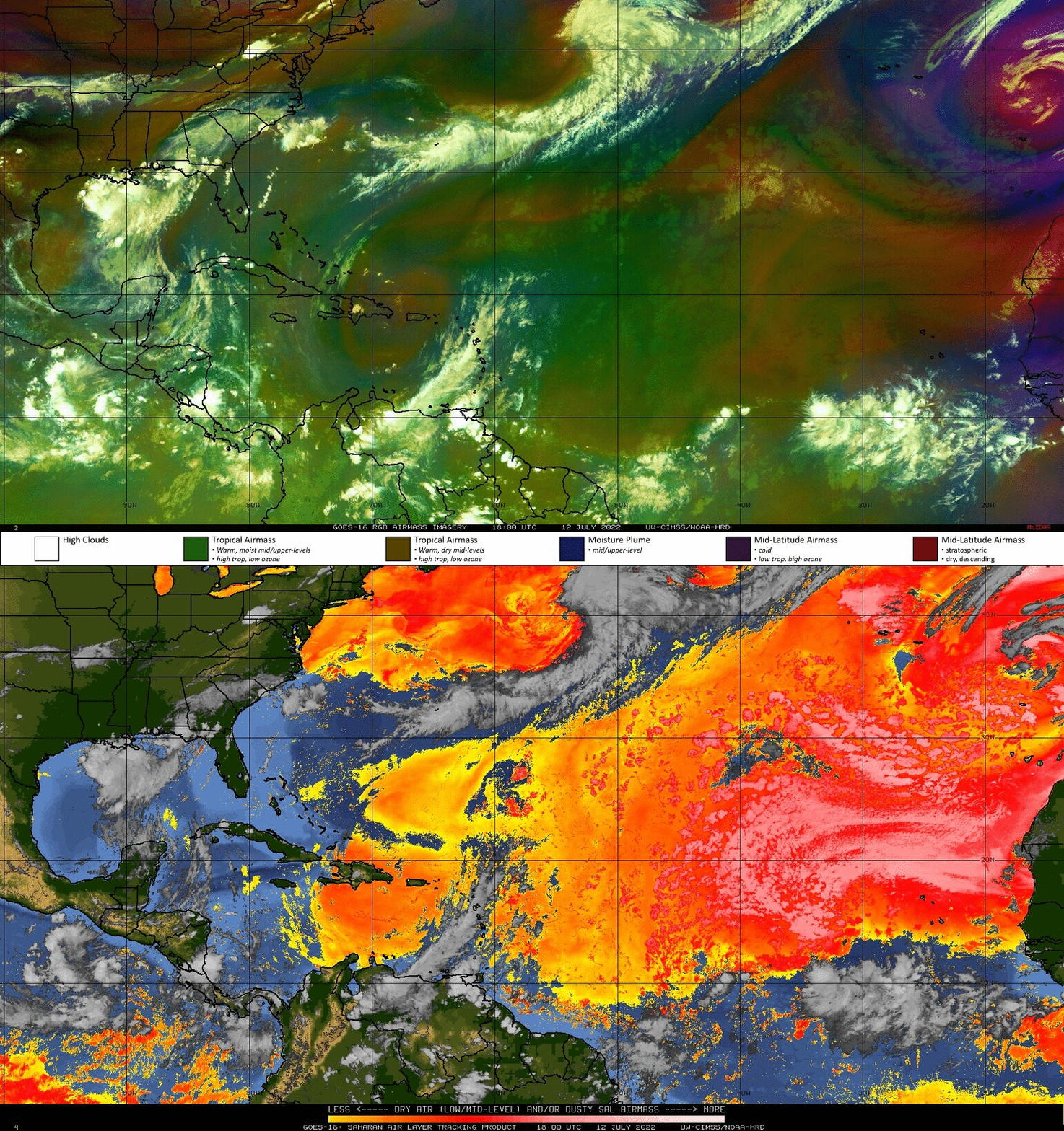
CSPP True Color imagery (link) above suggests a region of apparent dust over the eastern Caribbean Sea. That is, there is a hazy look to the imagery that persists even as the region of sun glint moves past. Suspended dust in the tropical Atlantic is known to suppress convection. Other products besides true-color imagery can be used to show dry the air (qualitatively and quantitatively) over the Caribbean. For example, the toggle below (from this site) of the Saharan Air Layer analysis (via the Split Window Difference) and the Airmass RGB shows very dry air south of Hispaniola and Puerto Rico — orange in the Split Window Difference, and also an orange tint to the Airmass RGB.

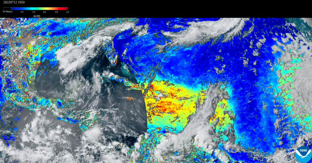
Air over the eastern Caribbean also shows large values of Aerosol Optical Depth (from the AerosolWatch site); the enhanced values are most likely a result of suspended dust from the Sahara. AOD is not computed in the region of sun glint — that’s the cause of the smooth curved line that arcs through extreme eastern Cuba.

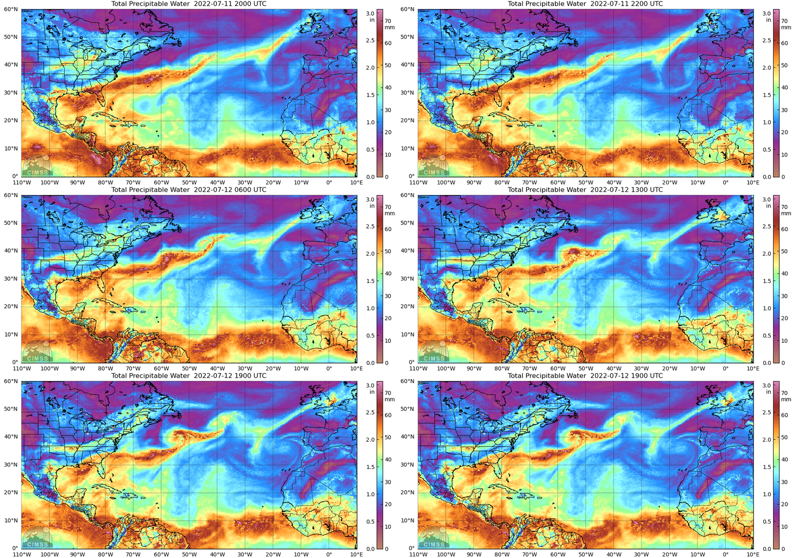
Total Precipitable Water (TPW) from the MIMIC site (link) shows dry air over the eastern Caribbean (and over much of the tropical Atlantic Ocean north of 10oN). Total precipitable water derived from gridded NUCAPS fields (here), and relative humidity at 700 mb (here), also show dry air over the eastern Caribbean; they are also shown in a toggle with NUCAPS Quality Flags below.


An interesting feature in the animation at the top of this blog post is the development of convection over Hispaniola, over the topography, even in the presence of fairly dry air. NUCAPS analyses of 500-mb air temperature (here), show a cold pocket of air over Puerto Rico and Hispaniola, helping the development of convection there.
When assessing the environment of a region with sparse conventional data, such as the Atlantic (or Pacific) Ocean, or the Caribbean Sea, take advantage of information that satellite observations can give you.

