Satellite Images of the Sun (on April 8th)
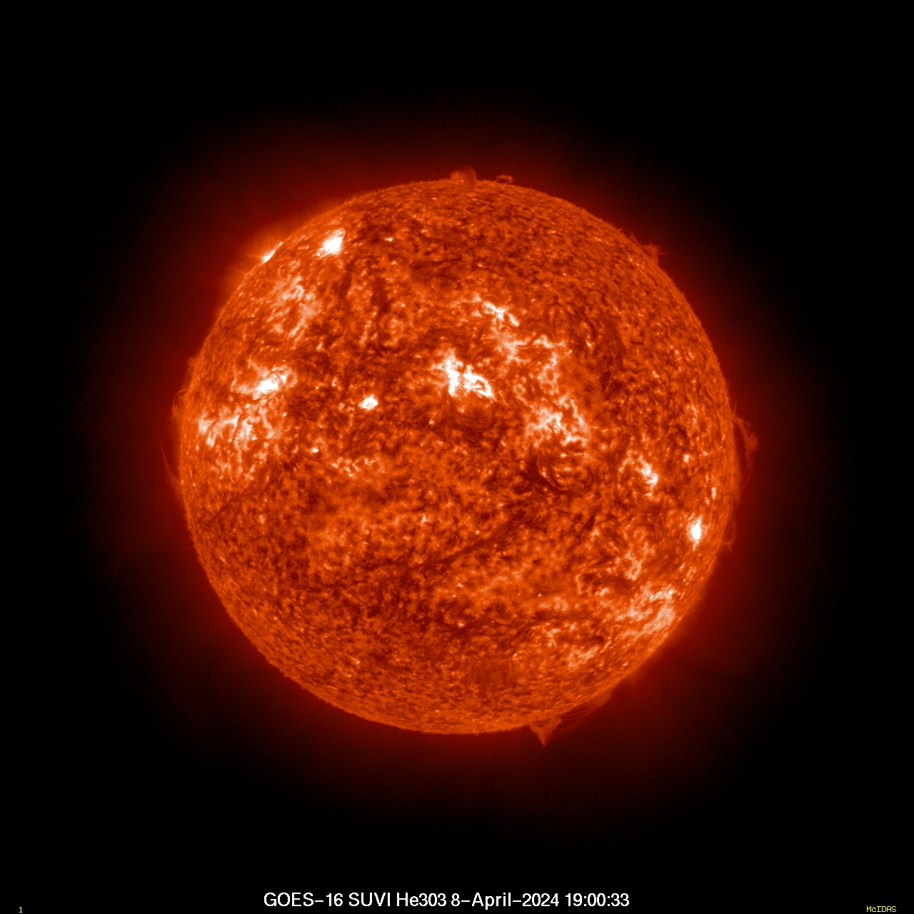
There are several satellites that routinely image the Sun, to support Space Weather. Due to the recent total solar eclipse, there has been much interest in the Sun. SUVIThe GOES-R series also has a number of space weather instruments, including the SUVI (Solar UV Imager). The above images are via the UW/SSEC ingest... Read More