Heavy Rain over New York City
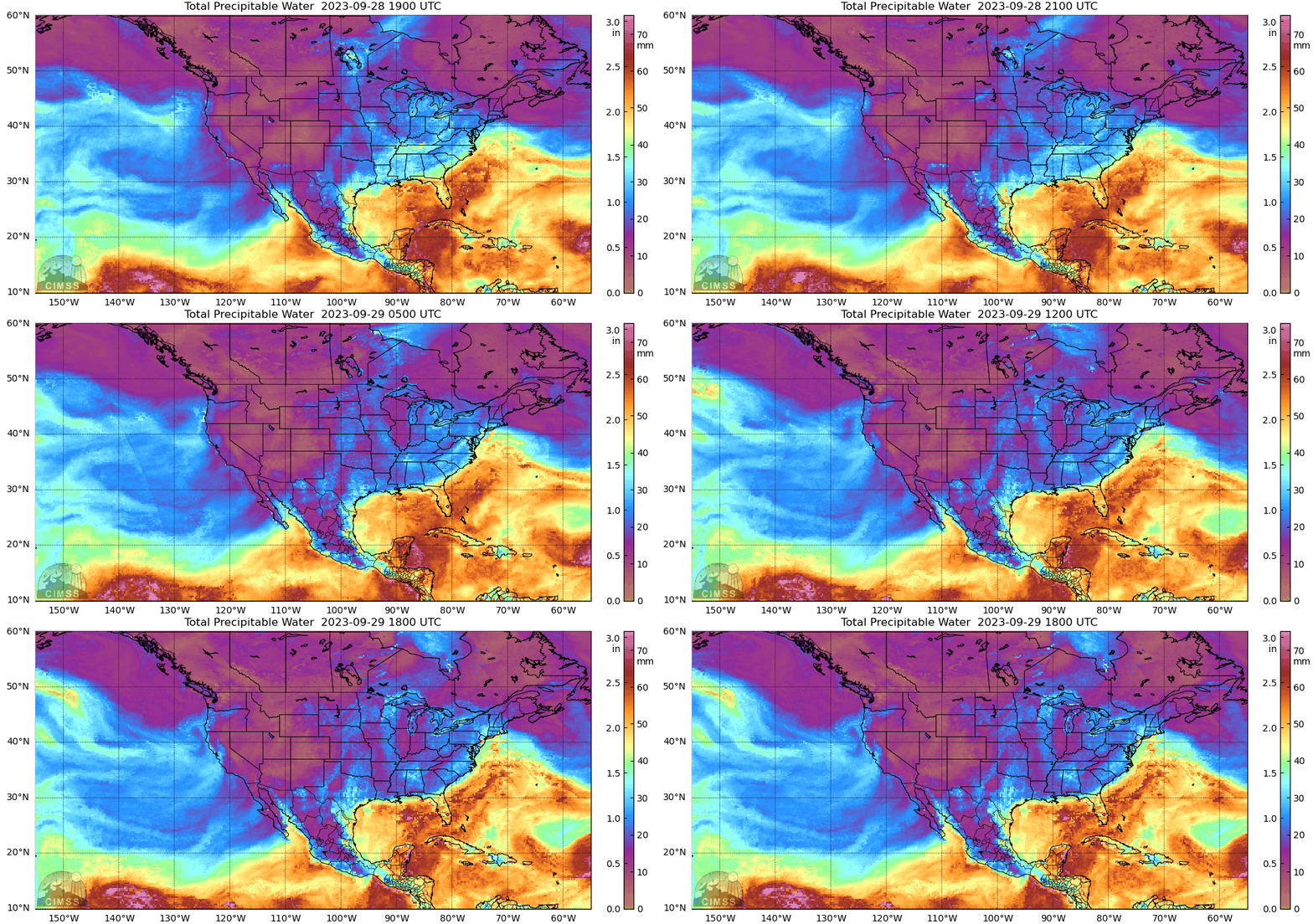
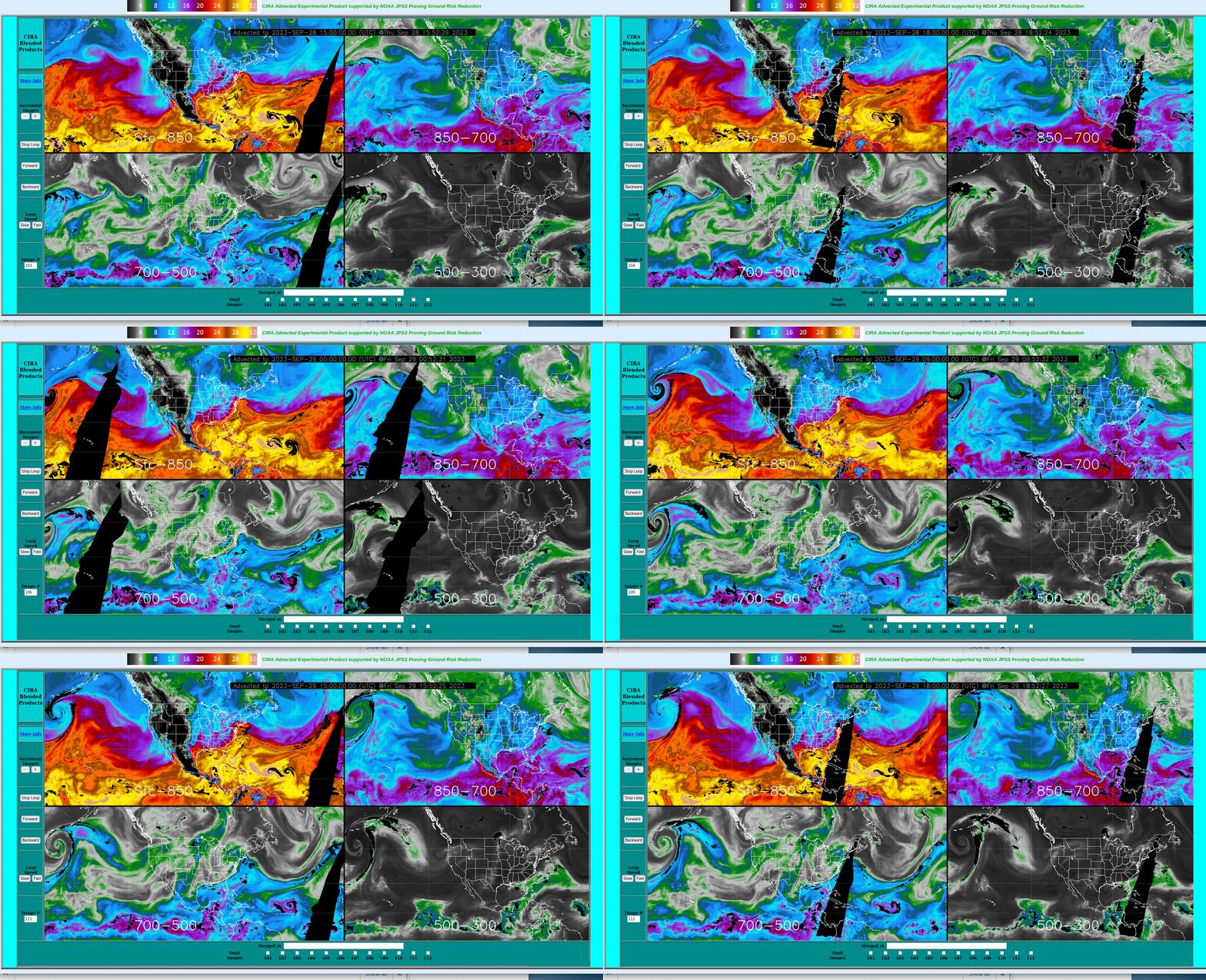
Persistent rains over the New York City metropolitan area have caused urban flooding on 29 September (29 September is the wettest day since 1948 in NYC well!). MIMIC TPW, above (source), shows moisture moving inland from the Atlantic Ocean. It’s often the case that heavy rain is accompanied by advection of moisture at multiple layers in the atmosphere; the Advected Layer Precipitable Water product, below (source), identifies two sources of moisture moving over metropolitan New York: moisture from the Atlantic is moving towards New York in the layer from the Surface to 850 mb; moisture from the Great Lakes is moving towards New York in the 700-500 mb layer, accompanying what appears to be a mid-level impulse. The edge of that feature from 700-500 mb is close to New York at 1800 UTC, the end of the animation, as shown in this annotated image (see the dotted orange line in the lower left image).
GOES-16 imagery, below, shows persistent redevelopment of convection over western Long Island/metropolitan New York City. As in the ALPW fields, a boundary is approaching metropolitan New York City by the end of the animation (1851 UTC). Perhaps the passage of that boundary will lessen the likelihood of convective redevelopment (caveat: your blogger is not a paid forecaster!) Abundant moisture (values exceeding 1.6″) is to the southeast of New Jersey (reddish orange in the enhancement), with more modest values (1.3-1.4 inches, yellow in the enhancement used) over New Jersey/eastern Pennsylvania.
GOES-16 Visible/Infrared Sandwich RGB images with METAR 1-hour Precipitation Accumulation reports plotted in yellow, from 1106-2201 UTC (courtesy Scott Bachmeier, CIMSS) [click to play animated GIF | MP4]
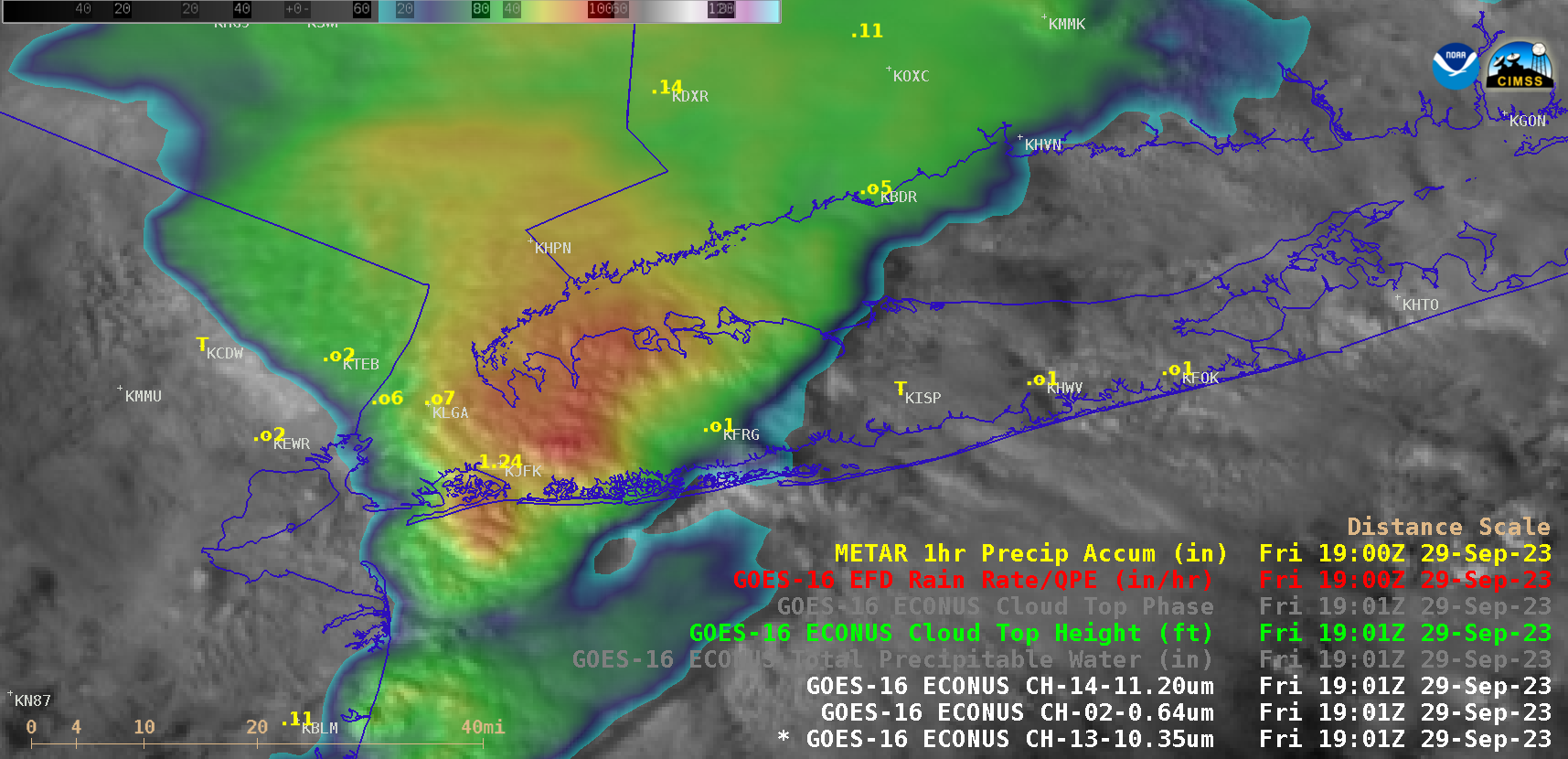
GOES-16 Visible/Infrared Sandwich RGB images (above) provided a closer look at the NYC area — METAR 1-hour Precipitation Accumulations were as high as 1.96 inches at Central Park (surface observations), 1.42 inches at Farmingdale (KFRG, surface observations), 1.40 inches at La Guardia Airport (KLGA, surface observations) and 1.24 inches at Kennedy International Airport (KJFK, surface observations). Such rainfall rates contributed to the high precipitation totals across the region, with amounts exceeding 9 inches in the NYC area.
GOES-16 Visible/Infrared Sandwich RGBs with cursor sampling of the associated Rainfall Rate and Cloud Top Height derived products (below) displayed Rainfall Rates of 0.56 to 0.67 inch per hour for 3 consecutive 5-minute images — associated with the thunderstorm that was passing over/near La Guardia Airport KLGA (where the 1-hour METAR Precipitation Accumulation at 1300 UTC was 1.40 inches). Taking parallax into account, the ~40 kft cloud tops were actually located about 16 km (10 miles) to the south (closer to KLGA).
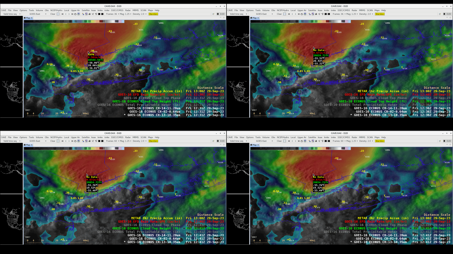
GOES-16 Visible/Infrared Sandwich RGB images with cursor sampling of Rainfall Rate (red) and Cloud Top Height (green), from 1231-1241 UTC (courtesy Scott Bachmeier, CIMSS) [click to enlarge]
AWIPS cursor sampling of GOES Level 2 derived products associated with a variety of RGBs is available via “Satellite -> Local Menu Items“. This technique of sampling satellite-derived rainfall rates could prove to be helpful in areas where radar coverage is poor (or unavailable).
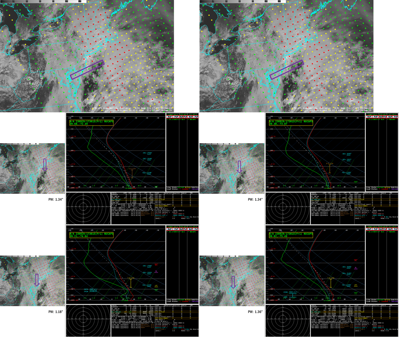
NOAA-20 overflew New York just before 1800 UTC on 29 September 2023. In the Sounding Availability Plot below, a line of NUCAPS profiles stretching east-northeastward from the central DelMarva peninsula are plotted in green — meaning the infrared retrieval converged to a solution — and boxed in purple. The individual profiles are shown in the animation, with locations indicated. The 3 easternmost soundings show a profile very similar to the 1200 UTC sounding at Upton, NY (also available here); that is, nearly moist adiabatic and close to saturation.
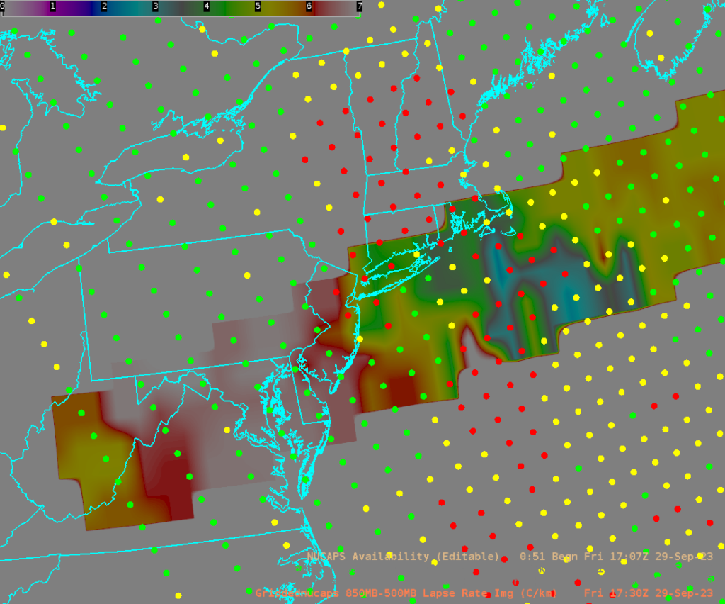
NUCAPS profiles can be horizontally interpolated to a grid. The 850-500 mb lapse rate computed from those fields is shown below. The most unstable air stretches back into northern Virginia.
Two Mesoscale Prediction discussions from NOAA’s Weather Prediction Center (WPC) (11:35 PM on the night before the event; 5:05 AM on the morning before the event) show how well this event was anticipated. New York City’s Emergency Management issued this Press Release long before the flooding occurred.

