Wildfires in British Columbia and Alberta produce numerous pyrocumulonimbus clouds
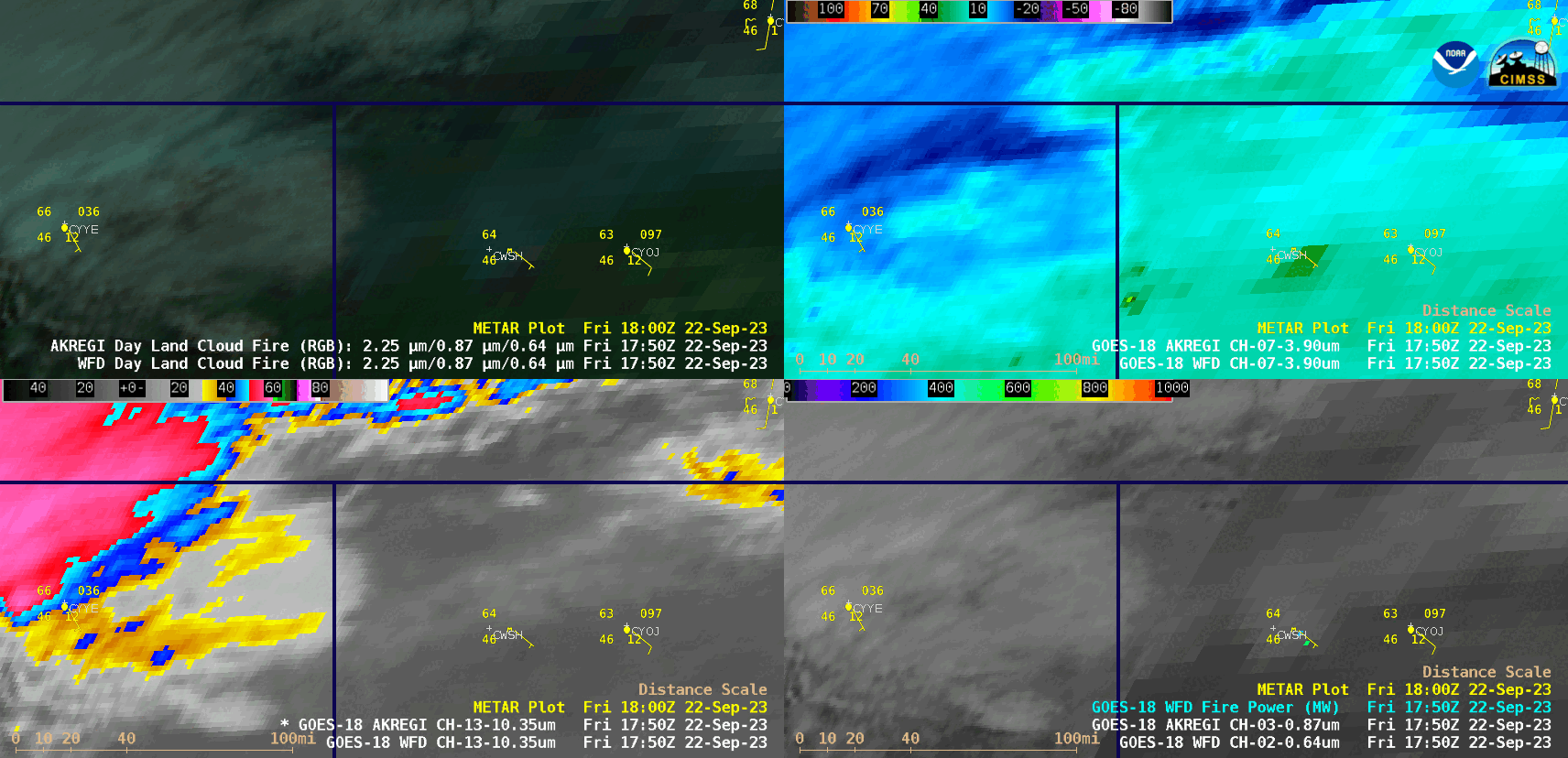
GOES-18 Day Land Cloud Fire RGB (top left), Shortwave Infrared (3.9 µm, top right), “Clean” Infrared Window (10.3 µm, bottom left) and “Red” Visible (0.64 µm) + Fire Power derived product (bottom right), from 1750 UTC on 22 September to 0500 UTC on 23 September [click to play animated GIF | MP4]
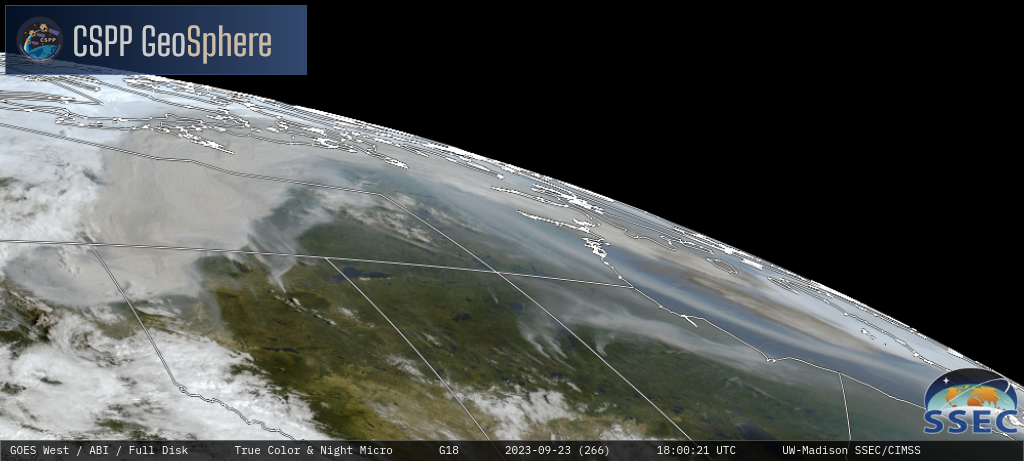
True Color RGB images from the CSPP GeoSphere site (below) displayed the BC/AB pyroCb development, as well as widespread dense smoke from the many wildfires across the region.
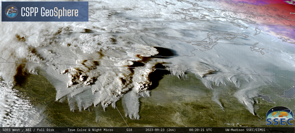
GOES-18 True Color RGB images [click to play MP4 animation]
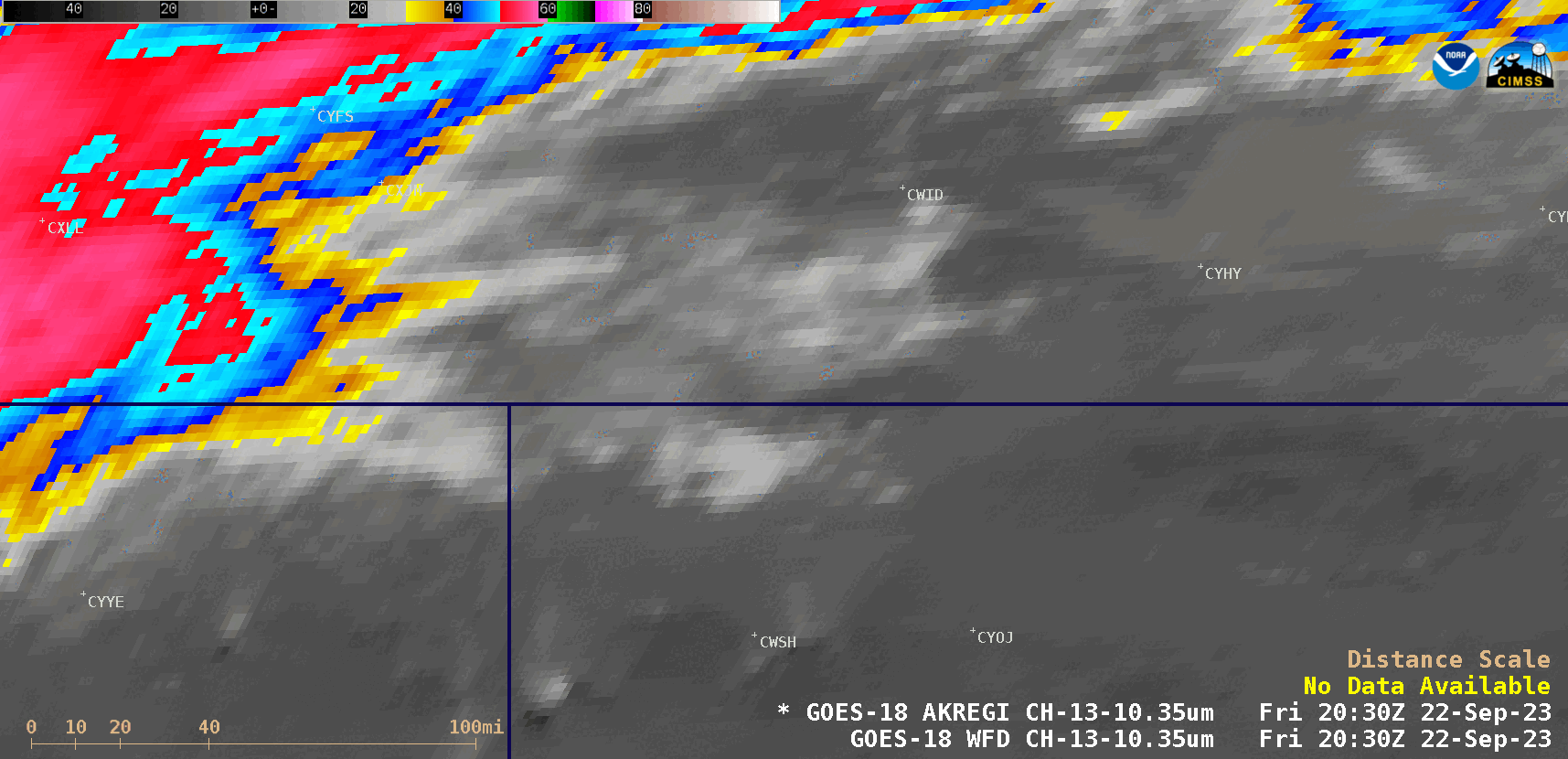
GOES-18 “Clean” Infrared Window (10.3 µm) images, from 2030 UTC on 22 September to 1000 UTC on 23 September [click to play animated GIF | MP4]
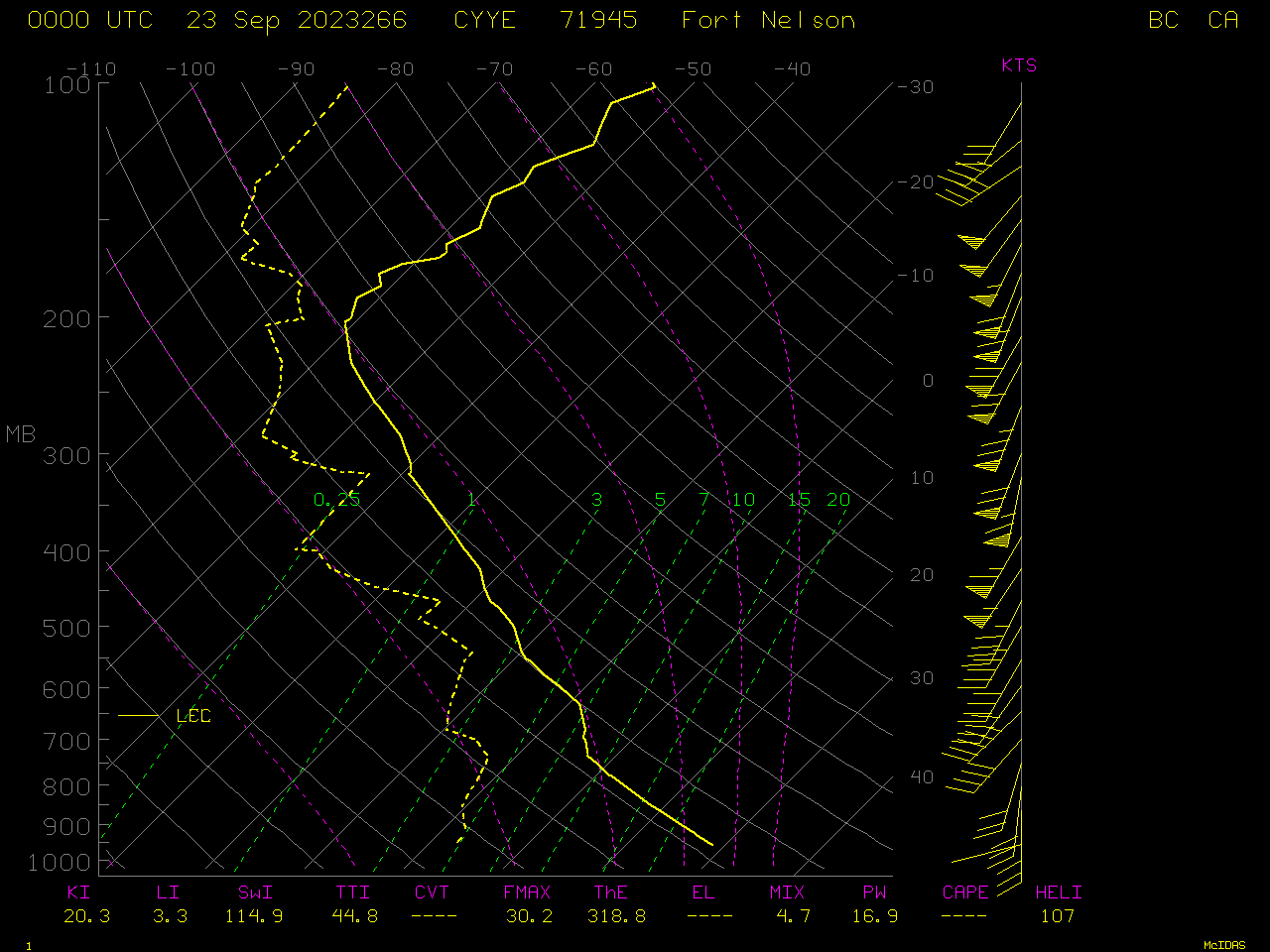
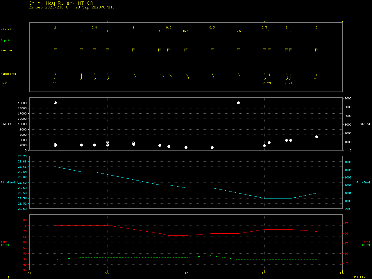
Plot of rawinsonde data from Fort Nelson, British Columbia at 0000 UTC on 23 September [click to enlarge]
GOES-18 True Color RGB images [click to play MP4 animation]
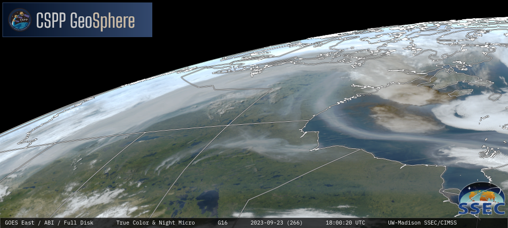
GOES-16 True Color RGB images [click to play MP4 animation]