Kasatochi volcanic plume
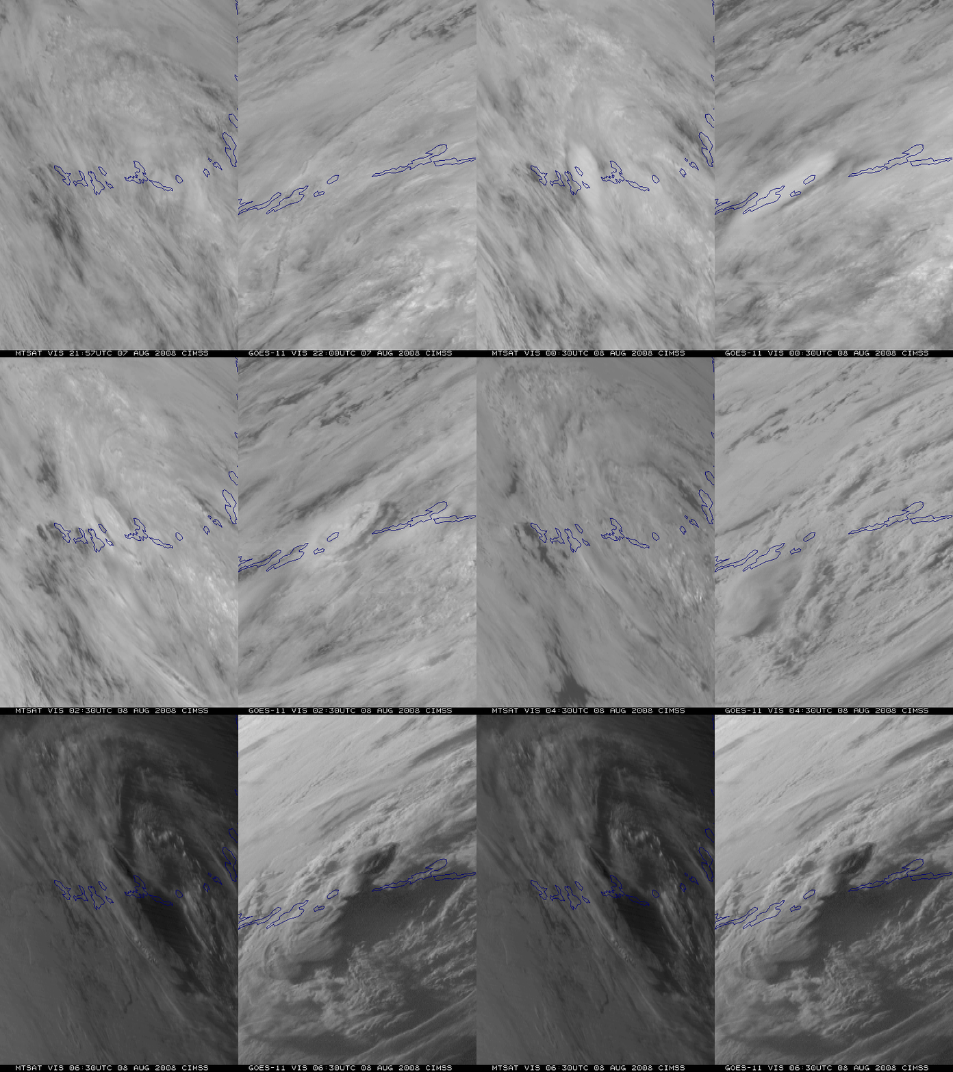
The Kasatochi Volcano (located in the Aleutian Islands of Alaska) experienced a series of eruptions on 07-08 August 2008. A comparison of visible channel images from the MTSAT-1R and GOES-11 satellites (above) shows the initial sequence of volcanic plumes from 2 very different satellite viewing angles — note that the third eruption plume (beginning around 05 UTC on 08 August) appeared much darker that the previous 2 plumes, suggesting a higher volcanic ash content.
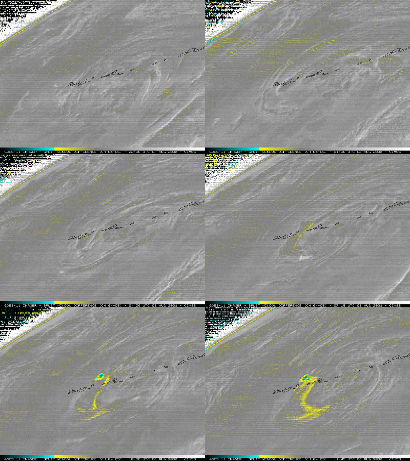
GOES-11 “split window” IR difference images (below) displayed a volcanic ash signal (yellow to cyan color enhancement) — again, the volcanic ash signal appeared to be more well-defined after the third eruption (beginning around 05 UTC on 08 August).
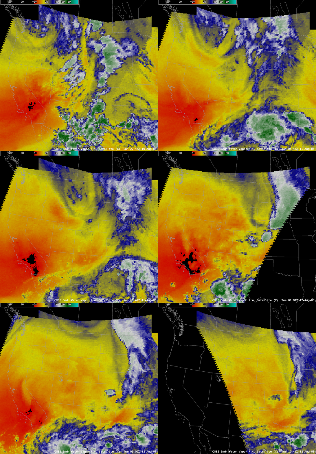
About 4 days after the initial eruption, AWIPS images of the GOES-11 + GOES-12 Sounder 7.4 µm channel (below) revealed a signature of a portion of the volcanic plume (lighter blue color enhancement) that was drifting eastward across the northwestern and north-central US on 11-12 August. The GOES Sounder 7.4 µm channel was designed to be used primarily as a lower-tropospheric “water vapor” channel, but it happens to also be sensitive to sulfur dioxide (SO2). However, this volcanic plume was also evident on GOES-11 visible channel images (QuickTime animation), which suggests that the “SO2 plume” is an aerosol feature (possibly a plume consisting of supercooled water coated sulfate particles).
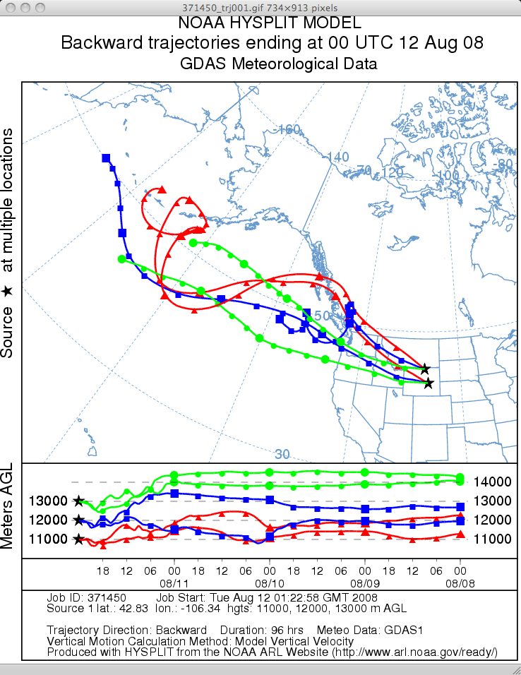
NOAA Air Resources Laboratory HYSPLIT model trajectories (below) suggested that the features seen arriving over eastern Wyoming around 00 UTC on 12 August could very well have been transported from the region of the Kasatochi eruption over the Aleutians. There were also a number of pilot reports of volcanic ash over the region during that time period (including an interesting report of “SULFUR SNOW” over northeastern Montana).
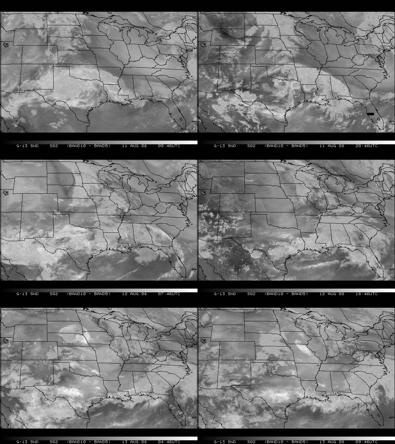
The GOES-13 satellite had just recently been taken out of on-orbit storage for evaluation and testing in early August 2008. A sequence of GOES-13 Sounder IR difference [7.4 µm (Band 10) minus 13.4 µm (Band 5] images (below; courtesy of Tony Schreiner, CIMSS) showed a signal of the “volcanic SO2 plume” (darker black enhancement) as it moved eastward from Montana and Wyoming on 11 August to Minnesota and Iowa on 13 August. As the cloud shield cleared over southern Wisconsin on 13 August, Arctic High Spectral Resolution Lidar located at the University of Wisconsin – Madison indicated a layer of aerosol backscatter centered around 12 km, which could very well have been part of the Kasatochi volcanic plume.
In addition, another portion of the “volcanic SO2 plume” could be seen moving southward across Ontario on 12 August, then moving southeastward across New England on 13 August — these particular volcanic plume features were forecast with remarkable accuracy by an Environment Canada Lagrangian transport model. The large hazy feature seen in the northeastern part of the MODIS true color image from the SSEC MODIS Today site (below) was the leading edge of the Ontario “volcanic SO2 / aerosol plume” as it began to move southward over the Great Lakes region on 12 August. According to the NASA Earth Observatory News, this was one of the largest volcanic sulfur dioxide clouds scientists have observed since Chile’s Hudson volcano erupted in August 1991. In addition, this was the second Alaskan volcanic plume in as many months to be observed over the Lower 48 states — the Okmok volcanic plume was seen in mid-July 2008.
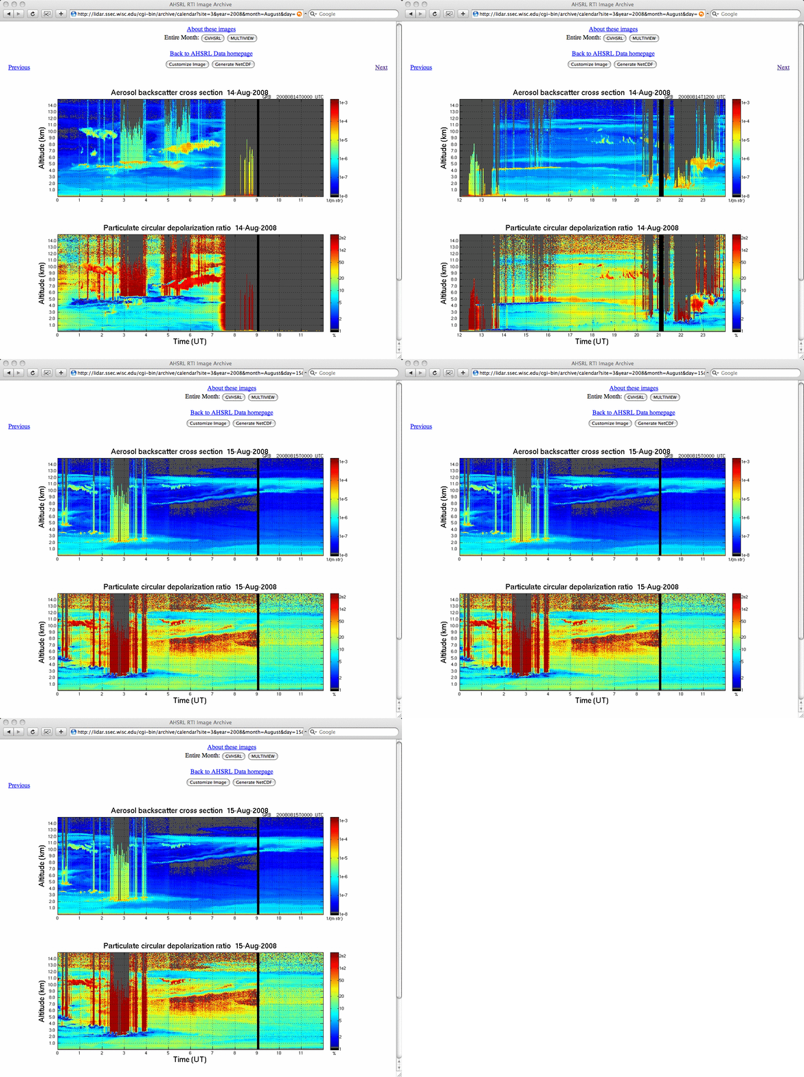
** 15 AUGUST UPDATE ** Additional lidar data obtained from the University of Wisconsin – Madison on 14-15 August (below) continued to show thin layers of aerosol backscatter with small depolarization ratios (cyan colors) in the upper troposphere that were possibly due to Kasatochi volcanic plumes.
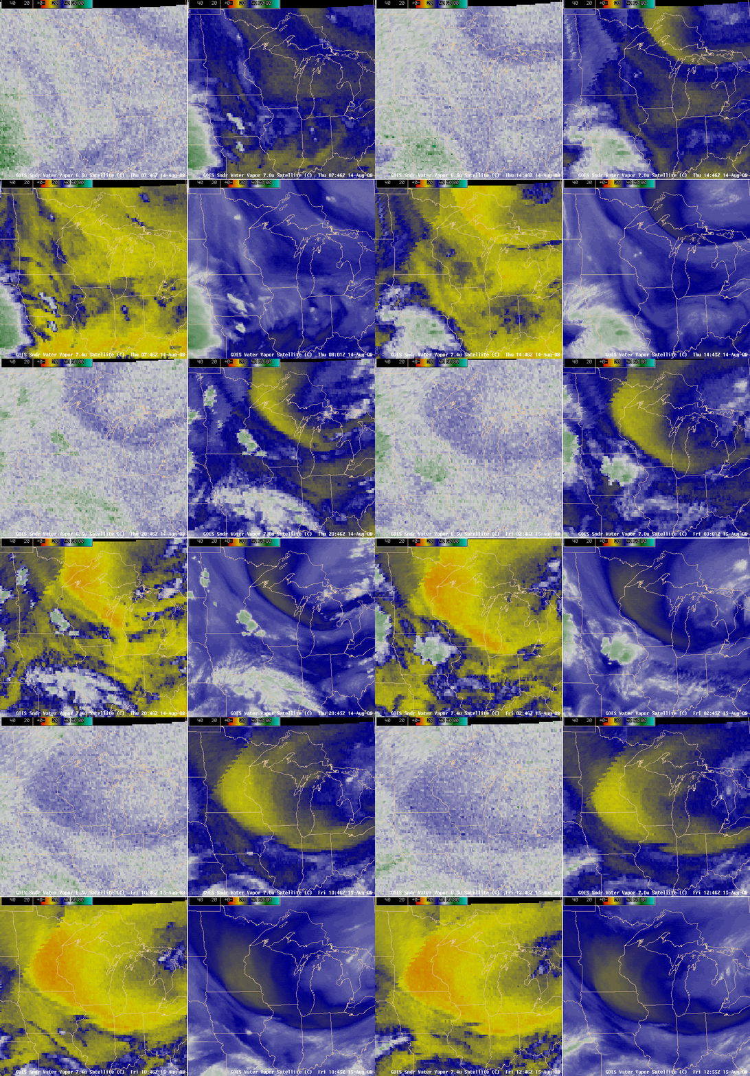
It is interesting to note the thin “tail” of aerosol backscatter (cyan colors) that extended downward from the main aerosol layer (located between altitudes of 11-12 km) to as low as the 8-9 km altitude range during the 04-08 UTC time period on 15 August. AWIPS images of the GOES Sounder + GOES Imager water vapor channels (below) indicated that strong subsidence was occurring over Wisconsin during that time — warmer water vapor brightness temperatures values (indicative of drier air) were depicted by the blue to yellow to orange colors (depending on which particular water vapor channel was being viewed).
So the Question of the Day is: could the lidar data be showing evidence that some of the volcanic aerosol plume aloft was being transported downward several km by the strong subsidence that was occurring within the middle to upper troposphere over Wisconsin on 15 August? The GOES Sounder total column ozone product showed a lobe of elevated ozone values, concurrent with a lowering of the dynamic tropopause (taken to be the pressure of the PV1.5 surface) to around the 300 hPa pressure level (around 9 km) over the Madison WI area, in agreement with the lidar filament seen extending down to the 8-9 km level — so perhaps a stratospheric intrusion may have helped to transport a portion of the volcanic aerosol plume downward. HYSPLIT back trajectories (EDAS | GDAS) indicated that the transport arriving over Madison WI on 15 August at the 8, 10, and 12 km altitudes all passed over Ontario and Hudson Bay during the preceeding 24 hours, where the thick aerosol feature was seen on GOES and MODIS imagery 2 days earlier.


