![MTSAT-2 Infrared (10.8 µm) image with the track of In-fa [click to enlarge]](http://cimss.ssec.wisc.edu/satellite-blog/wp-content/uploads/2015/11/151120_TY_In-Fa_track.gif)
MTSAT-2 Infrared (10.8 µm) image with the track of In-fa [click to enlarge]
Tropical Depression In-fa (27W) formed well south of the Marshall Islands in the West Pacific Ocean on 17 November 2015, and proceeded to track northwestward to a position south of Guam on 20 November
(above). Following a brief decrease in intensity on 18 September, In-fa began another period of intensification during the 19-20 September period. Rapid-scan (2.5-minute interval) Himawari-8 Visible (0.64 µm) images
(below; also available as a large 73 Mbyte animated gif) showed a series of eyewall convective bursts and the occasional appearance of a recognizable eye. (Note: the
ABI instrument on the upcoming
GOES-R satellite will also have a rapid-scan capability, but at 1-minute or even 30-second intervals)
![Himawari-8 Visible (0.64 um) images [click to play MP4 animation]](http://cimss.ssec.wisc.edu/satellite-blog/wp-content/uploads/2015/11/960x1280_AHIM08_B3_HIM_VIS_IN_FA_2015324_011545_1PANEL.GIF)
Himawari-8 Visible (0.64 um) images [click to play MP4 animation]
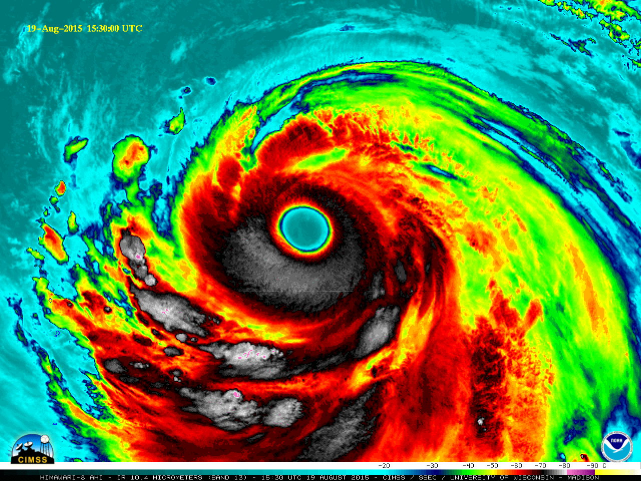
A longer animation spanning the entire 19-20 September period
(below; also available as a large 120 Mbyte animated gif) revealed an improving trend in the overall satellite presentation of In-fa, with the eye becoming well defined by the end of the animation as the tropical cyclone reached Category 3 intensity. In fact, this became the the 15th Category 3 or stronger typhoon in the Northwest Pacific basin in 2015 – the most on record in any tropical cyclone season by the date of 20 November.
![Himawari-8 Infrared (10.4 um) images [click to play MP4 animation]](http://cimss.ssec.wisc.edu/satellite-blog/wp-content/uploads/2015/11/960x1280_AHIM08_B13_HIM_IR_IN_FA_2015324_155000_1PANEL.GIF)
Himawari-8 Infrared (10.4 um) images [click to play MP4 animation]
A comparison of Suomi NPP VIIRS Infrared (11.45 µm) and Day/Night Band (0.7 µm) images at 1547 UTC
(below; courtesy of William Straka, SSEC) showed the coldest cloud-top IR brightness temperatures in the southern hemisphere of the eyewall, along with the nighttime glow of lights from the island of Guam.
![Suomi NPP VIIRS Infrared (11.45 um) and Day/Night Band (0.7 um) images [click to enlarge]](http://cimss.ssec.wisc.edu/satellite-blog/wp-content/uploads/2015/11/151120_1547utc_suomi_npp_viirs_ir_dnb_Typhoon_In-Fa_anim.gif)
Suomi NPP VIIRS Infrared (11.45 um) and Day/Night Band (0.7 um) images [click to enlarge]
A well-defined eye was evident in MTSAT-2 Infrared (10.8 µm) and DMSP SSMIS Microwave (85 GHz) images around 2230 UTC on 20 September
(below).
![DMSP-19 SSMIS microwave (85 GHz) and MTSAT Infrared (10.8 um) images [click to enlarge]](http://cimss.ssec.wisc.edu/satellite-blog/wp-content/uploads/2015/11/151120_2130utc_mtsat_ir_dmsp_ssmi_mw_In-fa_anim.gif)
DMSP-19 SSMIS microwave (85 GHz) and MTSAT Infrared (10.8 um) images [click to enlarge]
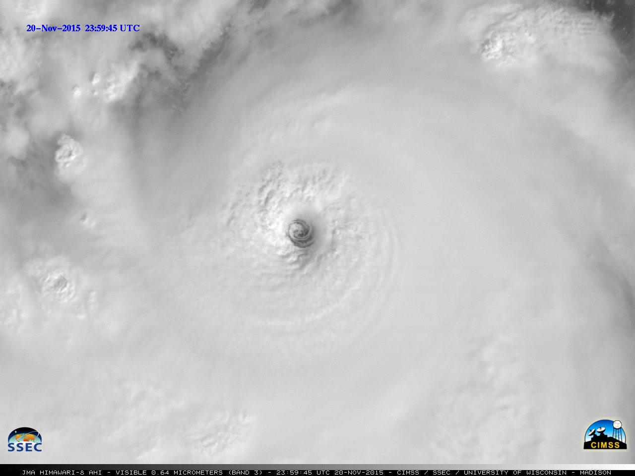
Mesovortices within the eye were seen in rapid-scan Himawari-8 Visible (0.64 µm) images beginning late in the day on 20 November as In-fa intensified to a Category 4 typhoon.
(below; also available as a large 50 Mbyte animated GIF).
![Himawari-8 Visible (0.64 µm) images [click to play MP4 animation]](http://cimss.ssec.wisc.edu/satellite-blog/wp-content/uploads/2015/11/960x1280_AHIM08_B3_HIM_VIS_IN_FA_21NOV_2015324_235945_1PANEL.GIF)
Himawari-8 Visible (0.64 µm) images [click to play MP4 animation]