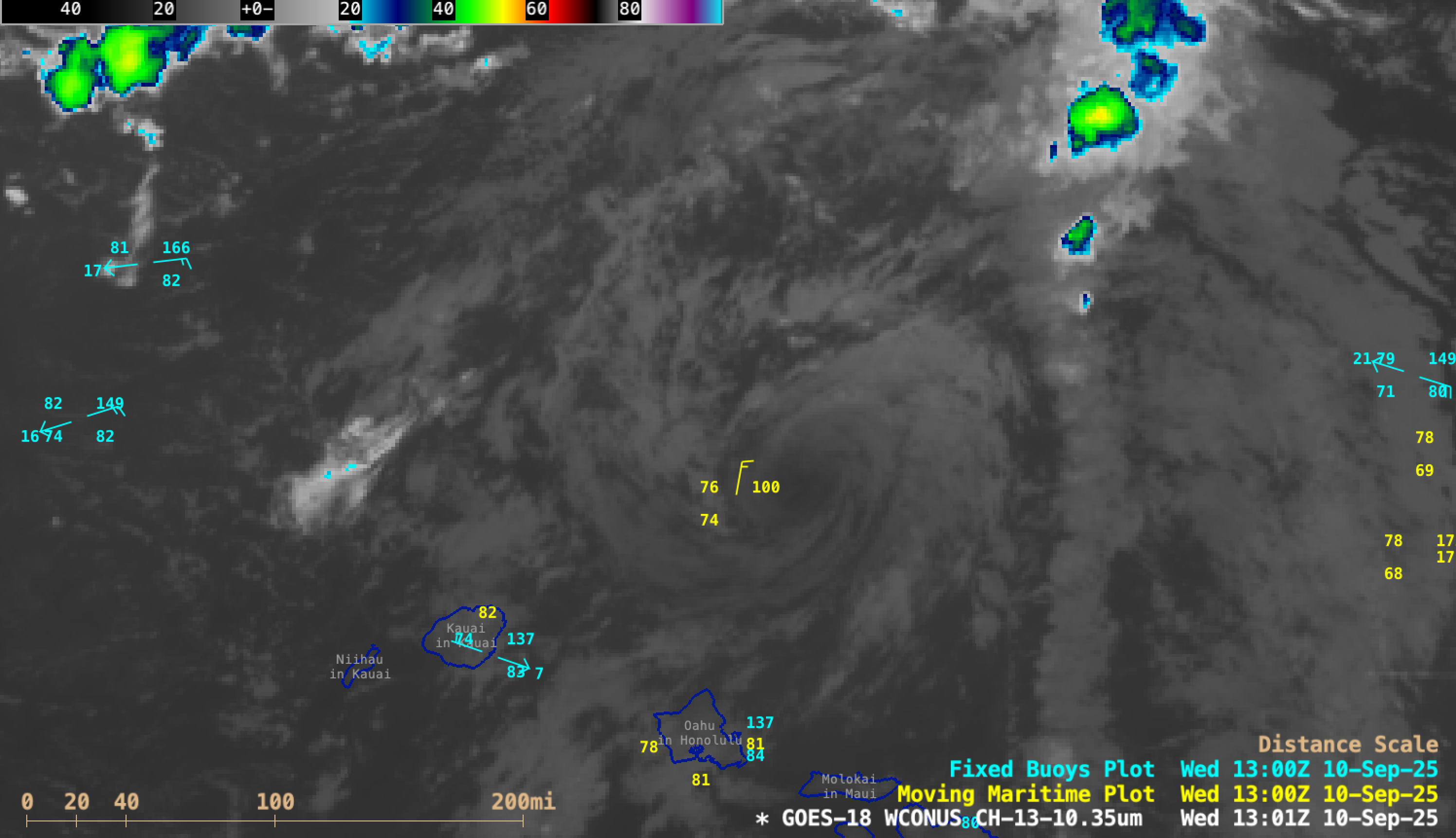
Post-Tropical Cyclone Kiko north of Hawai’i

5-minute GOES-18 “Clean” Infrared Window (10.3 µm) images with an overlay of GLM Flash Extent Density, from 0901 UTC on 10 September to 0001 UTC on 11 September [click to play MP4 animation]
A comparison of GOES-18 Infrared and Visible images (below) showed that the LLCC was more distinct in the higher spatial resolution Visible imagery — however, the LLCC eventually moved beneath the canopy of growing thunderstorms after 1900 UTC, making it impossible to further track.
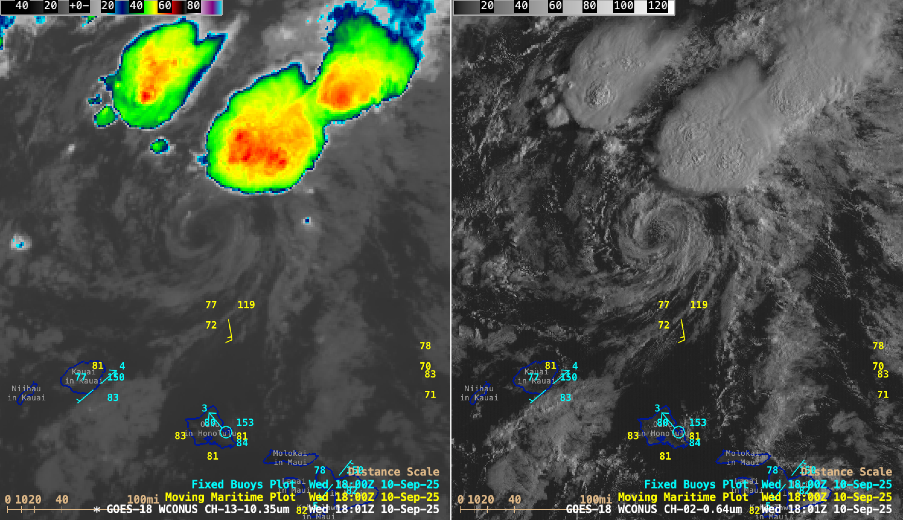
5-minute GOES-18 “Clean” Infrared Window (10.3 µm, left) and “Red” Visible (0.64 µm, right) images, from 1621 UTC on 10 September to 0001 UTC on 11 September [click to play MP4 animation]
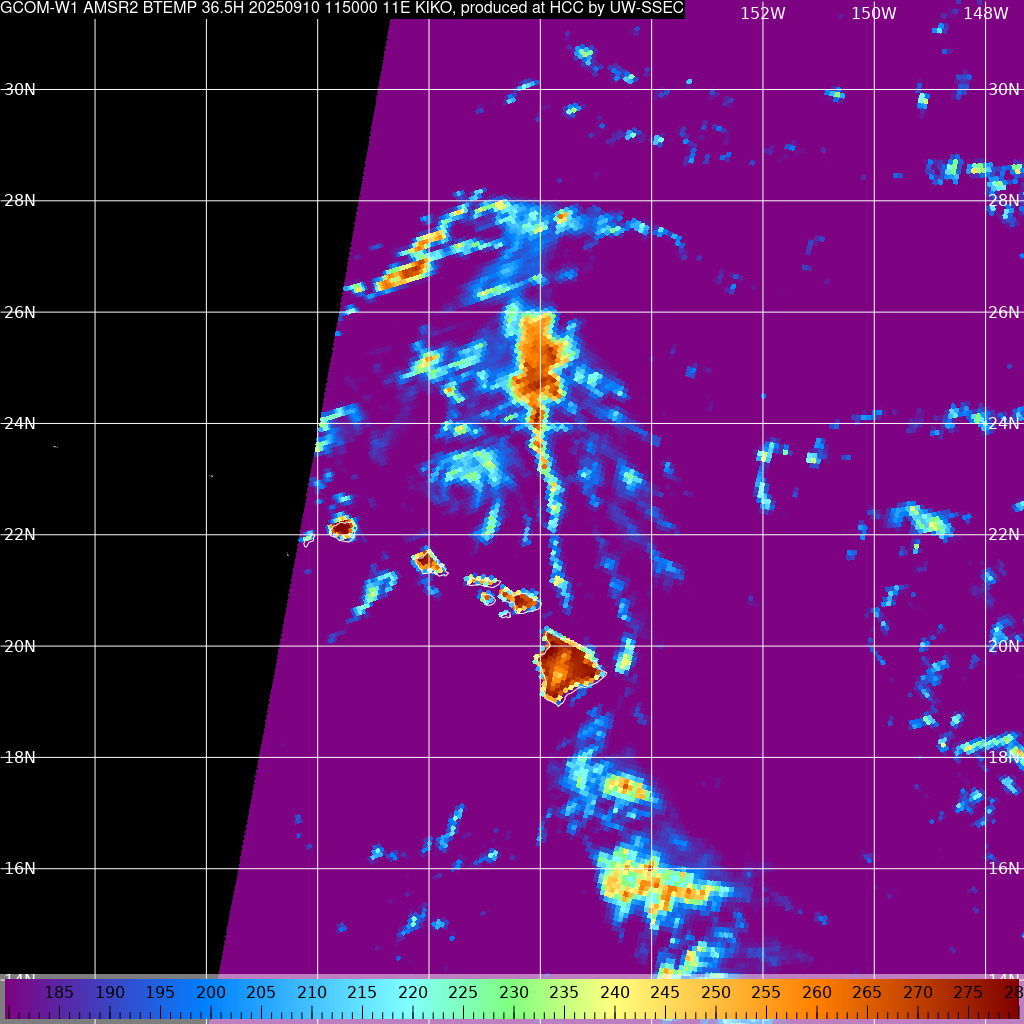
GCOM-W1 AMSR2 Microwave (36.5 GHz) image at 1150 UTC on 10 September [click to enlarge]

ASCAT winds from Metop-B (at 0735 UTC) and Metop-C (at 2051 UTC) on 10 September