Hurricane Matthew makes landfall in western Haiti, then eastern Cuba
Hurricane Matthew has made landfall in western Haiti. The rocking animation (click here for a straight animation) above shows the cloud-filled eye of the storm crossing the Tiburon Peninsula. The storm’s center is forecast to remain largely over water as it moves through the Windward Passage between Cuba and Hispaniola.
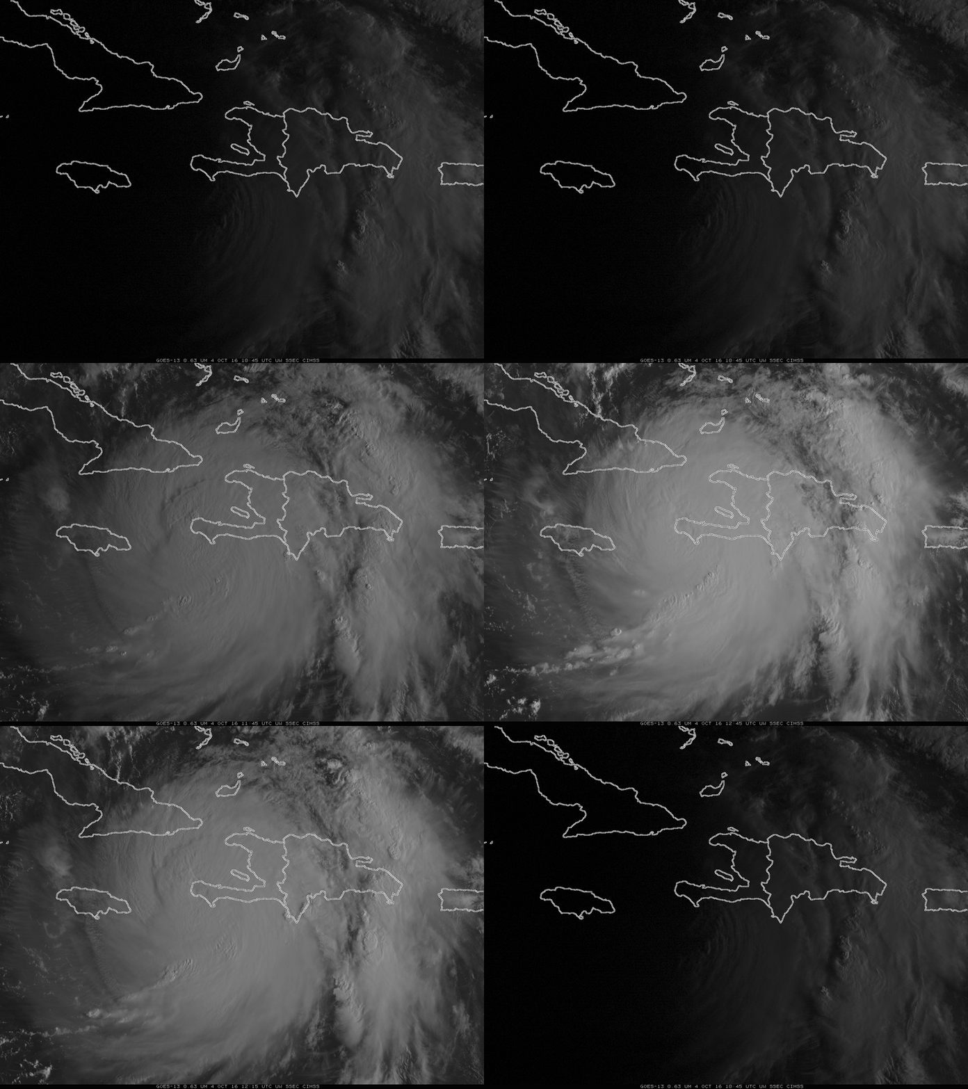
A closer look using a 2-panel comparison of GOES-13 Visible (0.63 µm) and Infrared Window (10.7 µm) images, below, shows the deteriorating satellite presentation following interaction with the topography of the islands. The GOES-13 satellite was in Rapid Scan Operations (RSO) mode, providing images as frequently as every 5-7 minutes.
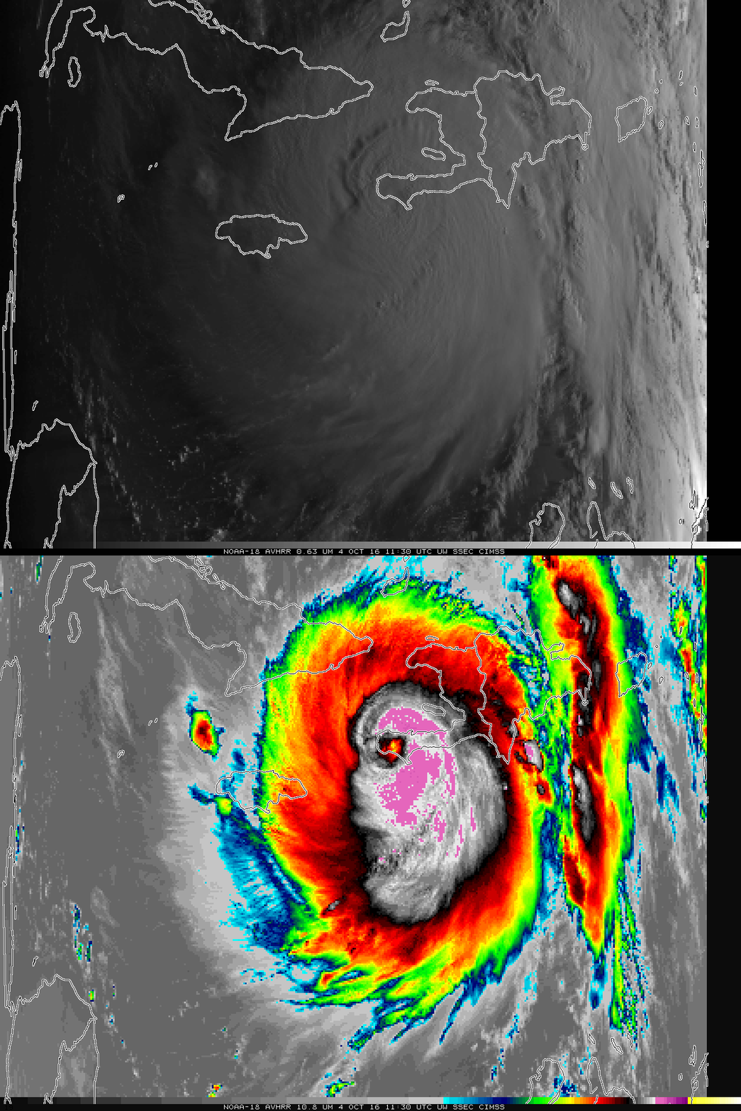
NOAA-18 overflew the region around 1130 UTC while the eye was on land, and the toggle below shows Visible (0.64 µm) and Infrared Window Channel (10.8 µm) imagery from 1130 UTC. The cloud-filled eye is distinct in the infrared image at that time, but a sequence of POES AVHRR Infrared (12.0 µm) images showed the rapid deterioration shortly after landfall (as was seen in the GOES-13 images above).
NOAA-18 AVHRR Visible (0.64 µm) and Infrared (10.8 µm) Imagery, 1130 UTC on 4 October 2016 (Click to enlarge)
A toggle between 1215 UTC GOES-13 Infrared Window (10.7 µm) and 1217 UTC DMSP-18 SSMIS Microwave (85 GHz) images from the CIMSS Tropical Cyclones site, below, revealed that a well-defined eye was still evident in the microwave data.
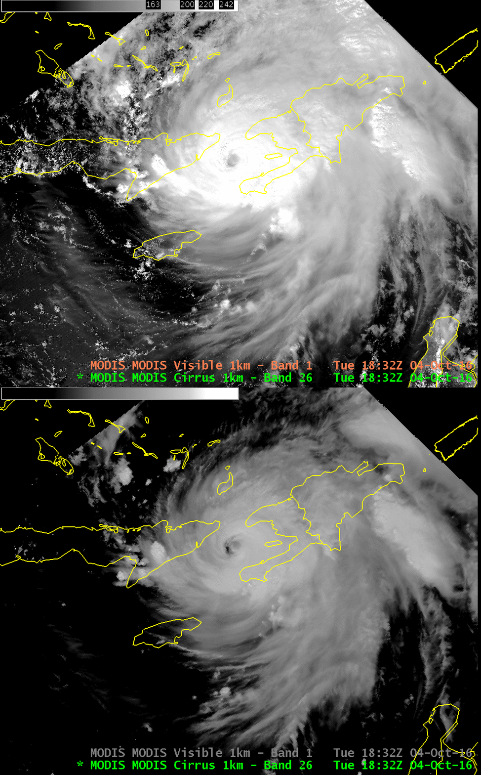
Aqua overflew Matthew shortly after 1800 UTC on 4 October, and the toggle below shows the 1-km visible (0.65 µm) and the 1-km ‘Cirrus Channel’ (1.38 µm). The Cirrus Channel detects radiation at a wavelength where very strong absorption by water vapor is occurring; only high clouds are detected with this channel, and the toggle between the Cirrus Channel and the Visible nicely outlines the cirrus canopy of the storm. The Advanced Baseline Imager (ABI) on GOES-R also includes a Cirrus Channel.

Aqua MODIS Visible (0.65 µm) and “Cirrus Channel” (1.38 µm) at 1832 UTC on 4 October 2016 [Click to enlarge]
Meanwhile, to the northeast of Matthew, in the tropical Atlantic, Tropical Storm Nicole has formed. The animation of visible imagery from GOES-13, below, shows a sheared storm; the low-level circulation is west of the deepest convection. It’s unlikely that Nicole will intensify much under such sheared conditions. Cirrus outflow from Matthew is evident at the south and west of Nicole.
ASCAT on METOP-A sampled both storms in its morning overpass over the western Atlantic, as shown below. The maximum scatterometer-derived wind speeds were 60 knots with Matthew and 40 knots for Julia. Late in the day on 04 October, Category 4 Hurricane Mathew made a second landfall along the far eastern tip of Cuba. As seen in the image toggle below, in spite of a ragged appearance on GOES-13 Infrared Window (10.7 µm) imagery, a distinct eye was still seen using DMSP-18 SSMIS Microwave (85 GHz) data.


![GOES-13 Infrared Window (10.7 µm) and DMSP-18 SSMIS Microwave (85 GHz) images [Click to enlarge]](https://cimss.ssec.wisc.edu/satellite-blog/wp-content/uploads/sites/5/2016/10/161004_1215utc_goes13_infrared_dmsp18_ssmis_microwave_Matthew_anim.gif)
![GOES-13 Visible (0.63 µm) image, with Metop-AASCAT winds [Click to enlarge]](https://cimss.ssec.wisc.edu/satellite-blog/wp-content/uploads/sites/5/2016/10/goes13_visible_ascat-20161004_140000.png)
![GOES-13 Infrared Window (10.7 µm) and DMSP-18 SSMIS Microwave (85 GHz) images [Click to enlarge]](https://cimss.ssec.wisc.edu/satellite-blog/wp-content/uploads/sites/5/2016/10/161004_2330utc_dmsp_ssmis_microwave_2354utc_goes13_infrared_Matthew_anim.gif)